
Bemidji Crude-Oil Project
Minnesota PROJECTS
USGS IN YOUR STATE
USGS Water Science Centers are located in each state.

|
August 1979 photos showing oil contamination at the Bemidji
site immediately following the spill:
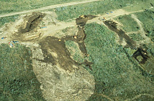 Aerial view of pipeline break,
north and south oil pools, spray zone, and remediation
efforts. 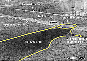 A labeled
aerial view view of the pipeline break, spray zone, drainage path, and remediation
efforts. 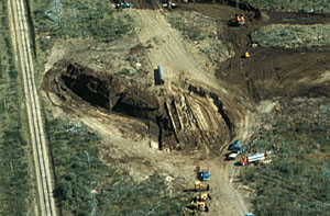 Aerial (close-up) view of
the pipeline break, trench, and remediation
efforts at the north pool. 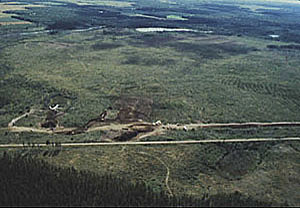 Distant
view of the spill site from the air. 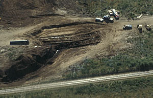 Closer
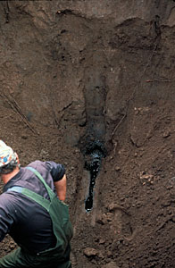
view. 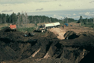 A trench was dug to remove the
crude oil from where it pooled at what we call the
"north oil pool." This is a view of exposed
pipelines in this trench; the repaired section
of pipeline that ruptured is visible in the
right-center portion of this picture. 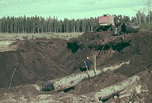 Exposed
pipelines showing a pipeline employee in the
trench. 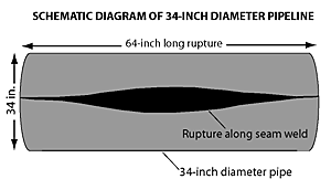 The 34-inch diameter pipeline
ruptured along a seam weld and was repaired soon
after the spill occurred. 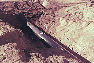 This is a schematic diagram of the ruptured pipeline and a view of the repaired
section of pipeline. The crude oil sprayed from the rupture site to the west into an area we call the
"spray zone." 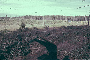 This is a picture of oil-covered
vegetation in the spray zone following the
spill. 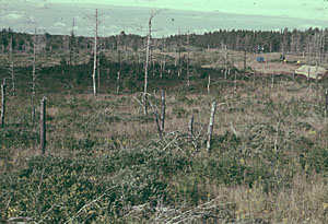 Spray
zone. 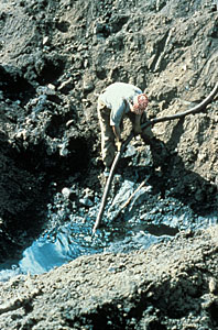 A pipeline company employee pumping the oil from
the bottom of a trench at the north pool.
 Crude oil can been seen seeping
in along the side and bottom of a trench in this
picture. 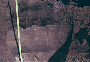 Oil-saturated sand can clearly be seen in the wall
of the trench in this picture.
Immediately following the spill,
crude oil moved overland from the "spray
zone" through low-lying areas
and toward a wetland near what we now call the
"south oil pool." 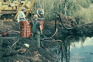 Some crude oil reached the wetland and the pipeline company removed
the floating oil with... 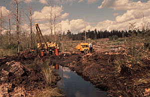 pumps
and other machinery. 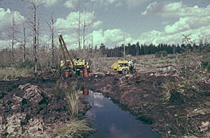 Removal of
oil from the wetland. 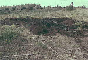 Excavation
of contaminated soil also occurred at the... 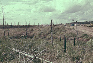 middle
oil pool. 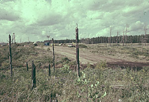 View of oil near the middle
pool as it crosses the pipeline road. 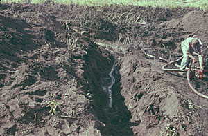 Crude
oil pooled in a shallow trench at an unknown
location at the site. 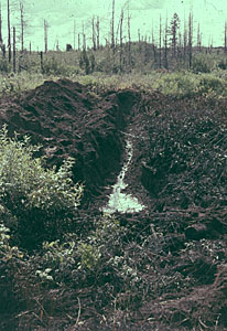 Oil
is being pumped out of a shallow trench at an
unknown location. 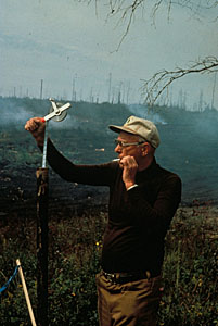 Much of the crude oil
contaminated soil that was removed from the spill
site was spread over an adjacent area north of the
site where it was burned.
|
