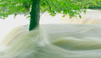
Minnesota FloodWatch
Minnesota FloodWatchThis map, (from USGS's WaterWatch Web site), shows the location of streamgages where the water level is above flood stage (depicted as a black triangle) or at high flow (depicted as blue circles) High flow conditions are expressed as percentiles that compare the current (i.e., within the past several hours) instantaneous flow value to historical daily mean flow values for all days of the year. Flood conditions may be more extensive than shown because the National Weather Service (NWS) has not identified a flood stage at all USGS streamgaging sites. The most complete depiction of streamgages at or above flood stage is on the NWS River Conditions Map. Minnesota FloodWatch
Flood Information
Flood Links
Map of streamgages where the current water level is above flood stage or at high flow.
Rainfall Calculator
All the water in floods comes from the sky—but have you ever wondered just how many gallons of water falls on an area when it rains? You might be surprised at how much water comes down. Use our Water Science rainfall calculator to see how many gallons of water falls from the sky during a rainstorm. |
![]() U.S. Department of the Interior |
U.S. Geological Survey
U.S. Department of the Interior |
U.S. Geological Survey
URL: http://mn.water.usgs.gov/flood/index.html
Page Contact Information: Webmaster
Page Last Modified: Wednesday, 28-Jan-2015 11:37:34 EST