USGS - science for a changing world

Minnesota Water Science Center

  Home   Information/Data   Projects   Publications   Flood   NAWQA   Office   Contact   Other USGS [an error occurred while processing this directive]   Internal
UMIS Study Unit Map.

UMIS NAWQA

USGS IN YOUR STATE

USGS Water Science Centers are located in each state.

There is a USGS Water Science Center office in each State. Washington Oregon California Idaho Nevada Montana Wyoming Utah Colorado Arizona New Mexico North Dakota South Dakota Nebraska Kansas Oklahoma Texas Minnesota Iowa Missouri Arkansas Louisiana Wisconsin Illinois Mississippi Michigan Indiana Ohio Kentucky Tennessee Alabama Pennsylvania West Virginia Georgia Florida Caribbean Alaska Hawaii New York Vermont New Hampshire Maine Massachusetts South Carolina North Carolina Rhode Island Virginia Connecticut New Jersey Maryland-Delaware-D.C.

General Information: Geology, Climate, Water Usage, and Land Usage

Anoka

Average flow of the Mississippi River, 10 miles upstream from Minneapolis, is 7,900 cubic feet per second.

The Upper Mississippi River Basin was selected as a NAWQA study area because it contains the headwaters of the most significant river in the Nation, based on area drained, economic importance, intensity of use, and value as a natural resource. The Upper Mississippi River Basin NAWQA study area encompasses more than 48,000 square miles in five states (see FIGURE 1) and includes three major drainage basins--those of the Mississippi, Minnesota, and St. Croix Rivers.

Sampling at Jordan

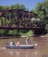
The average flow of the Minnesota River at Jordan, Minnesota is 3,760 cubic feet per second.

Geology, geomorphology, climate, hydrology, and land cover in the study area are diverse and control the occurrence and flow of water, and the distribution of water-quality constituents. Landforms within the study area are primarily the result of Pleistocene glaciation. Soils developed on glacial deposits range from heavy, poorly-drained clayey soils developed on ground moraine to light, well-drained sands on outwash plains. Agriculture is the dominant land use in the southern and western parts of the study area; forests cover much of the northern and eastern parts of the study area, and the Twin Cities Metropolitan Area dominates the east-central part of the study area.

Mississippi Falls

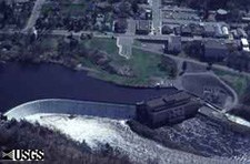
Average flow of the St. Croix River at St. Croix Falls, Wisconsin (52 miles upstream from its mouth) is 4,300 cubic feet per second.

The climate of the study area is subhumid continental. The average monthly temperature ranges from 11 degrees (F) in January to 74 degrees (F) in July. Average precipitation increases from 22 inches in the west to 30 inches in the eastern portion of the study area. About 3/4 of the annual precipitation falls from April-September.

The three major tributaries of the Upper Mississippi River Basin are the Mississippi River, the Minnesota River, and the St. Croix River (see FIGURE 1).

Runoff in the area varies annually, but mostly occurs in spring and early summer from rainfall on saturated soils. Water quality in the three major tributaries is significantly different. Among the three rivers, concentrations of total-suspended solids and total-suspended sediment are greatest in the Minnesota River and least in the St. Croix River.

The estimated population of the study area is approximately 3 million people, 2.4 million of whom live in the Twin Cities Metropolitan Area. In 1990, public water supplies served about 2.1 million people in the study area. An average of 360 million gallons of water per day were used; 53 percent was from ground-water sources and 47 percent was from surface-water sources. Suburban and rural areas primarily used ground water as a source of municipal-water supplies. Surface water is predominantly used by the cities of Minneapolis, St. Paul, and St. Cloud and for thermoelectric purposes. Twin Cities

About 60 percent of the study area is used for agriculture (see FIGURE 2). Principal crops grown in the study area include corn, soybeans, and hay. About 23 percent of the study area is occupied by forests, and the remaining 17 percent of the study area is covered by water (5%), wetlands (7%), urban and suburban areas (5%).

The study area is underlain by glacial sediments and by a thick sequence of limestone, shale, shaley sandstone, and sandstone of Precambrian and Paleozoic age. Glacial deposits in the western part of the study area are composed of ground moraine and outwash deposits, and the land surface is relatively flat; the eastern part of the study area contains numerous end moraines and has substantial local relief. Glacial meltwater left numerous flat plains of outwash sand throughout the study area. Hydrogeologic units in the glacial deposits include surficial and buried aquifers and confining units. The Anoka Sand Plain aquifer (see FIGURE 3) is a major surficial aquifer that extends for 1,700 square miles in the study area. Wells completed in that aquifer can yield more than 500 gallons of water per minute. Many other stratified-drift aquifers cover small areas and have little hydraulic connection with other aquifers.

Bedrock aquifers and confining beds are part of a thick sequence of sedimentary rocks that were deposited in a north-south trending trough referred to as the Hollandale Embayment (see FIGURE 4). Up to 1,200 feet of those rocks underlie the Twin Cities. The bedrock hydrogeologic system of the study area can be divided into four major aquifers separated by confining units. The aquifers are, in descending order, the St. Peter, the Prairie du Chien-Jordan, the Ironton-Galesville, and the Mt. Simon-Hinckley. The confining units are the Platteville and Glenwood, the basal portion of the St. Peter Sandstone, the St. Lawrence-Franconia, and the Eau Claire. Crystalline rock and minor aquifers and confining units underlie these major aquifers.

USGS Home Water Climate Change Core Science Ecosystems Energy and Minerals Env. Health Hazards

Accessibility FOIA Privacy Policies and Notices

USA.gov logo U.S. Department of the Interior | U.S. Geological Survey
URL: http://mn.water.usgs.gov/nawqa/umis/projectDescription/generalInfoStudyUnit.html
Page Contact Information: Webmaster
Page Last Modified: Wednesday, 31-Dec-2008 17:34:22 EST

05311000: Flow=985cfs,Stage=5.29ft,Floodstage=14ft,2024-02-26 17:00,>90,MINNESOTA RIVER AT MONTEVIDEO, MN 05301000: Flow=997cfs,Stage=24.10ft,2024-02-26 17:00,>90,MINNESOTA RIVER NEAR LAC QUI PARLE, MN 05292000: Flow=202cfs,Stage=2.64ft,Floodstage=10ft,2024-02-26 17:30,>90,MINNESOTA RIVER AT ORTONVILLE, MN 05129290: Flow=79.6cfs,Stage=14.40ft,Floodstage=20.5ft,2024-02-26 17:30,>90,GOLD PORTAGE OUTLET FROM KABETOGAMA LK NR RAY,MN 05344500: Flow=12800cfs,2024-02-26 16:55,Stage=25.36ft,2024-02-26 17:15:00,76-90,MISSISSIPPI RIVER AT PRESCOTT, WI 05340500: Flow=2800cfs,Stage=3.27ft,2024-02-26 17:00,76-90,ST. CROIX RIVER AT ST. CROIX FALLS, WI 05315000: Flow=50.7cfs,Stage=7.39ft,Floodstage=14ft,2024-02-26 17:00,76-90,REDWOOD RIVER NEAR MARSHALL, MN 05288500: Flow=6750cfs,Stage=3.37ft,Floodstage=12ft,2024-02-26 17:00,76-90,MISSISSIPPI RIVER AT HWY 610 IN BROOKLYN PARK, MN 05270500: Flow=199cfs,Stage=0.97ft,Floodstage=6ft,2024-02-26 17:15,76-90,SAUK RIVER NEAR ST. CLOUD, MN 05267000: Flow=4100cfs,Stage=9.50ft,2024-02-26 17:15,76-90,MISSISSIPPI RIVER NEAR ROYALTON, MN 05457000: Flow=64.2cfs,Stage=2.76ft,Floodstage=10ft,2024-02-26 17:00,25-75,CEDAR RIVER NEAR AUSTIN, MN 05385500: Flow=132cfs,Stage=1.96ft,2024-02-26 17:30,25-75,SOUTH FORK ROOT RIVER NEAR HOUSTON, MN 05385000: Flow=472cfs,Stage=3.16ft,Floodstage=15ft,2024-02-26 17:45,25-75,ROOT RIVER NEAR HOUSTON, MN 05345000: Flow=38.1cfs,Stage=2.32ft,2024-02-26 17:15,25-75,VERMILLION RIVER NEAR EMPIRE, MN 05333500: Flow=1050cfs,Stage=1.07ft,Floodstage=7ft,2024-02-26 17:00,25-75,ST. CROIX RIVER NEAR DANBURY, WI 05247500: Flow=858cfs,Stage=3.76ft,2024-02-26 17:45,25-75,CROW WING RIVER NEAR PILLAGER, MN 05245100: Flow=102cfs,Stage=1.87ft,Floodstage=7ft,2024-02-26 17:15,25-75,LONG PRAIRIE RIVER AT LONG PRAIRIE, MN 05129115: Flow=260cfs,Stage=5.62ft,Floodstage=14ft,2024-02-26 17:30,25-75,VERMILION RIVER NR CRANE LAKE, MN 05127500: Flow=595cfs,Stage=2.97ft,Floodstage=7.5ft,2024-02-26 17:30,25-75,BASSWOOD RIVER NEAR WINTON, MN 05125000: Flow=128cfs,Stage=2.19ft,Floodstage=6.5ft,2024-02-26 17:30,25-75,SOUTH KAWISHIWI RIVER NEAR ELY, MN 05124480: Flow=71.0cfs,Stage=3.13ft,2024-02-26 17:00,25-75,KAWISHIWI RIVER NEAR ELY, MN 05046000: Flow=339cfs,Stage=2.83ft,2024-02-26 17:30,25-75,OTTER TAIL RIVER BL ORWELL D NR FERGUS FALLS, MN 06604000: Stage=13.22ft,Floodstage=16ft,2024-02-26 17:15,Not ranked,Spirit Lake near Orleans, IA 06483290: Stage=7.20ft,2024-02-26 17:15:00,Floodstage=13ft,Not ranked,Ice affected,Rock River below Tom Creek at Rock Rapids, IA 06482610: Stage=1.89ft,2024-02-26 16:45:00,Floodstage=8.5ft,Not ranked,Ice affected,SPLIT ROCK CREEK AT CORSON,SD 05476000: Stage=7.67ft,2024-02-26 17:30:00,Floodstage=12ft,Not ranked,Ice affected,DES MOINES RIVER AT JACKSON, MN 05475350: Stage=10.68ft,Floodstage=19ft,2024-02-26 17:15,Not ranked,Ice,DES MOINES RIVER ABOVE WINDOM, MN 05388250: Stage=6.58ft,2024-02-26 17:00:00,Floodstage=14ft,Not ranked,Ice affected,Upper Iowa River near Dorchester, IA 05387030: Stage=6.61ft,2024-02-26 17:30,Not ranked,CROOKED CREEK AT FREEBURG MN 05386400: Stage=30.94ft,2024-02-26 17:45,Not ranked,MISSISSIPPI RIVER AT BROWNSVILLE, MN 05384350: Stage=8.25ft,Floodstage=21ft,2024-02-26 17:00,Not ranked,ROOT RIVER ABOVE RUSHFORD, MN 05383950: Stage=7.67ft,2024-02-26 17:00:00,Floodstage=19ft,Not ranked,Ice affected,ROOT RIVER NEAR PILOT MOUND, MN 05383075: Flow=318cfs,Stage=2.50ft,Floodstage=7.5ft,2024-02-26 17:00,Not ranked,LA CROSSE RIVER NEAR LA CROSSE, WI 05378500: Stage=5.71ft,2024-02-26 17:45:00,Floodstage=13ft,Not ranked,Ice affected,MISSISSIPPI RIVER AT WINONA, MN 05378490: Stage=5.97ft,Floodstage=655ft,2024-02-26 17:15,Not ranked,MISSISSIPPI RIVER AT LOCK AND DAM 5A NR WINONA, MN 05374000: Stage=5.23ft,Floodstage=18ft,2024-02-26 17:30,Not ranked,ZUMBRO RIVER AT ZUMBRO FALLS, MN 05372995: Stage=2.38ft,2024-02-26 17:15:00,Floodstage=14ft,Not ranked,Ice affected,SOUTH FORK ZUMBRO RIVER AT ROCHESTER, MN 05355250: Stage=2.93ft,2024-02-26 17:15:00,Floodstage=14ft,Not ranked,Seasonal site,MISSISSIPPI RIVER AT RED WING, MN 05355200: Stage=3.39ft,2024-02-26 17:00:00,Not ranked,Ice affected,CANNON RIVER AT WELCH, MN 05355092: Flow=167cfs,Stage=7.33ft,2024-02-26 17:50,Not ranked,CANNON RIVER AT 9TH ST. BRIDGE IN CANNON FALLS, MN 05355080: Stage=11.92ft,2024-02-26 17:15,Not ranked,PRAIRIE CREEK NEAR CANNON FALLS, MN 05355038: Stage=5.25ft,2024-02-26 17:30,Not ranked,CHUB CREEK AT CO. HWY. 47 ABOVE RANDOLPH, MN 05355024: Flow=128cfs,Stage=889.76ft,Floodstage=897ft,2024-02-26 17:30,Not ranked,CANNON RIVER AT NORTHFIELD MN 05354500: Stage=8.94ft,2024-02-26 17:15:00,Not ranked,Seasonal site,CANNON RIVER AT CO. HWY. 29 BELOW FARIBAULT, MN 05353800: Stage=3.77ft,2024-02-26 17:15:00,Not ranked,Ice affected,STRAIGHT RIVER NEAR FARIBAULT, MN 05344490: Flow=3650cfs,Stage=25.36ft,2024-02-26 17:15,Not ranked,ST. CROIX RIVER AT PRESCOTT, WI 05342000: Flow=91.8cfs,Stage=8.18ft,2024-02-26 17:30,Not ranked,KINNICKINNIC RIVER NEAR RIVER FALLS, WI 05341550: Stage=675.67ft,2024-02-26 17:15:00,Floodstage=687.00ft,Not ranked,Ice affected,ST. CROIX RIVER AT STILLWATER, MN 05338500: Stage=3.19ft,2024-02-26 17:15:00,Floodstage=9ft,Not ranked,Ice affected,SNAKE RIVER NEAR PINE CITY, MN 05336700: Stage=4.23ft,2024-02-26 17:00:00,Not ranked,Ice affected,KETTLE RIVER BELOW SANDSTONE, MN 05331580: Flow=9020cfs,Stage=7.18ft,2024-02-26 16:55,Not ranked,MISSISSIPPI RIVER BELOW L&D 2 AT HASTINGS, MN 05331000: Stage=3.36ft,2024-02-26 17:00:00,Floodstage=14ft,Not ranked,Ice affected,MISSISSIPPI RIVER AT ST. PAUL, MN 05330000: Stage=6.49ft,2024-02-26 17:45:00,Floodstage=25ft,Not ranked,Ice affected,MINNESOTA RIVER NEAR JORDAN, MN 05327000: Stage=3.36ft,2024-02-26 17:00:00,Not ranked,Seasonal site,HIGH ISLAND CREEK NEAR HENDERSON, MN 05325000: Stage=4.38ft,2024-02-26 17:30:00,Floodstage=22ft,Not ranked,Ice affected,MINNESOTA RIVER AT MANKATO, MN 05320500: Stage=1.77ft,2024-02-26 17:00:00,Not ranked,Ice affected,LE SUEUR RIVER NEAR RAPIDAN, MN 05320000: Stage=1.87ft,2024-02-26 16:45:00,Not ranked,Ice affected,BLUE EARTH RIVER NEAR RAPIDAN, MN 05319500: Stage=1.25ft,2024-02-26 17:30:00,Not ranked,Ice affected,WATONWAN RIVER NEAR GARDEN CITY, MN 05317200: Stage=2.31ft,2024-02-26 17:15:00,Not ranked,Ice affected,LITTLE COTTONWOOD RIVER NEAR COURTLAND, MN 05317000: Stage=4.30ft,2024-02-26 17:00:00,Floodstage=11ft,Not ranked,Ice affected,COTTONWOOD RIVER NEAR NEW ULM, MN 05316770: Stage=787.64ft,2024-02-26 17:45:00,Floodstage=800ft,Not ranked,Ice affected,MINNESOTA RIVER AT NEW ULM, MN 05316580: Flow=1470cfs,Stage=10.86ft,Floodstage=21ft,2024-02-26 17:00,Not ranked,MINNESOTA RIVER AT MORTON, MN 05316500: Stage=2.35ft,2024-02-26 17:00:00,Floodstage=6ft,Not ranked,Ice affected,REDWOOD RIVER NEAR REDWOOD FALLS, MN 05313500: Stage=3.39ft,2024-02-26 17:45:00,Not ranked,Ice affected,YELLOW MEDICINE RIVER NEAR GRANITE FALLS, MN 05311150: Flow=634cfs,2023-11-15 05:45,Stage=881.02ft,2024-02-26 17:15:00,Floodstage=885ft,Not ranked,MINNESOTA RIVER AT HWY 212 IN GRANITE FALLS, MN 05305000: Stage=36.11ft,2024-02-26 17:00:00,Not ranked,Ice affected,CHIPPEWA RIVER (TW) NEAR WATSON, MN 05304995: Stage=39.57ft,2024-02-26 17:00,Not ranked,CHIPPEWA R. (HW) ABOVE COUNTY RD 13 NR WATSON, MN 05304500: Stage=1.64ft,2024-02-26 17:45:00,Not ranked,Ice affected,CHIPPEWA RIVER NEAR MILAN, MN 05300000: Stage=7.06ft,2024-02-26 17:45:00,Not ranked,Ice affected,LAC QUI PARLE RIVER NEAR LAC QUI PARLE, MN 05294000: Stage=5.18ft,2024-02-26 17:00:00,Not ranked,Ice affected,POMME DE TERRE RIVER AT APPLETON, MN 05293000: Stage=2.98ft,2024-02-26 17:15:00,Not ranked,Ice affected,YELLOW BANK RIVER NEAR ODESSA, MN 05291000: Stage=1.84ft,2024-02-26 17:45:00,Floodstage=12ft,Not ranked,Ice affected,WHETSTONE RIVER NEAR BIG STONE CITY, SD 05290000: Stage=10.92ft,2024-02-26 17:00:00,Floodstage=17ft,Not ranked,Ice affected,LITTLE MINNESOTA RIVER NEAR PEEVER, SD 05289800: Stage=12.03ft,2024-02-26 17:00:00,Not ranked,Ice affected,MINNEHAHA CREEK AT HIAWATHA AVE. IN MINNEAPOLIS,MN 05289100: Stage=925.22ft,2024-02-26 17:00,Not ranked,MINNEHAHA CREEK BLW GRAYS BAY DAM IN MINNETONKA MN 05289000: Stage=928.73ft,2024-02-26 17:00,Not ranked,LAKE MINNETONKA ABV GRAYS BAY OTLT IN MINNETONKA 05288705: Stage=9.16ft,2024-02-26 17:00:00,Not ranked,Ice affected,SHINGLE CREEK AT QUEEN AVE IN MINNEAPOLIS, MN 05288670: Stage=89.44ft,Floodstage=16ft,2024-02-26 17:30,Not ranked,MISSISSIPPI RIVER ABV 37TH AVE. NE IN FRIDLEY, MN 05288580: Stage=6.29ft,2024-02-26 17:00:00,Not ranked,Ice affected,RICE CREEK BLW OLD HWY. 8 IN MOUNDS VIEW, MN 05287890: Stage=3.95ft,2024-02-26 17:00:00,Not ranked,Ice affected,ELM CREEK NR CHAMPLIN, MN 05286000: Stage=2.83ft,2024-02-26 17:00:00,Floodstage=8ft,Not ranked,Ice affected,RUM RIVER NEAR ST. FRANCIS, MN 05284000: Stage=10.75ft,2024-02-26 17:15,Not ranked,MILLE LACS LAKE AT COVE BAY NEAR ONAMIA, MN 05283500: Stage=4.55ft,2024-02-26 17:30:00,Floodstage=12ft,Not ranked,Ice affected,MISSISSIPPI RIVER AT US HWY 169 AT CHAMPLIN, MN 05280000: Stage=3.25ft,2024-02-26 17:00:00,Floodstage=10ft,Not ranked,Ice affected,CROW RIVER AT ROCKFORD, MN 05275000: Stage=1.01ft,2024-02-26 17:15:00,Not ranked,Ice affected,ELK RIVER NEAR BIG LAKE, MN 05270700: Stage=4.80ft,2024-02-26 16:45:00,Floodstage=9ft,Not ranked,Ice affected,MISSISSIPPI RIVER AT ST. CLOUD, MN 05244000: Stage=2.69ft,2024-02-26 17:00:00,Not ranked,Ice affected,CROW WING RIVER AT NIMROD, MN 05243725: Stage=1.16ft,2024-02-26 17:30:00,Not ranked,Ice affected,STRAIGHT RIVER NEAR PARK RAPIDS, MN 05242300: Stage=5.97ft,2024-02-26 17:30:00,Floodstage=16ft,Not ranked,Back Water,MISSISSIPPI RIVER AT BRAINERD, MN 05227530: Not ranked,Equipment malfunction,MISSISSIPPI RIVER DIVERSION NEAR AITKIN, MN 05227500: Stage=6.44ft,2024-02-26 17:30:00,Floodstage=13ft,Not ranked,Back Water,MISSISSIPPI RIVER AT AITKIN, MN 05212700: Stage=2.57ft,2024-02-26 17:45:00,Floodstage=10ft,Not ranked,Ice affected,PRAIRIE RIVER NEAR TACONITE, MN 05211000: Stage=2.76ft,2024-02-26 17:15:00,Not ranked,Ice affected,MISSISSIPPI RIVER AT GRAND RAPIDS, MN 05210000: Stage=72.44ft,2024-02-26 17:30,Not ranked,MISSISSIPPI R. AT DAYS HIGH LANDING NR DEER RIVER 05207600: Stage=5.48ft,2024-02-26 17:15:00,Not ranked,Ice affected,MISSISSIPPI RIVER AT WILLOW BEACH AT BALL CLUB, MN 05205900: Stage=94.47ft,2024-02-26 17:30,Not ranked,LEECH LAKE AT SUGAR POINT NEAR FEDERAL DAM, MN 05200510: Not ranked,Seasonal site,MISSISSIPPI RIVER NEAR BEMIDJI, MN 05140521: Stage=58.25ft,2024-02-26 17:00,Not ranked,LK OF THE WOODS @ SPRINGSTEEL IS NR. WARROAD, MN 05140520: Stage=58.27ft,2024-02-26 17:30,Not ranked,LAKE OF THE WOODS AT WARROAD, MN 05137500: Stage=4.00ft,2024-02-26 17:00,Not ranked,RAINY RIVER NEAR BOAT LANDING AT WHEELERS POINT,MN 05134200: Not ranked,Equipment malfunction,RAPID RIVER NEAR BAUDETTE, MN 05133500: Stage=3.39ft,2024-02-26 17:30:00,Not ranked,Ice affected,RAINY RIVER AT MANITOU RAPIDS, MN 05132000: Stage=3.76ft,2024-02-26 17:30:00,Floodstage=16ft,Not ranked,Ice affected,BIG FORK RIVER AT BIG FALLS, MN 05131500: Stage=2.89ft,2024-02-26 17:30:00,Floodstage=22ft,Not ranked,Ice affected,LITTLE FORK RIVER AT LITTLEFORK, MN 05129515: Stage=15.12ft,2024-02-26 17:30:00,Not ranked,Ice affected,RAINY R AT BOAT LANDING BLW INTERNATIONAL FALLS,MN 05126210: Flow=259cfs,Stage=3.95ft,2024-02-26 17:30,Not ranked,SOUTH KAWISHIWI R ABV WHITE IRON LAKE NR ELY, MN 05112000: Stage=2.35ft,2024-02-26 17:30:00,Not ranked,Ice affected,ROSEAU RIVER BELOW STATE DITCH 51 NR CARIBOU, MN 05107500: Stage=2.32ft,2024-02-26 17:30:00,Not ranked,Ice affected,ROSEAU RIVER AT ROSS, MN 05106000: Not ranked,Equipment malfunction,SPRAGUE CREEK NEAR SPRAGUE, MANITOBA, CANADA 05104500: Stage=3.96ft,2024-02-26 17:00:00,Not ranked,Ice affected,ROSEAU RIVER BELOW SOUTH FORK NEAR MALUNG, MN 05102490: Stage=14.44ft,Floodstage=39ft,2024-02-26 17:30,Not ranked,RED RIVER OF THE NORTH AT PEMBINA, ND 05094000: Stage=3.40ft,2024-02-26 17:15:00,Not ranked,Ice affected,SOUTH BRANCH TWO RIVERS AT LAKE BRONSON, MN 05092000: Stage=12.91ft,2024-02-26 17:45:00,Floodstage=32ft,Not ranked,Ice affected,RED RIVER OF THE NORTH AT DRAYTON, ND 05087500: Stage=3.91ft,2024-02-26 14:00:00,Not ranked,Ice affected,MIDDLE RIVER AT ARGYLE, MN 05085450: Stage=61.87ft,2024-02-26 16:45:00,Floodstage=67ft,Not ranked,Ice affected,SNAKE RIVER ABOVE WARREN, MN 05083500: Stage=10.09ft,Floodstage=26ft,2024-02-26 17:15,Not ranked,RED RIVER OF THE NORTH AT OSLO, MN 05082500: Stage=16.58ft,2024-02-26 17:45:00,Floodstage=28ft,Not ranked,Ice affected,RED RIVER OF THE NORTH AT GRAND FORKS, ND 05080000: Stage=12.48ft,2024-02-26 17:30:00,Not ranked,Ice affected,RED LAKE RIVER AT FISHER, MN 05079000: Stage=5.02ft,2024-02-26 16:15:00,Floodstage=15ft,Not ranked,Ice affected,RED LAKE RIVER AT CROOKSTON, MN 05078500: Not ranked,Equipment malfunction,CLEARWATER RIVER AT RED LAKE FALLS, MN 05078230: Stage=3.78ft,2024-02-26 17:30:00,Not ranked,Ice affected,LOST RIVER AT OKLEE, MN 05078000: Stage=3.42ft,2024-02-26 17:15:00,Not ranked,Ice affected,CLEARWATER RIVER AT PLUMMER, MN 05076000: Stage=4.69ft,2024-02-26 17:15:00,Not ranked,Ice affected,THIEF RIVER NEAR THIEF RIVER FALLS, MN 05075000: Stage=5.30ft,2024-02-26 17:00:00,Floodstage=12ft,Not ranked,Seasonal site,RED LAKE RIVER AT HIGH LANDING NR GOODRIDGE, MN 05074500: Stage=69.65ft,2024-02-26 17:30:00,Not ranked,Ice affected,RED LAKE RIVER NEAR RED LAKE, MN 05074000: Stage=74.19ft,2024-02-26 17:30,Not ranked,LOWER RED LAKE NR RED LAKE, MN 05073500: Stage=74.07ft,2024-02-26 17:30,Not ranked,UPPER RED LAKE AT WASKISH, MN 05070000: Stage=19.32ft,2024-02-26 17:15:00,Not ranked,Ice affected,RED RIVER OF THE NORTH NEAR THOMPSON, ND 05069000: Stage=5.19ft,2024-02-26 17:45:00,Floodstage=20ft,Not ranked,Ice affected,SAND HILL RIVER AT CLIMAX, MN 05067500: Flow=0.09cfs,2023-11-30 19:45,Not ranked,MARSH RIVER NEAR SHELLY, MN 05064500: Stage=8.32ft,2024-02-26 17:30:00,Floodstage=26ft,Not ranked,Ice affected,RED RIVER OF THE NORTH AT HALSTAD, MN 05064000: Stage=5.71ft,2024-02-26 17:30:00,Floodstage=20ft,Not ranked,Ice affected,WILD RICE RIVER AT HENDRUM, MN 05063398: Stage=5.75ft,2024-02-26 17:00:00,Not ranked,Back Water,S. BR. WILD RICE RIVER AT CO. RD. 27 NR FELTON, MN 05062500: Stage=2.60ft,2024-02-26 16:45:00,Floodstage=10ft,Not ranked,Ice affected,WILD RICE RIVER AT TWIN VALLEY, MN 05062000: Not ranked,Equipment malfunction,BUFFALO RIVER NEAR DILWORTH, MN 05061500: Stage=7.00ft,2024-02-26 17:45:00,Floodstage=13ft,Not ranked,Back Water,SOUTH BRANCH BUFFALO RIVER AT SABIN, MN 05061000: Stage=3.30ft,2024-02-26 16:45:00,Floodstage=8ft,Not ranked,Ice affected,BUFFALO RIVER NEAR HAWLEY, MN 05060400: Stage=69.50ft,2024-02-26 17:15:00,Floodstage=84ft,Not ranked,Ice affected,SHEYENNE RIVER AT HARWOOD, ND 05054000: Stage=15.05ft,2024-02-26 17:15:00,Floodstage=18ft,Not ranked,Ice affected,RED RIVER OF THE NORTH AT FARGO, ND 05053000: Stage=11.08ft,2024-02-26 14:00:00,Floodstage=20ft,Not ranked,Ice affected,WILD RICE RIVER NR ABERCROMBIE, ND 05052500: Stage=24.01ft,2023-10-01 00:45:00,Not ranked,Zero flow,ANTELOPE CREEK AT DWIGHT, ND 05051522: Stage=11.68ft,2024-02-26 16:45:00,Floodstage=30ft,Not ranked,Ice affected,RED RIVER OF THE NORTH AT HICKSON, ND 05051500: Stage=5.16ft,2024-02-26 17:30:00,Floodstage=11ft,Not ranked,Ice affected,RED RIVER OF THE NORTH AT WAHPETON, ND 05051300: Stage=7.95ft,2024-02-26 17:00:00,Not ranked,Ice affected,BOIS DE SIOUX RIVER NEAR DORAN, MN 05050000: Stage=5.17ft,2024-02-26 17:30:00,Floodstage=14ft,Not ranked,Ice affected,BOIS DE SIOUX RIVER NEAR WHITE ROCK, SD 05049995: Stage=72.42ft,2024-02-26 17:30,Not ranked,MUD LAKE ABOVE WHITE ROCK DAM NEAR WHITE ROCK, SD 05049710: Stage=72.65ft,2024-02-26 17:00,Not ranked,LAKE TRAVERSE OTLT AT RESERVATION DAM NR WHEATON 05049700: Stage=77.03ft,2024-02-26 17:00,Not ranked,LAKE TRAVERSE AT RESERVATION DAM NEAR WHEATON, MN 05049000: Stage=77.05ft,2024-02-26 17:30:00,Not ranked,Seasonal site,MUSTINKA RIVER ABOVE WHEATON, MN 05046475: Stage=15.06ft,2024-01-07 00:45:00,Not ranked,Ice affected,OTTER TAIL RIVER DIVERSION AT BRECKENRIDGE, MN 05030500: Flow=334cfs,Stage=5.66ft,2024-02-26 17:00,Not ranked,OTTER TAIL RIVER NEAR ELIZABETH, MN 04024430: Stage=4.89ft,2024-02-26 17:00:00,Floodstage=24ft,Not ranked,Back Water,NEMADJI RIVER NEAR SOUTH SUPERIOR, WI 04024000: Stage=3.81ft,2024-02-26 17:30:00,Floodstage=10.5ft,Not ranked,Ice affected,ST. LOUIS RIVER AT SCANLON, MN 04021520: Stage=3.94ft,2024-02-26 17:00:00,Not ranked,Back Water,STONEY BROOK AT PINE DRIVE NEAR BROOKSTON, MN 04015438: Stage=17.60ft,2024-02-26 16:45:00,Not ranked,Ice affected,ST. LOUIS RIVER NEAR SKIBO, MN 04015330: Not ranked,Equipment malfunction,KNIFE RIVER NEAR TWO HARBORS, MN 04010500: Not ranked,Equipment malfunction,PIGEON RIVER AT MIDDLE FALLS NR GRAND PORTAGE MN Go to WaterWatch (offsite) for a larger map with additional options