Project Title: Changes in groundwater and surface-water flows and quality from wetland and prairie restoration at Glacial Ridge National Wildlife Refuge, northwestern Minnesota
Project Number: 97L02
Project Chief: Cowdery, Timothy K.
Project Start Date: October 2010
Project End Date: September 2015
Cooperator: Red Lake Watershed District
Abstract
Statement of Problem:
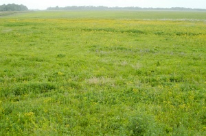
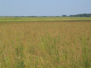
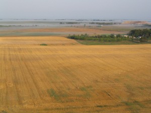
The Nature Conservancy (TNC) owns and manages 24,795 acres of mixed wetland, farmland and woods east of
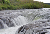
Crookston in northwestern Minnesota. The land was a naturally poorly drained portion of the eastern edge
of Glacial Lake Agassiz and is composed of a series of sandy beach ridges separated by inter-ridge wetlands. Much of
the land is now artificially drained by ditches and under cultivation. The landowner in partnership with eleven national,
state, local and private organizations intends to restore much of this land to pre-settlement wetlands and native prairie
with the aim of improving water quality, reducing flooding, and improving wildlife habitat. The U.S. Fish and Wildlife
Service plans to incorporate the TNC land with various state and national public lands into a 30,000-acre contiguous
block of protected and managed natural lands called Glacial Ridge National Wildlife Refuge. Wetland restoration will
involve modifying many ditches. The Red Lake Watershed District, the Minnesota Department of Natural Resources,
and others are concerned that TNC restorations will negatively affect their land or interests. In preparation for the restoration activities and to document the hydrologic changes resulting from these restorations,TNC and the Red Lake Watershed District have asked the U.S. Geological Survey (USGS) to perform a hydrologic investigation of a 250,000-acre study area containing TNC and other public lands.
Objectives:
- Continue the long-term monitoring program to determine hydrologic changes resulting from prairie and wetland restorations.
- Investigate mercury releases from newly restored wetlands.
Relevance and Impact:
This study will benefit the USGS, sister federal bureaus, State of Minnesota resource departments, local regulatory and
management agencies, private organizations interested in restoration activities, and the general scientific and
environmental policy-making communities. The USGS will benefit from this study by documenting the hydrologic setting
of the largest wetland and prairie restoration project in U.S. history. The Red Lake Watershed District, the local agency responsible for the ditch system in the study area, will benefit from this project by being able to make decisions about ditch abandonment based on detailed knowledge of the hydrology of study area. The City of Crookston, whose backup city water well is within the study area, will be able to use the ground-watermodel to delineate a well-head protection area for their well. Consortia like the Red River Flood Damage Reduction Working Group, will be able to use results of the study to encourage wetland management to reduce flood damage. The Nature Conservancy will be able to much more effectively manage their restoration projects with the hydrologic understanding of their land that this study will produce. Without the study, TNC will probably not be allowed to pursue its goal of wetland restoration over much of its land. TNC also will have no scientific basis upon which to judge theeffectiveness of their restoration efforts without this study.All parties will benefit from the USGS reputation for impartiality and superb science. The parties will be able to quicklysettle on the facts of the restoration issues and concentrate on the policy issues that they must decide.
Progress during FY13
Water level, water temperature (wells only) and shelter temperature were recorded hourly at 12 wells and every 15 minutes at 6 ditch gages. Rating curves are now maintained to convert stage into flow. Fifteen-minute rainfall sums were recorded at the 10 wells. Continuous hydrograph data are available in real time on the world-wide-web. All SW gages were switched to satellite telemetry to improve reliability. All bubbler gage leaks were fixed. Coordination between USGS and USFWS ditch gaging staff was greatly improved. All SW and wetland gage measuring points were optically surveyed. Historic groundwater hydrographs were approved for well G15. All GW records are worked through the spring calibration measurements. The four sampling trips were completed. During each trip, 12 GW and 7 SW samples were collected and analyzed for nutrient and suspended sediment (SW sites only) concentrations. Four synoptic water-level measurements were completed by a U.S. Fish and Wildlife Service (USFWS) employee. The synoptic measurement consists of 72 wells, 11 wetlands, and 7 ditches. These data were rigorously quality assured. The measuring-point heights of all synoptic water-level sites were re-measured and reconciled with previous measurements. Water levels were corrected to account for any changes.
A grant from the Legislative and Citizen Commission on Minnesota Resources (LCCMR) was secured that will fund substantial parts of this project through its completion. This funding has added a new goal of extending project findings to other parts of Minnesota. Another LCCMR proposal was funded to continue all project gaging. Two SW gages and 3 GW gages were not decommissioned beginning in FY 2014 because this funding was secured. The seasonal analysis of water flows and the water-quality synoptic are also able to continue. The mercury report was published and a press announcement sent. This resulted in a newspaper article in the St. Paul Pioneer Press. Although groundwater levels remain near historic lows for the summer and early fall, late fall rains have resulted in some recharge. Generally, nitrate concentrations remain low and constant, but some low-concentration wells (<1 mg/L an N) show slight increases. Nitrate concentrations have decreased to less than 2 mg/L as N in all but 4 wells: (G16, G15, E03, and G22). Concentrations at G15 and G22 continue to decrease. Those at E03 are highly variable. Those at G16 continue to increase and are now at 4 mg/L as N. Nitrate concentrations at G22 are still above 35 mg/L. This well is the only well left that is beneath agricultural land and it is irrigated.
Progress during 2014
Water level, water temperature (wells only) and shelter temperature were recorded hourly at 12 wells and every 15 minutes at 6 ditch gages. Rating curves are now maintained to convert stage into flow. Fifteen-minute rainfall sums were recorded at the 10 wells. Continuous hydrograph data are available in real time on the world-wide-web.
Telemetry was partially reestablished at GW sites using a tower at the University of North Dakotas Glacial Ridge Atmospheric Research Site.
All wetland gage measuring points were optically surveyed in October, 2013 and September 2014. Gages at WL2 and WL7 were reestablished. SW gage MPs were surveyed in July 2014. Transfer of responsibilities for SW records were successfully transferred to new staff.
All GW records are worked and approved through the spring calibration measurements. All continuous records at the 12 GW sites were checked for daily-mean (or daily-total for precipitation) completeness and approval. Missing records were estimated from hydrographs at nearby wells, producing complete hydrographs since the beginning of WY2003. The rise program was used to calculate annual and seasonal recharge at all wells during WY2003-WY 2012.
Fifteen-minute precipitation data were entered into NWIS for 7 of 10 sites because of a data request from a university researcher on the East Coast. These data were not corrected and approved.
The five GW and six SW sampling trips were completed. During each trip, 12 GW and/or 6 SW samples were collected and analyzed for nutrient and suspended sediment (SW sites only) concentrations. All water-quality data collected through September 2013 were reviewed for accuracy and approved. Permanent pump lines were installed in 2 wells which require extensive purging because of their depths. These lines permitted proper purging at well E03 for the first time in the history of the project. Nitrate concentrations suggest that the extra purging had little effect on water-quality results.
A student intern, Catherine Christenson, was hired and trained to quality-assure all synoptic WL measurements in preparation for water-table map construction and GW storage change calculations.
A new U.S. Fish and Wildlife Service (USFWS) employee was trained for synoptic WL measurements and GW sampling. Six synoptic water-level measurements were completed. The synoptic measurement consists of 72 wells, 11 wetlands, and 6 ditches. These data were rigorously quality assured. Measuring points were rationalized and fixed in NWIS to reduce MP errors when using MONKES. NWIS Water levels for the entire period of record (12 years) were re-evaluated by plotting hydrographs at each well and comparing these to hydrographs at nearby sites. ArcMap models were created to automate the construction of water-table (WT) maps and these maps were made for each synoptic water level measurement since 2003. Subsequent WT maps were subtracted from previous ones to create WT change maps. These methods identified many erroneous water levels each of which was checked and either corrected or deleted in NWIS. Serious inconsistencies among measuring points were found and corrected for wetland and ditch gages.
A $168,000 grant from the Legislative and Citizen Commission on Minnesota Resources (LCCMR) was secured that will all components of this project through its completion, except water-quality synoptic sampling and analysis. This additional funding has prevented the discontinuation of two SW gages and 3 GW gages beginning in FY 2014. The seasonal analysis of water flows and the water-quality synoptic are also not yet funded.
Many revisions were made to both LCCMR grant budgets. Bills already submitted needed to be amended and resubmitted. Changes to the first LCCMR grant budget were made and submitted and approved.
Progress during 2015
Water level, water temperature (wells only) and shelter temperature were recorded hourly at 12 wells and every 15 minutes at 6 ditch gages. Rating curves are maintained to convert stage into flow. Fifteen-minute rainfall sums were recorded at the 10 wells.
Water level and flow monitoring were discontinued with the end of federal fiscal year 2015 on 1 October. Dataloggers will continue to operate as long as they are able through the end of the project and calibration groundwater levels will be measured when other work in the area permits it. No further records will be corrected.
Catherine Christenson and a student worker at the U.S. Fish and Wildlife Service was trained on MONKES and how to make synoptic water-level measurements. They measured water levels for five synoptic runs at 92 water levels sites each; water levels were quality-assured, entered into NWIS, and approved. All synoptic water-level measurements from 2002-2015 were interpolated to a 50-m water-table grid.
Measuring-point elevations were measured with an optical level at 9 wetland staff gages.
New or destroyed elevation reference marks were surveyed and water level elevations were corrected. These corrected water levels were incorporated into temporal data sets and a water table map was produced for each synoptic water level measurement. Difference maps were also produced between subsequent measurements and the change in groundwater storage was calculated for each basin in the study.
Land-use data were compiled from NRCS Wetland Reserve Programs records and remote sensing crop estimates (USDA Cropland Data Layer) to produce a time series of land use during the period 2006-13. These data will be used as input to the SWB model to estimate evapotranspiration for water mass balances. The data will also be used to quantify land-use change in the study area before and after restoration. Compilation of rainfall data has begun.
Five groundwater and six ditch-water temporal water sampling events were completed at 12 wells and 6 ditch sites. Two quality assurance samples were collected during each event. Field parameters, including turbidity, were collected for all samples, which were analyzed for nutrients and suspended sediment (ditch-water samples only). All water-quality data were reviewed for accuracy and approved.
Compiled rainfall data were interpolated to a 50-m grid of the study area for each day during 1 October 2002-31 December 2014. Analysis of precipitation between recorder sites and DayMet interpolations at the same locations showed that unheated raingage data recorded about 25% of winter precipitation. To adjust for this, all recorded precipitation was increased by 4-times before interpolation. Because timing of winter precipitation is not accurate, these data can only be used in winter aggregations.
Dave Lorenz developed an automated method in R to estimate recharge using individual groundwater recession curves. This method will be used to more accurately estimate recharge at continuous water-level wells.
Initial work began on unit-hydrograph modeling of ditch-gage flow hydrographs.
Amendments were approved to delay completion of the project to 31 December 2016.
Nutrient concentrations continue to fall or remain low in samples from most wells. However, samples from about one-half of the wells now have increasing nitrate since 2010.
Nitrate, ammonia, and organic nitrogen continue to be the major nutrient in ditch water, all generally below about 1.5 mg/L as N.
Analysis of precipitation data show that study data are about 20% lower than DayMet data. Equivalent DayMet data are 5 times less variable than study precipitation data.
Local variability is very important in precipitation, especially in the summer when individual storms may be very local.
During 2002-2014, average precipitation was 20.68 in., (SD = 4.12 in.). 2010 was wettest with 28.95 in. and 2011 was driest with 14.62 in.
Progress during 2016
Water level, water temperature (wells only) and shelter temperature were recorded hourly at 11 wells. Fifteen-minute rainfall sums were recorded at the 10 wells. Continuous hydrograph data are available on the world-wide-web.
Water level and flow monitoring were discontinued with the end of federal fiscal year 2015 on 1 October. Dataloggers will continue to operate as long as they are able through the end of the project and calibration groundwater levels will be measured when other work in the area permits it. Groundwater records were corrected and approved through early April 2016. No further records will be corrected. The trandsducer at well E01D failed on 9 April 2016 and was not replaced. The transducer at well G08 failed on 2 August 2015 and was replaced on 19 April 2016 and continues to function. Raingages continue to operate but many data are absent because the gages are not cleaned. We will try to interest U.S. Fish and Wildlife Service staff in cleaning the raingages.
One groundwater and ditch-water temporal water sampling event was completed at 12 wells and 6 ditch sites. Two quality assurance samples were also collected. Field parameters, including turbidity, were collected for all samples, which were analyzed for nutrients and suspended sediment (ditch-water samples only). All water-quality data were reviewed for accuracy and approved.
One water-levels synoptic of 89 sites was completed; water levels were quality-assured, entered into NWIS, and approved. All synoptic water-level measurement during 2002¿15 were interpolated to a 30-m water-table grid to be used in mass-balance calculations.
Rainfall data were compiled, gaps filled in, and aggregated to seasonal and annual totals at 9 of the 10 study sites and the SCAN climate station through 30 September 2015. Gaps were filled in by data from the nearest 4 other sites. If data were missing at all 5 of these sites, DayMet data from the cell containing the site was used. Recorded winter precipitation data at all sites were retained and used in the compilation. All rainfall data were re-interpolated to a 60-m grid of the study area for each day during 1 October 2002-30 September 2015. The new grid was chosen to be a multiple of the 30-m landuse data that will be used in mass-balance and landscape factor analyses.
Groundwater recharge, groundwater discharge to ditches and total ditch runoff were re-calculated at all stations during 1 October 2002-30 September 2015and were distributed among the mass-balance basins using Thiessen polygons and aggregated annually and seasonally. Annual change in groundwater storage was calculated by basin using a newly developed water-table interpolation tool. Evapotranspiration was calculated from 2002 through 2014 using a published Statewide SWB model and using a new, much more detailed, uncalibrated study-scale SWB model. All synoptic water-levels were contoured and maps subtracted to produce changes in groundwater storage. All components of the water budget are now calculated.
Unit-hydrograph modeling of ditch-gage flow hydrographs was completed. Ditch flow was aggregated seasonally and annually during 1 October 2002-30 September 2015.
Land-use data were compiled from NRCS Wetland Reserve Programs records and remote sensing crop estimates (USDA Cropland Data Layer) to produce a time series of land use during the period 2006-13. These data will be used as input to the SWB model to estimate evapotranspiration for water mass balances. The data will also be used to quantify land-use change in the study area before and after restoration.
Land-use change summaries were calculated by basin seasonally. 60-m grids of landscape characteristic were produced that may explain changes between pre- and post-restoration hydrologic changes.
Two abstracts were subsubmitted and accepted to 2 conferences. These were withdrawn from 1 conference for lack of travel funds. The final report outline was completed.
Statement of Work for 2017
Annual mass balances will be completed and analyzed, characterizing changes in water flux during the pre- and post-restoration periods of the study.
Water-quality data analysis will be completed. This analysis will document the change in surface-water and groundwater quality between the pre- and post-restoration conditions by surface-water basin.
Catherine Christenson will produce 50-m grids of landscape characteristic that may explain changes between pre- and post-restoration hydrologic changes. In addition to land-use change, characteristics will include density of restored lands, type of restoration, restoration maintenance practice, continuing agricultural use density and mix, soil type, and land slope.
Analysis of hydrologic change by basin will be completed. This analysis will identify landscape characteristic that produce positive hydrologic changes. Based on these characteristics, other areas in western Minnesota will be identified that hold promise for positive hydrologic change from wetland and prairie restoration.
The final report draft will be completed.
|