Minnesota Water Science Center

DATA CENTER
USGS IN YOUR STATEUSGS Water Science Centers are located in each state. 
|
Surface-Water Information and Data
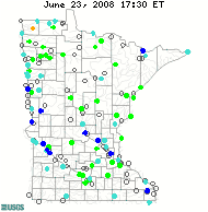
The U.S. Geological Survey operates and maintains approximately 7,300 streamgages nationwide, 149 here in Minnesota, which provide long-term, accurate, and unbiased information that meets the needs of many diverse users. The USGS collects the streamflow data needed by Federal, State, and local agencies for planning and operating water-resources projects and regulatory programs. The map to the left shows current streamflow conditions in Minnesota; click the map to go to a full size version from USGS WaterWatch. The links below allow you to find information and data about Minnesota's surface-water resources. ( Surface-Water DataStreamflow
WaterWatch
Information ResourcesUSGS National resources
Water-education resources
|