USGS - science for a changing world

Minnesota Water Science Center

  Home   Information/Data   Projects   Publications   Drought   Flood   NAWQA   Office   Contact   Other USGS
UMIS Study Unit Map.

UMIS NAWQA

USGS IN YOUR STATE

USGS Water Science Centers are located in each state.

There is a USGS Water Science Center office in each State. Washington Oregon California Idaho Nevada Montana Wyoming Utah Colorado Arizona New Mexico North Dakota South Dakota Nebraska Kansas Oklahoma Texas Minnesota Iowa Missouri Arkansas Louisiana Wisconsin Illinois Mississippi Michigan Indiana Ohio Kentucky Tennessee Alabama Pennsylvania West Virginia Georgia Florida Caribbean Alaska Hawaii New York Vermont New Hampshire Maine Massachusetts South Carolina North Carolina Rhode Island Virginia Connecticut New Jersey Maryland-Delaware-D.C.

National Water-Quality Assessment (NAWQA) Projects in Minnesota


All NAWQA sites in the United States

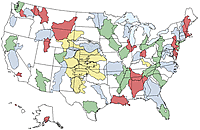
The National Water-Quality Assessment (NAWQA) Program is designed to describe the status and trends in the quality of the Nation's surface- and ground-water resources and to provide a sound understanding of the natural and anthropogenic factors that affect the quality of these resources. As part of the program, investigations are conducted in 59 areas called "study units" throughout the Nation to provide a framework for national and regional water-quality assessment. Regional and national synthesis of information from study units consist of comparative studies of specific water-quality issues using nationally consistent information.

NAWQA Programs Conducted by the Minnesota Water Science Center:

USGS Home Water Resources Biology Geography Geology Geospatial

Accessibility FOIA Privacy Policies and Notices

Take Pride in America logo USA.gov logo U.S. Department of the Interior | U.S. Geological Survey
URL: http://mn.water.usgs.gov/nawqa/index.html
Page Contact Information: Webmaster
Page Last Modified: Wednesday, 25-Feb-2009 18:01:54 EST

05301000: Flow=2280cfs,Stage=27.94ft,2009-11-22 08:00,High,MINNESOTA RIVER NEAR LAC QUI PARLE, MN 05291000: Flow=134cfs,Stage=2.64ft,2009-11-22 08:00,High,WHETSTONE RIVER NEAR BIG STONE CITY, SD 05290000: Flow=126cfs,Stage=11.14ft,Floodstage=17.0ft,2009-11-22 08:45,High,LITTLE MINNESOTA RIVER NEAR PEEVER, SD 05062000: Flow=345cfs,Stage=7.34ft,Floodstage=12.0ft,2009-11-22 08:30,High,BUFFALO RIVER NEAR DILWORTH, MN 05054000: Flow=1910cfs,Stage=15.90ft,Floodstage=18.0ft,2009-11-22 08:15,High,RED RIVER OF THE NORTH AT FARGO, ND 05053000: Flow=346cfs,Stage=2.50ft,Floodstage=10.0ft,2009-11-22 08:15,High,WILD RICE RIVER NR ABERCROMBIE, ND 05051500: Flow=1840cfs,Stage=7.78ft,Floodstage=10.0ft,2009-11-22 08:00,High,RED RIVER OF THE NORTH AT WAHPETON, ND 05050000: Flow=1110cfs,Stage=9.17ft,Floodstage=80.0ft,2009-11-22 08:00,High,BOIS DE SIOUX RIVER NEAR WHITE ROCK, SD 05330000: Flow=5810cfs,Stage=10.46ft,Floodstage=25.0ft,2009-11-22 08:00,>90,MINNESOTA RIVER NEAR JORDAN, MN 05325000: Flow=5170cfs,Stage=6.41ft,Floodstage=22.0ft,2009-11-22 08:00,>90,MINNESOTA RIVER AT MANKATO, MN 05313500: Flow=135cfs,Stage=3.07ft,2009-11-22 07:00,>90,YELLOW MEDICINE RIVER NEAR GRANITE FALLS, MN 05311000: Flow=2570cfs,Stage=9.35ft,Floodstage=14.0ft,2009-11-22 08:00,>90,MINNESOTA RIVER AT MONTEVIDEO, MN 05300000: Flow=297cfs,Stage=6.98ft,2009-11-22 08:00,>90,LAC QUI PARLE RIVER NEAR LAC QUI PARLE, MN 05294000: Flow=236cfs,Stage=5.47ft,2009-11-22 08:00,>90,POMME DE TERRE RIVER AT APPLETON, MN 05293000: Flow=105cfs,Stage=2.72ft,2009-11-22 08:00,>90,YELLOW BANK RIVER NEAR ODESSA, MN 05270500: Flow=421cfs,Stage=2.27ft,Floodstage=6.0ft,2009-11-22 06:30,>90,SAUK RIVER NEAR ST. CLOUD, MN 05247500: Flow=2110cfs,2009-11-22 08:30,Stage=4.61ft,2009-11-22 07:00:00,>90,CROW WING RIVER NEAR PILLAGER, MN 05092000: Flow=5310cfs,Stage=13.83ft,Floodstage=32.0ft,2009-11-22 08:00,>90,RED RIVER OF THE NORTH AT DRAYTON, ND 05082500: Flow=4610cfs,Stage=17.66ft,Floodstage=28.0ft,2009-11-22 08:30,>90,RED RIVER OF THE NORTH AT GRAND FORKS, ND 05064500: Flow=3220cfs,Stage=9.35ft,Floodstage=26.0ft,2009-11-22 08:00,>90,RED RIVER OF THE NORTH AT HALSTAD, MN 05064000: Flow=644cfs,Stage=8.18ft,Floodstage=20.0ft,2009-11-22 07:00,>90,WILD RICE RIVER AT HENDRUM, MN 05062500: Flow=367cfs,Stage=3.50ft,Floodstage=10.0ft,2009-11-22 06:00,>90,WILD RICE RIVER AT TWIN VALLEY, MN 05061500: Flow=132cfs,2009-11-22 07:00,Stage=8.35ft,2009-11-21 21:00:00,Floodstage=12.0ft,>90,SOUTH BRANCH BUFFALO RIVER AT SABIN, MN 05061000: Flow=146cfs,2009-11-22 05:30,Stage=4.51ft,2009-11-22 06:45:00,Floodstage=7.0ft,>90,BUFFALO RIVER NEAR HAWLEY, MN 05046000: Flow=811cfs,Stage=3.57ft,2009-11-22 09:00,>90,OTTER TAIL RIVER BL ORWELL D NR FERGUS FALLS, MN 06482610: Flow=68cfs,Stage=2.31ft,Floodstage=8.5ft,2009-11-22 08:45,76-90,SPLIT ROCK CR AT CORSON,SD 05457000: Flow=187cfs,Stage=3.08ft,2009-11-22 08:00,76-90,CEDAR RIVER NEAR AUSTIN, MN 05388250: Flow=476cfs,Stage=7.78ft,Floodstage=14.0ft,2009-11-22 08:00,76-90,Upper Iowa River near Dorchester, IA 05320000: Flow=898cfs,Stage=3.01ft,2009-11-22 08:15,76-90,BLUE EARTH RIVER NEAR RAPIDAN, MN 05317000: Flow=249cfs,Stage=3.70ft,Floodstage=11ft,2009-11-22 08:00,76-90,COTTONWOOD RIVER NEAR NEW ULM, MN 05316500: Flow=145cfs,Stage=2.41ft,Floodstage=6.0ft,2009-11-22 06:00,76-90,REDWOOD RIVER NEAR REDWOOD FALLS, MN 05304500: Flow=399cfs,Stage=2.12ft,2009-11-22 08:00,76-90,CHIPPEWA RIVER NEAR MILAN, MN 05280000: Flow=1140cfs,Stage=3.62ft,Floodstage=10.0ft,2009-11-22 08:00,76-90,CROW RIVER AT ROCKFORD, MN 05267000: Flow=5830cfs,Stage=10.13ft,2009-11-22 08:00,76-90,MISSISSIPPI RIVER NEAR ROYALTON, MN 05245100: Flow=153cfs,Stage=2.36ft,Floodstage=6.0ft,2009-11-22 07:00,76-90,LONG PRAIRIE RIVER AT LONG PRAIRIE, MN 05244000: Flow=599cfs,Stage=3.35ft,2009-11-22 07:00,76-90,CROW WING RIVER AT NIMROD, MN 05094000: Flow=40cfs,Stage=3.79ft,2009-11-22 08:00,76-90,SOUTH BRANCH TWO RIVERS AT LAKE BRONSON, MN 05078500: Flow=190cfs,Stage=2.59ft,2009-11-22 08:00,76-90,CLEARWATER RIVER AT RED LAKE FALLS, MN 05078230: Flow=51cfs,2009-11-22 08:30,Stage=4.81ft,2009-11-22 06:00:00,76-90,LOST RIVER AT OKLEE, MN 05069000: Flow=48cfs,Stage=4.67ft,Floodstage=20.0ft,2009-11-22 06:00,76-90,SAND HILL RIVER AT CLIMAX, MN 05067500: Flow=9.1cfs,Stage=4.33ft,Floodstage=14.0ft,2009-11-22 08:15,76-90,MARSH RIVER NEAR SHELLY, MN 05333500: Flow=879cfs,Stage=0.94ft,Floodstage=7.0ft,2009-11-22 06:00,10-24,ST. CROIX RIVER NEAR DANBURY, WI 05127500: Flow=456cfs,Stage=2.77ft,2009-11-22 08:30,10-24,BASSWOOD RIVER NEAR WINTON, MN 05124480: Flow=28cfs,Stage=2.70ft,2009-11-22 08:00,10-24,KAWISHIWI RIVER NEAR ELY, MN 05355200: Flow=417cfs,Stage=3.44ft,2009-11-22 08:00,25-75,CANNON RIVER AT WELCH, MN 05353800: Flow=108cfs,Stage=4.16ft,2009-11-22 08:00,25-75,STRAIGHT RIVER NEAR FARIBAULT, MN 05345000: Flow=39cfs,Stage=2.61ft,2009-11-22 05:30,25-75,VERMILLION RIVER NEAR EMPIRE, MN 05340500: Flow=3270cfs,Stage=3.38ft,2009-11-22 06:15,25-75,ST. CROIX RIVER AT ST. CROIX FALLS, WI 05338500: Flow=379cfs,2009-11-22 06:00,0000-00-00 00:00:00,Floodstage=9.0ft,25-75,SNAKE RIVER NEAR PINE CITY, MN 05336700: Flow=420cfs,Stage=4.79ft,2009-11-22 06:00,25-75,KETTLE RIVER BELOW SANDSTONE, MN 05336000: Flow=1910cfs,Stage=4.43ft,2009-11-22 08:00,25-75,ST. CROIX RIVER NEAR GRANTSBURG, WI 05327000: Flow=70cfs,Stage=3.38ft,2009-11-22 05:30,25-75,HIGH ISLAND CREEK NEAR HENDERSON, MN 05320500: Flow=217cfs,Stage=1.69ft,2009-11-22 05:00,25-75,LE SUEUR RIVER NEAR RAPIDAN, MN 05319500: Flow=160cfs,Stage=1.40ft,2009-11-22 06:00,25-75,WATONWAN RIVER NEAR GARDEN CITY, MN 05317200: Flow=58cfs,Stage=3.68ft,2009-11-22 07:00,25-75,LITTLE COTTONWOOD RIVER NEAR COURTLAND, MN 05288500: Flow=8460cfs,Stage=3.98ft,2009-11-22 08:00,25-75,MISSISSIPPI RIVER NEAR ANOKA, MN 05286000: Flow=394cfs,Stage=2.81ft,2009-11-22 07:00,25-75,RUM RIVER NEAR ST. FRANCIS, MN 05278000: Flow=78cfs,Stage=3.26ft,2009-11-22 08:00,25-75,MIDDLE FORK CROW RIVER NEAR SPICER, MN 05275000: Flow=156cfs,Stage=1.13ft,2009-11-22 06:00,25-75,ELK RIVER NEAR BIG LAKE, MN 05227500: Flow=2480cfs,Stage=6.56ft,Floodstage=12.0ft,2009-11-22 08:00,25-75,MISSISSIPPI RIVER AT AITKIN, MN 05211000: Flow=1140cfs,Stage=4.51ft,2009-11-22 08:00,25-75,MISSISSIPPI RIVER AT GRAND RAPIDS, MN 05133500: Flow=13500cfs,Stage=6.63ft,2009-11-22 08:30,25-75,RAINY RIVER AT MANITOU RAPIDS, MN 05132000: Flow=499cfs,Stage=3.81ft,2009-11-22 08:30,25-75,BIG FORK RIVER AT BIG FALLS, MN 05131500: Flow=933cfs,Stage=4.04ft,2009-11-22 08:30,25-75,LITTLE FORK RIVER AT LITTLEFORK, MN 05130500: Flow=89cfs,Stage=2.33ft,2009-11-22 08:30,25-75,STURGEON RIVER NEAR CHISHOLM, MN 05112000: Flow=107cfs,Stage=2.46ft,2009-11-22 06:00,25-75,ROSEAU RIVER BELOW STATE DITCH 51 NR CARIBOU, MN 05107500: Flow=75cfs,Stage=2.56ft,2009-11-22 06:00,25-75,ROSEAU RIVER AT ROSS, MN 05106000: Flow=22cfs,Stage=3.03ft,2009-11-22 08:00,25-75,SPRAGUE CREEK NEAR SPRAGUE, MANITOBA, CANADA 05104500: Flow=17cfs,Stage=4.16ft,2009-11-22 08:30,25-75,ROSEAU RIVER BELOW SOUTH FORK NEAR MALUNG, MN 05087500: Flow=4.9cfs,Stage=3.69ft,2009-11-22 08:30,25-75,MIDDLE RIVER AT ARGYLE, MN 05079000: Flow=872cfs,Stage=5.71ft,Floodstage=15.0ft,2009-11-22 08:00,25-75,RED LAKE RIVER AT CROOKSTON, MN 05078000: Flow=87cfs,Stage=2.93ft,2009-11-22 07:00,25-75,CLEARWATER RIVER AT PLUMMER, MN 05076000: Flow=87cfs,Stage=5.16ft,2009-11-22 08:15,25-75,THIEF RIVER NEAR THIEF RIVER FALLS, MN 05074500: Flow=344cfs,Stage=70.58ft,2009-11-22 08:00,25-75,RED LAKE RIVER NEAR RED LAKE, MN 04024430: Flow=194cfs,Stage=5.21ft,Floodstage=20.0ft,2009-11-22 06:00,25-75,NEMADJI RIVER NEAR SOUTH SUPERIOR, WI 04024000: Flow=1530cfs,Stage=3.68ft,Floodstage=10.5ft,2009-11-22 08:30,25-75,ST. LOUIS RIVER AT SCANLON, MN 04015330: Flow=49cfs,2009-11-22 06:00,Stage=3.07ft,2009-11-22 07:30:00,25-75,KNIFE RIVER NEAR TWO HARBORS, MN 04010500: Flow=204cfs,Stage=3.02ft,2009-11-22 08:30,25-75,PIGEON RIVER AT MIDDLE FALLS NR GRAND PORTAGE MN 464646092052900: Stage=601.98ft,2009-11-22 06:25:00,Not ranked,Rating being developed or revised,SUPERIOR BAY DULUTH SHIP CANAL AT DULUTH, MN 06604000: Stage=14.13ft,2009-11-22 05:45:00,Floodstage=17.0ft,Not ranked,Spirit Lake near Orleans, IA 06483290: Flow=149cfs,Stage=7.75ft,Floodstage=13.0ft,2009-11-22 08:15,Not ranked,Rock River below Tom Creek at Rock Rapids, IA 05476000: Stage=4.06ft,2009-11-22 08:00:00,Floodstage=12.0ft,Not ranked,Rating being developed or revised,DES MOINES RIVER AT JACKSON, MN 05475350: Stage=14.32ft,2009-11-22 08:00:00,Floodstage=19.0ft,Not ranked,DES MOINES RIVER ABOVE WINDOM, MN -DM4 05386400: Stage=30.91ft,2009-11-22 08:00:00,Not ranked,MISSISSIPPI RIVER AT BROWNSVILLE, MN 05385500: Stage=1.29ft,2009-11-22 08:00:00,Not ranked,SOUTH FORK ROOT RIVER NEAR HOUSTON, MN 05385000: Stage=3.69ft,2009-11-22 08:00:00,Floodstage=15.0ft,Not ranked,ROOT RIVER NEAR HOUSTON, MN 05384330: Stage=10.99ft,2009-11-04 10:30:00,Not ranked,ROOT RIVER ABOVE RUSHFORD, MN 05383950: Flow=396cfs,Stage=8.34ft,2009-11-22 09:00,Not ranked,ROOT RIVER NEAR PILOT MOUND, MN 05383075: Flow=459cfs,Stage=3.30ft,2009-11-22 06:00,Not ranked,LA CROSSE RIVER NEAR LA CROSSE, WI 05380509: Stage=2.51ft,2009-11-22 06:00:00,Not ranked,TANK CREEK NEAR GALESVILLE, WI 05378500: Stage=5.57ft,Floodstage=13.0ft,2009-11-22 08:00,Not ranked,Very low value,MISSISSIPPI RIVER AT WINONA, MN 05378490: Stage=5.96ft,2009-11-22 08:00:00,Not ranked,MISSISSIPPI RIVER AT LOCK AND DAM 5A NR WINONA, MN 05374000: Stage=6.01ft,2009-11-22 08:00:00,Floodstage=18.0ft,Not ranked,ZUMBRO RIVER AT ZUMBRO FALLS, MN 05372995: Flow=145cfs,Stage=2.83ft,Floodstage=14.0ft,2009-11-22 08:00,Not ranked,SOUTH FORK ZUMBRO RIVER AT ROCHESTER, MN 05346050: Stage=669.02ft,2009-11-22 08:00:00,Not ranked,CLEAR LAKE, EAST SIDE, AT PRAIRIE ISLAND, MN 05344850: Stage=673.92ft,2009-11-22 05:00:00,Not ranked,STURGEON LAKE, WEST SIDE, AT PRAIRIE ISLAND, MN 05344500: Stage=25.75ft,2009-11-22 08:00,Not ranked,Very low value,MISSISSIPPI RIVER AT PRESCOTT, WI 05344490: Flow=4770cfs,Stage=25.75ft,2009-11-22 08:30,Not ranked,ST. CROIX RIVER AT PRESCOTT, WI 05342000: Flow=91cfs,Stage=9.82ft,2009-11-22 06:15,Not ranked,KINNICKINNIC RIVER NEAR RIVER FALLS, WI 05331580: Stage=7.74ft,2009-11-22 08:30:00,Not ranked,MISSISSIPPI RIVER BELOW L&D #2 AT HASTINGS, MN 05331000: Stage=4.14ft,Floodstage=14.0ft,2009-11-22 08:15,Not ranked,Very low value,MISSISSIPPI RIVER AT ST. PAUL, MN 05330920: Stage=688.41ft,2009-11-22 08:45:00,Not ranked,Equipment malfunction,MINNESOTA RIVER AT FORT SNELLING STATE PARK, MN 05320270: Flow=23cfs,Stage=4.93ft,2009-11-22 06:30,Not ranked,LITTLE COBB RIVER NEAR BEAUFORD, MN 05316580: Flow=3400cfs,Stage=14.46ft,2009-11-22 08:30,Not ranked,MINNESOTA RIVER AT MORTON, MN 05315000: Flow=18cfs,Stage=8.08ft,Floodstage=14.0ft,2009-10-08 03:00,Not ranked,REDWOOD RIVER NEAR MARSHALL, MN 05305000: Stage=37.88ft,2009-11-22 08:00:00,Not ranked,CHIPPEWA RIVER (TW) NEAR WATSON, MN 05304995: Stage=38.44ft,2009-11-22 08:00:00,Not ranked,CHIPPEWA R. (HW) ABOVE COUNTY RD 13 NR WATSON, MN 05292000: Flow=516cfs,Stage=3.91ft,Floodstage=10.0ft,2009-11-22 08:00,Not ranked,MINNESOTA RIVER AT ORTONVILLE, MN 05289800: Stage=11.82ft,2009-11-22 05:30:00,Not ranked,MINNEHAHA CREEK AT HIAWATHA AVE. IN MINNEAPOLIS,MN 05288705: Flow=1.0cfs,Stage=9.11ft,2009-11-22 09:00,Not ranked,SHINGLE CREEK AT QUEEN AVE IN MINNEAPOLIS, MN 05288580: Flow=50cfs,Stage=7.67ft,2009-11-22 08:30,Not ranked,RICE CREEK BLW OLD HWY. 8 IN MOUNDS VIEW, MN 05287890: Flow=9.5cfs,Stage=3.66ft,2009-11-22 08:00,Not ranked,ELM CREEK NR CHAMPLIN, MN 05284000: Stage=10.57ft,2009-11-22 06:00:00,Not ranked,MILLE LACS LAKE AT COVE BAY NEAR ONAMIA, MN 05270700: Flow=6510cfs,Stage=5.39ft,Floodstage=9.0ft,2009-11-22 06:30,Not ranked,MISSISSIPPI RIVER AT ST. CLOUD, MN 05243725: Flow=72cfs,Stage=1.72ft,2009-11-22 06:00,Not ranked,STRAIGHT RIVER NEAR PARK RAPIDS, MN 05242300: Flow=3320cfs,Stage=6.80ft,Floodstage=13.0ft,2009-11-22 07:00,Not ranked,MISSISSIPPI RIVER AT BRAINERD, MN 05220600: Flow=2070cfs,Stage=43.84ft,2009-11-22 08:00,Not ranked,MISSISSIPPI RIVER AT PALISADE, MN 05212700: Flow=138cfs,Stage=3.11ft,2009-11-22 08:30,Not ranked,PRAIRIE RIVER NEAR TACONITE, MN 05210000: Stage=73.59ft,2009-11-22 08:00:00,Not ranked,MISSISSIPPI R. AT DAYS HIGH LANDING NR DEER RIVER 05207600: Flow=635cfs,Stage=6.57ft,2009-11-22 08:00,Not ranked,MISSISSIPPI RIVER AT WILLOW BEACH AT BALL CLUB, MN 05205900: Stage=94.16ft,2009-11-22 08:00:00,Not ranked,LEECH LAKE AT SUGAR POINT NEAR FEDERAL DAM, MN 05200510: Flow=441cfs,Stage=3.90ft,2009-11-22 05:30,Not ranked,MISSISSIPPI RIVER NEAR BEMIDJI, MN 05140521: Stage=58.99ft,2009-11-22 08:00:00,Not ranked,LK OF THE WOODS @ SPRINGSTEEL IS NR. WARROAD, MN 05140520: Stage=59.10ft,2009-11-17 02:30:00,Not ranked,LAKE OF THE WOODS AT WARROAD, MN 05134200: Flow=28cfs,Stage=3.03ft,2009-11-22 08:00,Not ranked,RAPID RIVER NEAR BAUDETTE, MN 05129290: Flow=250cfs,Stage=16.07ft,2009-11-22 08:30,Not ranked,GOLD PORTAGE OUTLET FROM KABETOGAMA LK NR RAY,MN 05129115: Flow=547cfs,Stage=7.12ft,2009-11-22 08:30,Not ranked,VERMILION RIVER NR CRANE LAKE, MN 05126210: Flow=852cfs,Stage=5.17ft,2009-11-22 08:00,Not ranked,SOUTH KAWISHIWI R ABV WHITE IRON LAKE NR ELY, MN 05125000: Flow=294cfs,Stage=2.80ft,2009-11-22 08:00,Not ranked,SOUTH KAWISHIWI RIVER NEAR ELY, MN 05102490: Stage=15.79ft,2009-11-22 08:00:00,Not ranked,RED RIVER OF THE NORTH AT PEMBINA, ND 05085450: Flow=3.8cfs,Stage=60.62ft,2009-11-22 08:30,Not ranked,SNAKE RIVER ABOVE WARREN, MN 05085420: Not ranked,Site discontinued,SNAKE RIVER ABOVE RADIUM, MN 05083500: Stage=11.08ft,2009-11-22 08:15:00,Floodstage=26.0ft,Not ranked,RED RIVER OF THE NORTH AT OSLO, MN 05080000: Flow=723cfs,Stage=11.82ft,2009-11-22 06:45,Not ranked,RED LAKE RIVER AT FISHER, MN 05078770: Flow=0.95cfs,Stage=1.61ft,2009-11-22 19:00,Not ranked,JUDICIAL DITCH 66 NEAR MARCOUX CORNERS, MN (SW6) 05078720: Flow=0.24cfs,Stage=1.79ft,2009-10-01 11:15,Not ranked,CO DITCH 140 ABV BR-6 IMP NR TILDEN JCT, MN (SW8) 05075000: Stage=4.49ft,2009-11-22 08:00:00,Floodstage=12.0ft,Not ranked,RED LAKE RIVER AT HIGH LANDING NR GOODRIDGE, MN 05074000: Stage=74.73ft,2009-11-22 08:00:00,Not ranked,LOWER RED LAKE NR RED LAKE, MN 05073650: Stage=74.68ft,2009-11-22 08:00:00,Not ranked,LOWER RED LAKE AT MOUTH BATTLE RIVER NR SAUM, MN 05073500: Stage=74.76ft,2009-11-22 08:00:00,Not ranked,UPPER RED LAKE AT WASKISH, MN 05070000: Flow=3750cfs,Stage=21.94ft,2009-11-22 08:15,Not ranked,RED RIVER OF THE NORTH NEAR THOMPSON, ND 05063398: Flow=48cfs,Stage=4.95ft,2009-11-22 08:30,Not ranked,S. BR. WILD RICE RIVER AT CO. RD. 27 NR FELTON, MN 05060400: Stage=70.70ft,2009-11-22 07:00:00,Not ranked,SHEYENNE RIVER AT HARWOOD, ND 05052500: Not ranked,Seasonal site,ANTELOPE CREEK AT DWIGHT, ND 05051522: Flow=1290cfs,Stage=12.17ft,2009-11-21 17:45,Not ranked,RED RIVER OF THE NORTH AT HICKSON, ND 05051300: Flow=890cfs,Stage=12.28ft,2009-11-22 06:00,Not ranked,BOIS DE SIOUX RIVER NEAR DORAN, MN 05049995: Stage=73.87ft,2009-11-22 08:00:00,Not ranked,MUD LAKE ABOVE WHITE ROCK DAM NEAR WHITE ROCK, SD 05049000: Stage=77.32ft,2009-11-22 08:00:00,Floodstage=92.0ft,Not ranked,MUSTINKA RIVER ABOVE WHEATON, MN 05046475: Flow=9.2cfs,Stage=4.36ft,2009-11-22 08:00,Not ranked,OTTER TAIL RIVER DIVERSION AT BRECKENRIDGE, MN 05030500: Flow=506cfs,Stage=6.44ft,2009-11-22 06:00,Not ranked,OTTER TAIL RIVER NEAR ELIZABETH, MN 04021520: Stage=4.13ft,2009-11-22 08:00:00,Not ranked,Rating being developed or revised,STONEY BROOK AT PINE DRIVE NEAR BROOKSTON, MN Go to WaterWatch (offsite) for a larger map with additional options