USGS - science for a changing world

Minnesota Water Science Center

  Home   Information/Data   Projects   Publications   Drought   Flood   NAWQA   Office   Contact   Other USGS
UMIS Study Unit Map.

UMIS NAWQA

USGS IN YOUR STATE

USGS Water Science Centers are located in each state.

There is a USGS Water Science Center office in each State. Washington Oregon California Idaho Nevada Montana Wyoming Utah Colorado Arizona New Mexico North Dakota South Dakota Nebraska Kansas Oklahoma Texas Minnesota Iowa Missouri Arkansas Louisiana Wisconsin Illinois Mississippi Michigan Indiana Ohio Kentucky Tennessee Alabama Pennsylvania West Virginia Georgia Florida Caribbean Alaska Hawaii New York Vermont New Hampshire Maine Massachusetts South Carolina North Carolina Rhode Island Virginia Connecticut New Jersey Maryland-Delaware-D.C.

National Water Quality Assessment in the Upper Mississippi River Study Unit

A view of Mississippi River
Studies have been conducted since 1994 in the Upper Mississippi River Basin (UMIS), which includes land draining to the Mississippi River downstream to Lake Pepin, as part of the U.S. Geological Survey's National Water Quality Assessment (NAWQA) Program.
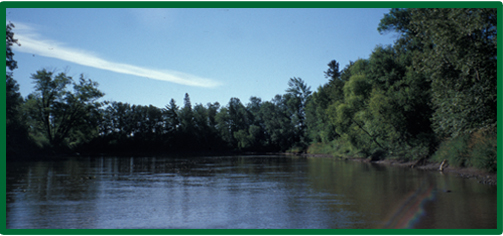
Goals of the NAWQA Program are to describe the status and trends of the quality of the Nation's streams, rivers, and aquifers and to improve understanding of the natural and anthropogenic factors that affect the quality of these resources.

Major Findings 1995 to Present


Agricultural Activities Increase Nutrient and Pesticide Concentrations in Ground Water and Streams

Water Quality and Aquatic Biological Conditions are Indicative of Dominant Land Uses
  • Chloride concentrations are greatest in Northern U.S. urban areas.
  • Urbanization affects fish communities and water quality in urban streams.
  • Concentrations of organic contaminants in fish tissues and bottom sediments are greatest in urban streams.
  • Invertebrates may reflect stream quality affected by urban development.


Riparian Characteristics Influence Aquatic Communities
  • Riparian cover and soil characteristics affect biological communities.
  • Riparian areas influence the quality of Midwestern streams and rivers.

NAWQA Program Changes

In 2001, the NAWQA Program begins its second decade of intensive water-quality assessments, which will build upon initial assessments of water-quality conditions and increase understanding of long-term trends and the factors that affect water quality.

What's New?


Status and Trends
  • Streams: Two surface-water sites continue for trend monitoring.
  • Groundwater: 17 existing wells continue to be sampled biennially as trend sites.
  • Source Water Quality: The objective of these assessments is to investigate ground and surface waters used for drinking water.

Nutrient Enrichment Effects on Streams

The study objective is to determine how nutrient conditions vary as a result of natural and human-related factors, and how nutrient conditions affect algae and other biological communities.

Regional Studies

Temporal trends in nutrients and suspended-sediments are being described for streams in the Upper Midwest.

USGS Home Water Climate Change Core Science Ecosystems Energy&Env. Health Hazards

Accessibility FOIA Privacy Policies and Notices

Take Pride in America logo USA.gov logo U.S. Department of the Interior | U.S. Geological Survey
URL: http://mn.water.usgs.gov/nawqa/umis/index.shtml
Page Contact Information: Webmaster
Page Last Modified: Wednesday, 31-Dec-2008 17:34:13 EST

05388250: Flow=5400cfs,Stage=12.99ft,Floodstage=14ft,2013-05-21 12:00,High,Upper Iowa River near Dorchester, IA 05385500: Flow=390cfs,Stage=2.61ft,2013-05-21 12:45,High,SOUTH FORK ROOT RIVER NEAR HOUSTON, MN 05385000: Flow=15700cfs,Stage=15.93ft,Floodstage=15ft,2013-05-21 12:45,High,ROOT RIVER NEAR HOUSTON, MN 05372995: Flow=2570cfs,Stage=8.22ft,Floodstage=14ft,2013-05-21 12:15,High,SOUTH FORK ZUMBRO RIVER AT ROCHESTER, MN 05345000: Flow=431cfs,Stage=6.21ft,2013-05-21 12:15,High,VERMILLION RIVER NEAR EMPIRE, MN 05129115: Flow=2870cfs,Stage=12.81ft,2013-05-21 12:30,High,VERMILION RIVER NR CRANE LAKE, MN 05106000: Flow=1020cfs,Stage=12.12ft,2013-05-21 12:30,High,SPRAGUE CREEK NEAR SPRAGUE, MANITOBA, CANADA 04015330: Flow=1650cfs,Stage=4.81ft,2013-05-21 12:15,High,KNIFE RIVER NEAR TWO HARBORS, MN 04010500: Flow=4860cfs,Stage=9.69ft,2013-05-21 12:30,High,PIGEON RIVER AT MIDDLE FALLS NR GRAND PORTAGE MN 05457000: Flow=3670cfs,Stage=9.70ft,2013-05-21 13:00,>90,CEDAR RIVER NEAR AUSTIN, MN 05355200: Flow=3260cfs,Stage=7.39ft,2013-05-21 12:15,>90,CANNON RIVER AT WELCH, MN 05353800: Flow=2540cfs,Stage=7.92ft,2013-05-21 12:15,>90,STRAIGHT RIVER NEAR FARIBAULT, MN 05333500: Flow=3270cfs,Stage=3.54ft,Floodstage=7ft,2013-05-21 12:15,>90,ST. CROIX RIVER NEAR DANBURY, WI 05327000: Flow=367cfs,Stage=4.34ft,2013-05-21 12:30,>90,HIGH ISLAND CREEK NEAR HENDERSON, MN 05287890: Flow=214cfs,Stage=7.46ft,2013-05-21 12:30,>90,ELM CREEK NR CHAMPLIN, MN 05247500: Flow=5190cfs,Stage=6.34ft,2013-05-21 12:30,>90,CROW WING RIVER NEAR PILLAGER, MN 05244000: Flow=1010cfs,Stage=3.85ft,2013-05-21 13:00,>90,CROW WING RIVER AT NIMROD, MN 05132000: Flow=3920cfs,Stage=7.55ft,2013-05-21 12:30,>90,BIG FORK RIVER AT BIG FALLS, MN 05131500: Flow=5700cfs,Stage=8.44ft,2013-05-21 12:30,>90,LITTLE FORK RIVER AT LITTLEFORK, MN 05104500: Flow=903cfs,Stage=9.44ft,2013-05-21 12:30,>90,ROSEAU RIVER BELOW SOUTH FORK NEAR MALUNG, MN 05094000: Flow=1400cfs,Stage=8.33ft,Floodstage=26ft,2013-05-21 12:30,>90,SOUTH BRANCH TWO RIVERS AT LAKE BRONSON, MN 05092000: Flow=24100cfs,Stage=28.86ft,Floodstage=32ft,2013-05-21 12:45,>90,RED RIVER OF THE NORTH AT DRAYTON, ND 05078500: Flow=2440cfs,Stage=6.30ft,2013-05-21 12:45,>90,CLEARWATER RIVER AT RED LAKE FALLS, MN 05078230: Flow=371cfs,Stage=7.30ft,2013-05-21 12:30,>90,LOST RIVER AT OKLEE, MN 05078000: Flow=939cfs,Stage=6.56ft,2013-05-21 12:15,>90,CLEARWATER RIVER AT PLUMMER, MN 05076000: Flow=1960cfs,Stage=10.79ft,2013-05-21 12:45,>90,THIEF RIVER NEAR THIEF RIVER FALLS, MN 05062500: Flow=1090cfs,Stage=5.27ft,Floodstage=10ft,2013-05-21 12:45,>90,WILD RICE RIVER AT TWIN VALLEY, MN 05061500: Flow=395cfs,Stage=10.22ft,Floodstage=12ft,2013-05-21 12:45,>90,SOUTH BRANCH BUFFALO RIVER AT SABIN, MN 05061000: Flow=298cfs,Stage=5.34ft,Floodstage=7ft,2013-05-21 12:45,>90,BUFFALO RIVER NEAR HAWLEY, MN 05054000: Flow=3310cfs,Stage=17.06ft,Floodstage=18ft,2013-05-21 12:15,>90,RED RIVER OF THE NORTH AT FARGO, ND 05051500: Flow=2640cfs,Stage=9.03ft,Floodstage=10ft,2013-05-21 12:30,>90,RED RIVER OF THE NORTH AT WAHPETON, ND 04024430: Flow=1280cfs,Stage=11.89ft,Floodstage=20ft,2013-05-21 12:00,>90,NEMADJI RIVER NEAR SOUTH SUPERIOR, WI 05378500: Flow=63500cfs,Stage=8.39ft,Floodstage=13ft,2013-05-21 12:45,76-90,MISSISSIPPI RIVER AT WINONA, MN 05336700: Flow=1540cfs,Stage=6.09ft,2013-05-21 12:45,76-90,KETTLE RIVER BELOW SANDSTONE, MN 05331000: Flow=35400cfs,Stage=7.94ft,Floodstage=14ft,2013-05-21 12:15,76-90,MISSISSIPPI RIVER AT ST. PAUL, MN 05320500: Flow=2260cfs,Stage=5.11ft,2013-05-21 13:00,76-90,LE SUEUR RIVER NEAR RAPIDAN, MN 05304500: Flow=979cfs,Stage=3.11ft,2013-05-21 12:30,76-90,CHIPPEWA RIVER NEAR MILAN, MN 05290000: Flow=137cfs,Stage=11.17ft,Floodstage=17ft,2013-05-21 12:45,76-90,LITTLE MINNESOTA RIVER NEAR PEEVER, SD 05288500: Flow=22500cfs,Stage=7.69ft,2013-05-21 13:00,76-90,MISSISSIPPI RIVER NEAR ANOKA, MN 05280000: Flow=2980cfs,Stage=5.72ft,Floodstage=10ft,2013-05-21 12:45,76-90,CROW RIVER AT ROCKFORD, MN 05270500: Flow=936cfs,Stage=3.37ft,Floodstage=6ft,2013-05-21 12:15,76-90,SAUK RIVER NEAR ST. CLOUD, MN 05267000: Flow=15900cfs,Stage=13.21ft,2013-05-21 12:15,76-90,MISSISSIPPI RIVER NEAR ROYALTON, MN 05245100: Flow=469cfs,Stage=4.89ft,Floodstage=6ft,2013-05-21 12:15,76-90,LONG PRAIRIE RIVER AT LONG PRAIRIE, MN 05227500: Flow=6870cfs,Stage=11.39ft,Floodstage=12ft,2013-05-21 12:30,76-90,MISSISSIPPI RIVER AT AITKIN, MN 05133500: Flow=37300cfs,Stage=13.76ft,2013-05-21 12:30,76-90,RAINY RIVER AT MANITOU RAPIDS, MN 05124480: Flow=918cfs,Stage=5.06ft,2013-05-21 12:15,76-90,KAWISHIWI RIVER NEAR ELY, MN 05112000: Flow=1700cfs,Stage=7.87ft,2013-05-21 12:30,76-90,ROSEAU RIVER BELOW STATE DITCH 51 NR CARIBOU, MN 05087500: Flow=102cfs,Stage=5.10ft,2013-05-21 13:00,76-90,MIDDLE RIVER AT ARGYLE, MN 05082500: Flow=12700cfs,Stage=21.43ft,Floodstage=28ft,2013-05-21 12:45,76-90,RED RIVER OF THE NORTH AT GRAND FORKS, ND 05067500: Flow=106cfs,Stage=5.94ft,Floodstage=14ft,2013-05-21 12:30,76-90,MARSH RIVER NEAR SHELLY, MN 05064500: Flow=6990cfs,Stage=14.14ft,Floodstage=26ft,2013-05-21 12:30,76-90,RED RIVER OF THE NORTH AT HALSTAD, MN 05053000: Flow=540cfs,Stage=3.59ft,Floodstage=10ft,2013-05-21 12:15,76-90,WILD RICE RIVER NR ABERCROMBIE, ND 05051522: Flow=2470cfs,Stage=15.68ft,Floodstage=30ft,2013-05-21 12:45,76-90,RED RIVER OF THE NORTH AT HICKSON, ND 05050000: Flow=856cfs,Stage=8.35ft,Floodstage=80ft,2013-05-21 12:30,76-90,BOIS DE SIOUX RIVER NEAR WHITE ROCK, SD 05046000: Flow=1180cfs,Stage=4.12ft,2013-05-21 12:30,76-90,OTTER TAIL RIVER BL ORWELL D NR FERGUS FALLS, MN 05030500: Flow=830cfs,Stage=7.77ft,2013-05-21 12:30,76-90,OTTER TAIL RIVER NEAR ELIZABETH, MN 05074500: Flow=63cfs,Stage=68.12ft,2013-05-21 12:30,10-24,RED LAKE RIVER NEAR RED LAKE, MN 06482610: Flow=68cfs,Stage=2.36ft,Floodstage=8.5ft,2013-05-21 12:45,25-75,SPLIT ROCK CR AT CORSON,SD 05476000: Flow=593cfs,Stage=5.42ft,Floodstage=12ft,2013-05-21 12:00,25-75,DES MOINES RIVER AT JACKSON, MN 05344500: Flow=40000cfs,Stage=29.04ft,2013-05-21 12:15,25-75,MISSISSIPPI RIVER AT PRESCOTT, WI 05340500: Flow=7170cfs,Stage=4.89ft,2013-05-21 12:00,25-75,ST. CROIX RIVER AT ST. CROIX FALLS, WI 05338500: Flow=1030cfs,Stage=4.16ft,Floodstage=9ft,2013-05-21 12:15,25-75,SNAKE RIVER NEAR PINE CITY, MN 05330000: Flow=10600cfs,2013-05-21 12:15,25-75,MINNESOTA RIVER NEAR JORDAN, MN 05320000: Flow=2300cfs,Stage=4.38ft,2013-05-21 12:00,25-75,BLUE EARTH RIVER NEAR RAPIDAN, MN 05319500: Flow=269cfs,Stage=1.72ft,2013-05-21 12:30,25-75,WATONWAN RIVER NEAR GARDEN CITY, MN 05317000: Flow=636cfs,Stage=4.88ft,Floodstage=11ft,2013-05-21 12:00,25-75,COTTONWOOD RIVER NEAR NEW ULM, MN 05316500: Flow=157cfs,Stage=2.48ft,Floodstage=6ft,2013-05-21 12:30,25-75,REDWOOD RIVER NEAR REDWOOD FALLS, MN 05315000: Flow=65cfs,Stage=7.41ft,Floodstage=14ft,2013-05-21 12:45,25-75,REDWOOD RIVER NEAR MARSHALL, MN 05311000: Flow=1900cfs,Stage=7.84ft,Floodstage=14ft,2013-05-21 12:00,25-75,MINNESOTA RIVER AT MONTEVIDEO, MN 05301000: Flow=1320cfs,Stage=25.02ft,2013-05-21 12:00,25-75,MINNESOTA RIVER NEAR LAC QUI PARLE, MN 05294000: Flow=297cfs,Stage=5.68ft,2013-05-21 12:45,25-75,POMME DE TERRE RIVER AT APPLETON, MN 05293000: Flow=120cfs,Stage=2.29ft,2013-05-21 12:30,25-75,YELLOW BANK RIVER NEAR ODESSA, MN 05286000: Flow=1170cfs,Stage=4.05ft,2013-05-21 12:15,25-75,RUM RIVER NEAR ST. FRANCIS, MN 05275000: Flow=325cfs,Stage=1.59ft,2013-05-21 12:15,25-75,ELK RIVER NEAR BIG LAKE, MN 05127500: Flow=4290cfs,Stage=5.55ft,2013-05-21 12:30,25-75,BASSWOOD RIVER NEAR WINTON, MN 04024000: Flow=5480cfs,Stage=5.88ft,Floodstage=10.5ft,2013-05-21 12:30,25-75,ST. LOUIS RIVER AT SCANLON, MN 464646092052900: Stage=600.48ft,2013-05-21 12:00:00,Not ranked,Rating being developed or revised,SUPERIOR BAY DULUTH SHIP CANAL AT DULUTH, MN 06604000: Stage=14.11ft,Floodstage=17ft,2013-05-21 12:15,Not ranked,Spirit Lake near Orleans, IA 06483290: Flow=216cfs,Stage=8.08ft,Floodstage=13ft,2013-05-21 12:15,Not ranked,Rock River below Tom Creek at Rock Rapids, IA 05475350: Stage=11.84ft,Floodstage=19ft,2013-05-21 12:00,Not ranked,DES MOINES RIVER ABOVE WINDOM, MN 05386400: Stage=31.88ft,2013-05-21 12:45,Not ranked,MISSISSIPPI RIVER AT BROWNSVILLE, MN 05383950: Stage=19.00ft,2013-05-21 08:00,Not ranked,ROOT RIVER NEAR PILOT MOUND, MN 05383075: Flow=603cfs,Stage=4.08ft,2013-05-21 12:00,Not ranked,LA CROSSE RIVER NEAR LA CROSSE, WI 05378490: Stage=9.59ft,2013-05-21 12:00,Not ranked,MISSISSIPPI RIVER AT LOCK AND DAM 5A NR WINONA, MN 05374000: Stage=12.31ft,Floodstage=18ft,2013-05-21 12:30,Not ranked,ZUMBRO RIVER AT ZUMBRO FALLS, MN 05355080: Stage=12.20ft,2013-05-21 12:15,Not ranked,PRAIRIE CREEK NEAR CANNON FALLS, MN 05355038: Stage=7.70ft,2013-05-21 12:30,Not ranked,CHUB CREEK AT CO. HWY. 47 ABOVE RANDOLPH, MN 05355024: Stage=894.57ft,2013-05-21 12:30,Not ranked,CANNON RIVER AT NORTHFIELD MN 05354500: Stage=16.13ft,2013-05-21 12:15,Not ranked,CANNON RIVER AT CO. HWY. 29 BELOW FARIBAULT, MN 05344490: Flow=4710cfs,Stage=29.09ft,2013-05-21 12:15,Not ranked,ST. CROIX RIVER AT PRESCOTT, WI 05342000: Flow=284cfs,Stage=11.13ft,2013-05-21 12:05,Not ranked,KINNICKINNIC RIVER NEAR RIVER FALLS, WI 05341550: Flow=6230cfs,2013-05-18 23:00,Stage=679.47ft,2013-05-21 12:15:00,Floodstage=87ft,Not ranked,ST. CROIX RIVER AT STILLWATER, MN 05331580: Flow=30500cfs,2013-05-21 12:15,Stage=11.36ft,2013-05-21 12:30:00,Not ranked,MISSISSIPPI RIVER BELOW L&D #2 AT HASTINGS, MN 05330920: Flow=12300cfs,Stage=693.03ft,2013-05-21 11:45,Not ranked,MINNESOTA RIVER AT FORT SNELLING STATE PARK, MN 05325000: Flow=8570cfs,Stage=8.39ft,Floodstage=22ft,2013-05-21 12:30,Not ranked,MINNESOTA RIVER AT MANKATO, MN 05316580: Stage=15.87ft,2013-05-15 11:30,Not ranked,MINNESOTA RIVER AT MORTON, MN 05313500: Stage=3.38ft,2013-05-21 12:45:00,Not ranked,Rating being developed or revised,YELLOW MEDICINE RIVER NEAR GRANITE FALLS, MN 05311150: Stage=883.08ft,2013-05-21 12:15,Not ranked,MINNESOTA RIVER AT HWY 212 IN GRANITE FALLS, MN 05305000: Flow=500cfs,Stage=38.32ft,2013-05-21 12:00,Not ranked,CHIPPEWA RIVER (TW) NEAR WATSON, MN 05304995: 2013-05-21 12:00,Not ranked,CHIPPEWA R. (HW) ABOVE COUNTY RD 13 NR WATSON, MN 05300000: Stage=5.97ft,2013-05-21 12:30:00,Not ranked,Rating being developed or revised,LAC QUI PARLE RIVER NEAR LAC QUI PARLE, MN 05292000: Flow=356cfs,Stage=3.23ft,Floodstage=10ft,2013-05-21 12:30,Not ranked,MINNESOTA RIVER AT ORTONVILLE, MN 05291000: Flow=86cfs,Stage=2.03ft,Floodstage=12ft,2013-05-21 05:45,Not ranked,WHETSTONE RIVER NEAR BIG STONE CITY, SD 05289800: Flow=108cfs,Stage=13.98ft,2013-05-21 13:00,Not ranked,MINNEHAHA CREEK AT HIAWATHA AVE. IN MINNEAPOLIS,MN 05288705: Flow=55cfs,Stage=10.42ft,2013-05-21 13:00,Not ranked,SHINGLE CREEK AT QUEEN AVE IN MINNEAPOLIS, MN 05288580: Flow=196cfs,Stage=9.71ft,2013-05-21 12:45,Not ranked,RICE CREEK BLW OLD HWY. 8 IN MOUNDS VIEW, MN 05284000: Stage=11.57ft,2013-05-21 12:00,Not ranked,MILLE LACS LAKE AT COVE BAY NEAR ONAMIA, MN 05270700: Flow=18900cfs,Stage=7.59ft,Floodstage=9ft,2013-05-21 12:15,Not ranked,MISSISSIPPI RIVER AT ST. CLOUD, MN 05243725: Flow=100cfs,Stage=1.78ft,2013-05-21 12:30,Not ranked,STRAIGHT RIVER NEAR PARK RAPIDS, MN 05242300: Flow=8310cfs,Stage=10.71ft,Floodstage=13ft,2013-05-21 12:30,Not ranked,MISSISSIPPI RIVER AT BRAINERD, MN 05211000: Stage=6.16ft,2013-05-21 13:00:00,Not ranked,MISSISSIPPI RIVER AT GRAND RAPIDS, MN 05210000: Stage=74.60ft,2013-05-21 12:30,Not ranked,MISSISSIPPI R. AT DAYS HIGH LANDING NR DEER RIVER 05207600: Flow=1160cfs,Stage=6.60ft,2013-05-21 12:15,Not ranked,MISSISSIPPI RIVER AT WILLOW BEACH AT BALL CLUB, MN 05205900: Stage=94.77ft,2013-05-21 12:00,Not ranked,LEECH LAKE AT SUGAR POINT NEAR FEDERAL DAM, MN 05200510: Flow=827cfs,Stage=4.68ft,2013-05-21 12:30,Not ranked,MISSISSIPPI RIVER NEAR BEMIDJI, MN 05140521: Stage=59.70ft,2013-05-21 12:00,Not ranked,LK OF THE WOODS @ SPRINGSTEEL IS NR. WARROAD, MN 05140520: Stage=59.64ft,2013-05-21 12:30,Not ranked,LAKE OF THE WOODS AT WARROAD, MN 05137500: Stage=5.55ft,2013-05-21 13:00:00,Not ranked,Rating being developed or revised,RAINY RIVER NEAR BOAT LANDING AT WHEELERS POINT,MN 05129515: Stage=24.85ft,2013-05-21 10:30:00,Not ranked,RAINY RIVER AT BOAT LANDING BLW INTERNATIONAL FLLS 05129290: Flow=546cfs,Stage=17.61ft,2013-05-21 12:30,Not ranked,GOLD PORTAGE OUTLET FROM KABETOGAMA LK NR RAY,MN 05126210: Flow=2630cfs,Stage=7.33ft,2013-05-21 12:30,Not ranked,SOUTH KAWISHIWI R ABV WHITE IRON LAKE NR ELY, MN 05125000: Flow=1640cfs,Stage=4.88ft,2013-05-21 12:30,Not ranked,SOUTH KAWISHIWI RIVER NEAR ELY, MN 05107500: Stage=10.80ft,2013-05-21 12:30:00,Not ranked,ROSEAU RIVER AT ROSS, MN 05102490: Stage=36.67ft,Floodstage=39ft,2013-05-21 12:30,Not ranked,RED RIVER OF THE NORTH AT PEMBINA, ND 05085450: Flow=453cfs,Stage=65.45ft,Floodstage=67ft,2013-05-21 12:45,Not ranked,SNAKE RIVER ABOVE WARREN, MN 05083500: Stage=21.02ft,Floodstage=26ft,2013-05-21 12:15,Not ranked,RED RIVER OF THE NORTH AT OSLO, MN 05080000: Stage=18.16ft,2013-05-21 12:30:00,Not ranked,RED LAKE RIVER AT FISHER, MN 05079250: Flow=50cfs,Stage=2.17ft,2013-05-21 12:30,Not ranked,COUNTY DITCH 65 NEAR MAPLE BAY, MN (SW2) 05079200: Flow=18cfs,Stage=2.73ft,2013-05-21 06:00,Not ranked,COUNTY DITCH 72 (BURNHAM CK) NR. MAPLE BAY  (SW3) 05079000: Stage=12.21ft,2013-05-21 12:45:00,Floodstage=15ft,Not ranked,Ice affected,RED LAKE RIVER AT CROOKSTON, MN 05078770: Stage=3.76ft,2013-05-21 12:30:00,Not ranked,Rating being developed or revised,JUDICIAL DITCH 66 NEAR MARCOUX CORNERS, MN (SW6) 05078730: Stage=1.33ft,2013-05-21 06:00:00,Not ranked,Ice affected,COUNTY DITCH 140 NEAR BENOIT, MN (SW1) 05078720: Flow=0.00cfs,Stage=0.62ft,2013-05-21 05:00,Not ranked,COUNTY DITCH 140 ABV BR-6 IMP NR TILDEN, MN (SW8) 05078520: Flow=32cfs,Stage=2.83ft,2013-05-21 12:15,Not ranked,CYR CREEK NEAR MARCOUX CORNERS, MN (SW5) 05078470: Flow=67cfs,Stage=3.39ft,2013-05-21 05:00,Not ranked,JUDICIAL DITCH 64 NEAR MENTOR, MN (SW4) 05075000: Stage=5.87ft,Floodstage=12ft,2013-05-21 13:00,Not ranked,RED LAKE RIVER AT HIGH LANDING NR GOODRIDGE, MN 05074000: Stage=74.26ft,2013-05-21 12:30,Not ranked,LOWER RED LAKE NR RED LAKE, MN 05073650: 2013-05-21 11:30,Not ranked,LOWER RED LAKE AT MOUTH BATTLE RIVER NR SAUM, MN 05073500: Stage=73.23ft,2013-05-21 12:30,Not ranked,UPPER RED LAKE AT WASKISH, MN 05070000: Flow=8620cfs,Stage=28.91ft,2013-05-21 12:15,Not ranked,RED RIVER OF THE NORTH NEAR THOMPSON, ND 05069000: Stage=7.19ft,2013-05-21 12:45:00,Floodstage=20ft,Not ranked,SAND HILL RIVER AT CLIMAX, MN 05064000: Stage=11.79ft,2013-05-21 12:30:00,Floodstage=20ft,Not ranked,WILD RICE RIVER AT HENDRUM, MN 05063398: Flow=92cfs,2013-05-21 12:30,Not ranked,S. BR. WILD RICE RIVER AT CO. RD. 27 NR FELTON, MN 05062000: Stage=8.47ft,2013-05-21 12:30:00,Floodstage=12ft,Not ranked,Equipment malfunction,BUFFALO RIVER NEAR DILWORTH, MN 05060400: Stage=78.02ft,Floodstage=884ft,2013-05-21 12:15,Not ranked,SHEYENNE RIVER AT HARWOOD, ND 05052500: Flow=20cfs,Stage=22.57ft,2013-05-21 12:00,Not ranked,ANTELOPE CREEK AT DWIGHT, ND 05051350: Stage=5.55ft,2013-05-08 13:00,Not ranked,DORAN SLOUGH AT COUNTY RD 158 NEAR DORAN, MN 05051300: Flow=1370cfs,Stage=13.80ft,2013-05-21 12:30,Not ranked,BOIS DE SIOUX RIVER NEAR DORAN, MN 05049995: Stage=72.48ft,2013-05-21 12:30,Not ranked,MUD LAKE ABOVE WHITE ROCK DAM NEAR WHITE ROCK, SD 05049000: Stage=79.63ft,Floodstage=92ft,2013-05-21 12:30,Not ranked,MUSTINKA RIVER ABOVE WHEATON, MN 05046475: Flow=142cfs,Stage=6.63ft,2013-05-21 13:00,Not ranked,OTTER TAIL RIVER DIVERSION AT BRECKENRIDGE, MN 04021520: Flow=279cfs,Stage=5.74ft,2013-05-21 13:00,Not ranked,STONEY BROOK AT PINE DRIVE NEAR BROOKSTON, MN 04015438: Flow=238cfs,Stage=18.96ft,2013-04-30 07:00,Not ranked,ST. LOUIS RIVER NEAR SKIBO, MN Go to WaterWatch (offsite) for a larger map with additional options