USGS - science for a changing world

Minnesota Water Science Center

  Home   Information/Data   Projects   Publications   Drought   Flood   NAWQA   Office   Contact   Other USGS
UMIS Study Unit Map.

UMIS NAWQA

USGS IN YOUR STATE

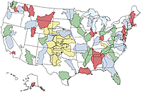
USGS Water Science Centers are located in each state.

There is a USGS Water Science Center office in each State. Washington Oregon California Idaho Nevada Montana Wyoming Utah Colorado Arizona New Mexico North Dakota South Dakota Nebraska Kansas Oklahoma Texas Minnesota Iowa Missouri Arkansas Louisiana Wisconsin Illinois Mississippi Michigan Indiana Ohio Kentucky Tennessee Alabama Pennsylvania West Virginia Georgia Florida Caribbean Alaska Hawaii New York Vermont New Hampshire Maine Massachusetts South Carolina North Carolina Rhode Island Virginia Connecticut New Jersey Maryland-Delaware-D.C.

Related Links

Map of NAWQA assessments
  • National NAWQA

  • Stream stages and discharges for the US. Brought to you by the USGS.

  • North Central River Forecast Center Information about regional precipitation, snow depths, and flash flood guidance, brought to you by the National Weather Service.

  • Minnesota River Basin Agricultural Resources and Research Information about water-quality and best-management practices in the Minnesota River Basin, which is substiantially affected by agriculture. This page is written by the Department of Soil, Water, and Climate at the University of Minnesota and includes a link to the Yahoo Search Engine.

  • Riverview Times Published mid-monthly on the west side of St. Paul, this newspaper has news and cultural stories about the Upper Mississippi River and a bookstore offering River literature.

  • Big River Published monthly in Winona, MN, this newsletter has a calendar of River activities and River-related news stories covering the River from St. Cloud, MN to the Quad Cities.

  • Great River Page Weather reports, river-related news, chat-room and travel guides are featured on this web page written by Pat Middleton.

  • Upper Midwest Environmental Sciences Center (UMESC) located in LaCrosse, Wisconsin, offers a wide range of biological, physical, spatial, and technical data collected in the Upper Mississippi River Basin.

  • Mississippi Headwaters Board The joint-powers board of the first 8 counties in the Upper Mississippi Drainage Basin is charged with protecting and preserving the natural resources of the first 400 miles of the Mississippi River. Their web site has information on the mission of the board and on water-quality monitoring conducted under its River Watch Project.

  • Minnesota Extension Service Site offers summary of water-quality programs at the University of Minnesota, complete texts of several water-quality publications, listing of water-quality extension faculty, and details about ongoing projects.

  • Minnesota Office of Environmental Assistance This site contains links to a wide variety of sites with environmental information related to Minnesota.

  • University of Minnesota Water Resources Research Center Information about UM-WRR research activities and publications including their monthly newsletter Minnegram and links to many water-related sites.

  • James Ford Bell Museum Information about fishes of Minnesota.

The sites listed above are for informational purposes only. Their listing does not constitute an endorsement of any commercial products or publications presented on those pages.

USGS Home Water Resources Biology Geography Geology Geospatial

Accessibility FOIA Privacy Policies and Notices

Take Pride in America logo USA.gov logo U.S. Department of the Interior | U.S. Geological Survey
URL: http://mn.water.usgs.gov/nawqa/umis/links.html
Page Contact Information: Webmaster
Page Last Modified: Wednesday, 31-Dec-2008 17:34:13 EST

05301000: Flow=2070cfs,Stage=27.37ft,2009-11-27 04:00,High,MINNESOTA RIVER NEAR LAC QUI PARLE, MN 05300000: Flow=254cfs,Stage=6.79ft,2009-11-27 04:00,High,LAC QUI PARLE RIVER NEAR LAC QUI PARLE, MN 05054000: Flow=2310cfs,Stage=16.32ft,Floodstage=18.0ft,2009-11-27 04:15,High,RED RIVER OF THE NORTH AT FARGO, ND 05053000: Flow=352cfs,Stage=2.53ft,Floodstage=10.0ft,2009-11-27 04:15,High,WILD RICE RIVER NR ABERCROMBIE, ND 05051500: Flow=1530cfs,Stage=7.18ft,Floodstage=10.0ft,2009-11-27 04:00,High,RED RIVER OF THE NORTH AT WAHPETON, ND 05330000: Flow=5960cfs,Stage=10.56ft,Floodstage=25.0ft,2009-11-27 04:00,>90,MINNESOTA RIVER NEAR JORDAN, MN 05325000: Flow=5870cfs,Stage=6.93ft,Floodstage=22.0ft,2009-11-27 04:00,>90,MINNESOTA RIVER AT MANKATO, MN 05320000: Flow=1560cfs,Stage=3.76ft,2009-11-27 04:15,>90,BLUE EARTH RIVER NEAR RAPIDAN, MN 05313500: Flow=118cfs,Stage=3.01ft,2009-11-27 03:00,>90,YELLOW MEDICINE RIVER NEAR GRANITE FALLS, MN 05311000: Flow=2510cfs,Stage=9.23ft,Floodstage=14.0ft,2009-11-27 04:00,>90,MINNESOTA RIVER AT MONTEVIDEO, MN 05294000: Flow=232cfs,Stage=5.45ft,2009-11-27 04:00,>90,POMME DE TERRE RIVER AT APPLETON, MN 05293000: Flow=93cfs,Stage=2.63ft,2009-11-27 04:00,>90,YELLOW BANK RIVER NEAR ODESSA, MN 05291000: Flow=121cfs,Stage=2.56ft,2009-11-27 04:00,>90,WHETSTONE RIVER NEAR BIG STONE CITY, SD 05290000: Flow=129cfs,Stage=11.14ft,Floodstage=17.0ft,2009-11-27 04:45,>90,LITTLE MINNESOTA RIVER NEAR PEEVER, SD 05280000: Flow=1080cfs,Stage=3.54ft,Floodstage=10.0ft,2009-11-27 04:00,>90,CROW RIVER AT ROCKFORD, MN 05270500: Flow=391cfs,Stage=2.19ft,Floodstage=6.0ft,2009-11-27 03:00,>90,SAUK RIVER NEAR ST. CLOUD, MN 05247500: Flow=2040cfs,2009-11-27 04:30,Stage=4.53ft,2009-11-27 03:30:00,>90,CROW WING RIVER NEAR PILLAGER, MN 05094000: Flow=39cfs,Stage=3.78ft,2009-11-27 04:00,>90,SOUTH BRANCH TWO RIVERS AT LAKE BRONSON, MN 05092000: Flow=5200cfs,Stage=13.75ft,Floodstage=32.0ft,2009-11-27 04:00,>90,RED RIVER OF THE NORTH AT DRAYTON, ND 05082500: Flow=5000cfs,Stage=17.83ft,Floodstage=28.0ft,2009-11-27 04:30,>90,RED RIVER OF THE NORTH AT GRAND FORKS, ND 05064500: Flow=3660cfs,Stage=9.99ft,Floodstage=26.0ft,2009-11-27 04:00,>90,RED RIVER OF THE NORTH AT HALSTAD, MN 05064000: Flow=607cfs,Stage=7.96ft,Floodstage=20.0ft,2009-11-27 03:00,>90,WILD RICE RIVER AT HENDRUM, MN 05062500: Flow=337cfs,Stage=3.41ft,Floodstage=10.0ft,2009-11-27 02:00,>90,WILD RICE RIVER AT TWIN VALLEY, MN 05062000: Flow=343cfs,Stage=7.32ft,Floodstage=12.0ft,2009-11-27 04:30,>90,BUFFALO RIVER NEAR DILWORTH, MN 05061500: Flow=156cfs,2009-11-27 03:00,Stage=8.62ft,2009-11-26 21:00:00,Floodstage=12.0ft,>90,SOUTH BRANCH BUFFALO RIVER AT SABIN, MN 05061000: Flow=138cfs,2009-11-27 01:30,Stage=4.45ft,2009-11-27 03:15:00,Floodstage=7.0ft,>90,BUFFALO RIVER NEAR HAWLEY, MN 05046000: Flow=822cfs,Stage=3.59ft,2009-11-27 04:00,>90,OTTER TAIL RIVER BL ORWELL D NR FERGUS FALLS, MN 06482610: Flow=73cfs,Stage=2.35ft,Floodstage=8.5ft,2009-11-27 04:45,76-90,SPLIT ROCK CR AT CORSON,SD 05457000: Flow=179cfs,Stage=3.05ft,2009-11-27 04:00,76-90,CEDAR RIVER NEAR AUSTIN, MN 05327000: Flow=74cfs,Stage=3.42ft,2009-11-27 01:30,76-90,HIGH ISLAND CREEK NEAR HENDERSON, MN 05320500: Flow=590cfs,Stage=2.58ft,2009-11-27 01:00,76-90,LE SUEUR RIVER NEAR RAPIDAN, MN 05317200: Flow=77cfs,Stage=3.85ft,2009-11-27 03:00,76-90,LITTLE COTTONWOOD RIVER NEAR COURTLAND, MN 05317000: Flow=270cfs,Stage=3.79ft,Floodstage=11ft,2009-11-27 04:00,76-90,COTTONWOOD RIVER NEAR NEW ULM, MN 05316500: Flow=135cfs,Stage=2.37ft,Floodstage=6.0ft,2009-11-27 02:00,76-90,REDWOOD RIVER NEAR REDWOOD FALLS, MN 05304500: Flow=399cfs,Stage=2.12ft,2009-11-27 04:00,76-90,CHIPPEWA RIVER NEAR MILAN, MN 05288500: Flow=8430cfs,Stage=3.97ft,2009-11-27 04:00,76-90,MISSISSIPPI RIVER NEAR ANOKA, MN 05267000: Flow=5660cfs,Stage=10.07ft,2009-11-27 04:00,76-90,MISSISSIPPI RIVER NEAR ROYALTON, MN 05245100: Flow=150cfs,Stage=2.33ft,Floodstage=6.0ft,2009-11-27 04:00,76-90,LONG PRAIRIE RIVER AT LONG PRAIRIE, MN 05244000: Flow=593cfs,Stage=3.34ft,2009-11-27 03:00,76-90,CROW WING RIVER AT NIMROD, MN 05131500: Flow=1060cfs,Stage=4.20ft,2009-11-27 04:30,76-90,LITTLE FORK RIVER AT LITTLEFORK, MN 05130500: Flow=108cfs,Stage=2.46ft,2009-11-27 04:30,76-90,STURGEON RIVER NEAR CHISHOLM, MN 05078500: Flow=158cfs,Stage=2.47ft,2009-11-27 04:00,76-90,CLEARWATER RIVER AT RED LAKE FALLS, MN 05076000: Flow=128cfs,Stage=5.33ft,2009-11-27 04:15,76-90,THIEF RIVER NEAR THIEF RIVER FALLS, MN 05069000: Flow=46cfs,Stage=4.64ft,Floodstage=20.0ft,2009-11-27 02:00,76-90,SAND HILL RIVER AT CLIMAX, MN 05067500: Flow=10cfs,Stage=4.36ft,Floodstage=14.0ft,2009-11-27 04:15,76-90,MARSH RIVER NEAR SHELLY, MN 05124480: Flow=30cfs,Stage=2.73ft,2009-11-27 04:00,10-24,KAWISHIWI RIVER NEAR ELY, MN 05388250: Flow=452cfs,Stage=7.73ft,Floodstage=14.0ft,2009-11-27 04:00,25-75,Upper Iowa River near Dorchester, IA 05355200: Flow=453cfs,Stage=3.52ft,2009-11-27 04:00,25-75,CANNON RIVER AT WELCH, MN 05353800: Flow=106cfs,Stage=4.15ft,2009-11-27 00:00,25-75,STRAIGHT RIVER NEAR FARIBAULT, MN 05345000: Flow=39cfs,Stage=2.62ft,2009-11-27 01:30,25-75,VERMILLION RIVER NEAR EMPIRE, MN 05338500: Flow=396cfs,2009-11-27 02:00,0000-00-00 00:00:00,Floodstage=9.0ft,25-75,SNAKE RIVER NEAR PINE CITY, MN 05336700: Flow=481cfs,Stage=4.90ft,2009-11-27 02:00,25-75,KETTLE RIVER BELOW SANDSTONE, MN 05336000: Flow=2090cfs,Stage=4.60ft,2009-11-27 04:00,25-75,ST. CROIX RIVER NEAR GRANTSBURG, WI 05319500: Flow=230cfs,Stage=1.67ft,2009-11-27 02:00,25-75,WATONWAN RIVER NEAR GARDEN CITY, MN 05286000: Flow=410cfs,Stage=2.84ft,2009-11-27 03:00,25-75,RUM RIVER NEAR ST. FRANCIS, MN 05278000: Flow=72cfs,Stage=3.21ft,2009-11-27 04:00,25-75,MIDDLE FORK CROW RIVER NEAR SPICER, MN 05275000: Flow=178cfs,Stage=1.21ft,2009-11-27 02:00,25-75,ELK RIVER NEAR BIG LAKE, MN 05227500: Flow=2530cfs,Stage=6.64ft,Floodstage=12.0ft,2009-11-27 04:00,25-75,MISSISSIPPI RIVER AT AITKIN, MN 05211000: Flow=1410cfs,Stage=4.98ft,2009-11-27 04:00,25-75,MISSISSIPPI RIVER AT GRAND RAPIDS, MN 05133500: Flow=13300cfs,Stage=6.56ft,2009-11-27 04:30,25-75,RAINY RIVER AT MANITOU RAPIDS, MN 05132000: Flow=447cfs,Stage=3.73ft,2009-11-27 04:30,25-75,BIG FORK RIVER AT BIG FALLS, MN 05127500: Flow=572cfs,Stage=2.94ft,2009-11-27 04:30,25-75,BASSWOOD RIVER NEAR WINTON, MN 05087500: Flow=4.4cfs,Stage=3.67ft,2009-11-27 04:30,25-75,MIDDLE RIVER AT ARGYLE, MN 05079000: Flow=984cfs,Stage=5.91ft,Floodstage=15.0ft,2009-11-27 04:00,25-75,RED LAKE RIVER AT CROOKSTON, MN 05078230: Flow=24cfs,2009-11-27 04:30,Stage=4.70ft,2009-11-27 04:00:00,25-75,LOST RIVER AT OKLEE, MN 05078000: Flow=73cfs,2009-11-27 03:00,Stage=2.72ft,2009-11-27 03:30:00,25-75,CLEARWATER RIVER AT PLUMMER, MN 05074500: Flow=332cfs,Stage=70.53ft,2009-11-27 04:00,25-75,RED LAKE RIVER NEAR RED LAKE, MN 04024000: Flow=1780cfs,Stage=3.87ft,Floodstage=10.5ft,2009-11-27 04:30,25-75,ST. LOUIS RIVER AT SCANLON, MN 464646092052900: Stage=601.55ft,2009-11-26 14:10:00,Not ranked,Rating being developed or revised,SUPERIOR BAY DULUTH SHIP CANAL AT DULUTH, MN 06604000: Stage=14.23ft,2009-11-27 01:45:00,Floodstage=17.0ft,Not ranked,Spirit Lake near Orleans, IA 06483290: Flow=153cfs,Stage=7.77ft,Floodstage=13.0ft,2009-11-27 04:15,Not ranked,Rock River below Tom Creek at Rock Rapids, IA 05476000: Stage=4.11ft,2009-11-27 04:00:00,Floodstage=12.0ft,Not ranked,Rating being developed or revised,DES MOINES RIVER AT JACKSON, MN 05475350: Stage=14.29ft,2009-11-27 04:00:00,Floodstage=19.0ft,Not ranked,DES MOINES RIVER ABOVE WINDOM, MN -DM4 05386400: Stage=30.69ft,2009-11-27 04:00:00,Not ranked,MISSISSIPPI RIVER AT BROWNSVILLE, MN 05385500: Stage=1.28ft,2009-11-27 04:00:00,Not ranked,SOUTH FORK ROOT RIVER NEAR HOUSTON, MN 05385000: Stage=3.64ft,2009-11-27 04:00:00,Floodstage=15.0ft,Not ranked,ROOT RIVER NEAR HOUSTON, MN 05384330: Stage=9.59ft,2009-11-24 16:30:00,Not ranked,ROOT RIVER ABOVE RUSHFORD, MN 05383950: Flow=377cfs,Stage=8.29ft,2009-11-27 05:00,Not ranked,ROOT RIVER NEAR PILOT MOUND, MN 05383075: Flow=467cfs,Stage=3.34ft,2009-11-26 14:00,Not ranked,LA CROSSE RIVER NEAR LA CROSSE, WI 05380509: Stage=2.54ft,2009-11-26 13:45:00,Not ranked,TANK CREEK NEAR GALESVILLE, WI 05378500: Stage=5.52ft,Floodstage=13.0ft,2009-11-27 04:00,Not ranked,Very low value,MISSISSIPPI RIVER AT WINONA, MN 05378490: Stage=5.94ft,2009-11-27 04:00:00,Not ranked,MISSISSIPPI RIVER AT LOCK AND DAM 5A NR WINONA, MN 05374000: Stage=5.91ft,2009-11-27 04:00:00,Floodstage=18.0ft,Not ranked,ZUMBRO RIVER AT ZUMBRO FALLS, MN 05372995: Flow=120cfs,Stage=2.69ft,Floodstage=14.0ft,2009-11-27 04:00,Not ranked,SOUTH FORK ZUMBRO RIVER AT ROCHESTER, MN 05346050: Stage=668.82ft,2009-11-27 04:00:00,Not ranked,CLEAR LAKE, EAST SIDE, AT PRAIRIE ISLAND, MN 05344850: Stage=673.62ft,2009-11-27 01:00:00,Not ranked,STURGEON LAKE, WEST SIDE, AT PRAIRIE ISLAND, MN 05344500: Stage=25.52ft,2009-11-27 04:00,Not ranked,Very low value,MISSISSIPPI RIVER AT PRESCOTT, WI 05344490: Flow=3700cfs,Stage=25.50ft,2009-11-27 04:30,Not ranked,ST. CROIX RIVER AT PRESCOTT, WI 05342000: Flow=95cfs,Stage=9.84ft,2009-11-25 18:00,Not ranked,KINNICKINNIC RIVER NEAR RIVER FALLS, WI 05340500: Flow=3480cfs,Stage=3.46ft,2009-11-26 14:15,Not ranked,ST. CROIX RIVER AT ST. CROIX FALLS, WI 05333500: Flow=993cfs,Stage=1.10ft,Floodstage=7.0ft,2009-11-26 14:00,Not ranked,ST. CROIX RIVER NEAR DANBURY, WI 05331580: Stage=7.50ft,2009-11-27 04:30:00,Not ranked,MISSISSIPPI RIVER BELOW L&D #2 AT HASTINGS, MN 05331000: Stage=3.89ft,Floodstage=14.0ft,2009-11-27 04:15,Not ranked,Very low value,MISSISSIPPI RIVER AT ST. PAUL, MN 05330920: Flow=6360cfs,Stage=688.12ft,2009-11-25 01:45,Not ranked,MINNESOTA RIVER AT FORT SNELLING STATE PARK, MN 05320270: Flow=61cfs,Stage=5.32ft,2009-11-27 02:30,Not ranked,LITTLE COBB RIVER NEAR BEAUFORD, MN 05316580: Flow=3330cfs,Stage=14.35ft,2009-11-27 04:30,Not ranked,MINNESOTA RIVER AT MORTON, MN 05315000: Flow=4.4cfs,Stage=7.78ft,Floodstage=14.0ft,2009-11-24 14:00,Not ranked,REDWOOD RIVER NEAR MARSHALL, MN 05305000: Stage=37.86ft,2009-11-27 04:00:00,Not ranked,CHIPPEWA RIVER (TW) NEAR WATSON, MN 05304995: Stage=38.44ft,2009-11-27 04:00:00,Not ranked,CHIPPEWA R. (HW) ABOVE COUNTY RD 13 NR WATSON, MN 05292000: Flow=413cfs,Stage=3.53ft,Floodstage=10.0ft,2009-11-27 04:00,Not ranked,MINNESOTA RIVER AT ORTONVILLE, MN 05289800: Stage=11.79ft,2009-11-27 01:30:00,Not ranked,MINNEHAHA CREEK AT HIAWATHA AVE. IN MINNEAPOLIS,MN 05288705: Flow=1.8cfs,Stage=9.17ft,2009-11-27 05:00,Not ranked,SHINGLE CREEK AT QUEEN AVE IN MINNEAPOLIS, MN 05288580: Flow=47cfs,Stage=7.63ft,2009-11-27 04:30,Not ranked,RICE CREEK BLW OLD HWY. 8 IN MOUNDS VIEW, MN 05287890: Flow=8.2cfs,Stage=3.61ft,2009-11-27 04:00,Not ranked,ELM CREEK NR CHAMPLIN, MN 05284000: Stage=10.55ft,2009-11-27 02:00:00,Not ranked,MILLE LACS LAKE AT COVE BAY NEAR ONAMIA, MN 05270700: Flow=6110cfs,Stage=5.30ft,Floodstage=9.0ft,2009-11-27 02:30,Not ranked,MISSISSIPPI RIVER AT ST. CLOUD, MN 05243725: Flow=57cfs,Stage=1.56ft,2009-11-27 02:00,Not ranked,STRAIGHT RIVER NEAR PARK RAPIDS, MN 05242300: Flow=3070cfs,Stage=6.61ft,Floodstage=13.0ft,2009-11-27 03:00,Not ranked,MISSISSIPPI RIVER AT BRAINERD, MN 05220600: Flow=2210cfs,Stage=44.05ft,2009-11-27 04:00,Not ranked,MISSISSIPPI RIVER AT PALISADE, MN 05212700: Flow=142cfs,Stage=3.11ft,Floodstage=10.0ft,2009-11-27 04:30,Not ranked,PRAIRIE RIVER NEAR TACONITE, MN 05210000: Stage=73.60ft,2009-11-27 04:00:00,Not ranked,MISSISSIPPI R. AT DAYS HIGH LANDING NR DEER RIVER 05207600: Flow=785cfs,Stage=7.02ft,2009-11-27 04:00,Not ranked,MISSISSIPPI RIVER AT WILLOW BEACH AT BALL CLUB, MN 05205900: Stage=94.18ft,2009-11-27 04:00:00,Not ranked,LEECH LAKE AT SUGAR POINT NEAR FEDERAL DAM, MN 05200510: Flow=437cfs,Stage=3.89ft,2009-11-27 01:30,Not ranked,MISSISSIPPI RIVER NEAR BEMIDJI, MN 05140521: Stage=59.23ft,2009-11-27 04:00:00,Not ranked,LK OF THE WOODS @ SPRINGSTEEL IS NR. WARROAD, MN 05140520: Stage=59.10ft,2009-11-17 02:30:00,Not ranked,LAKE OF THE WOODS AT WARROAD, MN 05134200: Flow=20cfs,Stage=2.96ft,2009-11-27 04:00,Not ranked,RAPID RIVER NEAR BAUDETTE, MN 05129290: Flow=230cfs,Stage=15.94ft,2009-11-27 04:30,Not ranked,GOLD PORTAGE OUTLET FROM KABETOGAMA LK NR RAY,MN 05129115: Flow=621cfs,Stage=7.42ft,2009-11-27 04:30,Not ranked,VERMILION RIVER NR CRANE LAKE, MN 05126210: Flow=559cfs,Stage=4.69ft,2009-11-27 04:00,Not ranked,SOUTH KAWISHIWI R ABV WHITE IRON LAKE NR ELY, MN 05125000: Flow=290cfs,Stage=2.79ft,2009-11-27 04:00,Not ranked,SOUTH KAWISHIWI RIVER NEAR ELY, MN 05112000: Stage=3.34ft,2009-11-27 02:00:00,Not ranked,Ice affected,ROSEAU RIVER BELOW STATE DITCH 51 NR CARIBOU, MN 05107500: Stage=2.98ft,2009-11-27 02:00:00,Not ranked,Ice affected,ROSEAU RIVER AT ROSS, MN 05106000: Stage=3.39ft,2009-11-27 04:00:00,Not ranked,Ice affected,SPRAGUE CREEK NEAR SPRAGUE, MANITOBA, CANADA 05104500: Stage=4.29ft,2009-11-27 04:30:00,Not ranked,Ice affected,ROSEAU RIVER BELOW SOUTH FORK NEAR MALUNG, MN 05102490: Stage=15.33ft,2009-11-27 04:00:00,Not ranked,RED RIVER OF THE NORTH AT PEMBINA, ND 05085450: Flow=5.7cfs,Stage=60.70ft,2009-11-27 04:30,Not ranked,SNAKE RIVER ABOVE WARREN, MN 05085420: Not ranked,Site discontinued,SNAKE RIVER ABOVE RADIUM, MN 05083500: Stage=11.30ft,2009-11-27 04:15:00,Floodstage=26.0ft,Not ranked,RED RIVER OF THE NORTH AT OSLO, MN 05080000: Flow=830cfs,Stage=12.13ft,2009-11-27 02:45,Not ranked,RED LAKE RIVER AT FISHER, MN 05078770: Flow=0.66cfs,Stage=1.54ft,2009-11-26 04:00,Not ranked,JUDICIAL DITCH 66 NEAR MARCOUX CORNERS, MN (SW6) 05078720: Flow=13cfs,Stage=2.71ft,2009-11-25 10:45,Not ranked,CO DITCH 140 ABV BR-6 IMP NR TILDEN JCT, MN (SW8) 05075000: Stage=4.45ft,2009-11-27 04:00:00,Floodstage=12.0ft,Not ranked,RED LAKE RIVER AT HIGH LANDING NR GOODRIDGE, MN 05074000: Stage=74.75ft,2009-11-27 04:00:00,Not ranked,LOWER RED LAKE NR RED LAKE, MN 05073650: Stage=74.63ft,2009-11-27 04:00:00,Not ranked,LOWER RED LAKE AT MOUTH BATTLE RIVER NR SAUM, MN 05073500: Stage=74.62ft,2009-11-27 04:00:00,Not ranked,UPPER RED LAKE AT WASKISH, MN 05070000: Flow=3990cfs,Stage=22.38ft,2009-11-27 04:15,Not ranked,RED RIVER OF THE NORTH NEAR THOMPSON, ND 05063398: Flow=49cfs,Stage=4.96ft,2009-11-27 04:30,Not ranked,S. BR. WILD RICE RIVER AT CO. RD. 27 NR FELTON, MN 05060400: Stage=70.23ft,2009-11-27 03:00:00,Not ranked,SHEYENNE RIVER AT HARWOOD, ND 05052500: Not ranked,Seasonal site,ANTELOPE CREEK AT DWIGHT, ND 05051522: Flow=1900cfs,Stage=13.51ft,2009-11-26 17:45,Not ranked,RED RIVER OF THE NORTH AT HICKSON, ND 05051300: Flow=495cfs,Stage=10.68ft,2009-11-27 02:00,Not ranked,BOIS DE SIOUX RIVER NEAR DORAN, MN 05050000: Flow=627cfs,Stage=7.49ft,Floodstage=80.0ft,2009-11-26 23:00,Not ranked,BOIS DE SIOUX RIVER NEAR WHITE ROCK, SD 05049995: Stage=73.36ft,2009-11-27 04:00:00,Not ranked,MUD LAKE ABOVE WHITE ROCK DAM NEAR WHITE ROCK, SD 05049000: Stage=77.38ft,2009-11-27 04:00:00,Floodstage=92.0ft,Not ranked,MUSTINKA RIVER ABOVE WHEATON, MN 05046475: Flow=6.3cfs,Stage=4.24ft,2009-11-27 04:00,Not ranked,OTTER TAIL RIVER DIVERSION AT BRECKENRIDGE, MN 05030500: Flow=522cfs,Stage=6.51ft,2009-11-27 02:00,Not ranked,OTTER TAIL RIVER NEAR ELIZABETH, MN 04024430: Flow=259cfs,Stage=5.67ft,Floodstage=20.0ft,2009-11-26 14:00,Not ranked,NEMADJI RIVER NEAR SOUTH SUPERIOR, WI 04021520: Stage=4.29ft,2009-11-27 04:00:00,Not ranked,Rating being developed or revised,STONEY BROOK AT PINE DRIVE NEAR BROOKSTON, MN 04015330: Flow=55cfs,2009-11-26 22:00,Stage=3.13ft,2009-11-27 04:00:00,Not ranked,KNIFE RIVER NEAR TWO HARBORS, MN 04010500: Flow=210cfs,Stage=3.05ft,2009-11-26 21:30,Not ranked,PIGEON RIVER AT MIDDLE FALLS NR GRAND PORTAGE MN Go to WaterWatch (offsite) for a larger map with additional options