Minnesota Water Science Center
Minnesota PROJECTSABOUT THE MINNESOTA
|
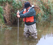
Surface Water Projects in MinnesotaMN001 - USGS-cooperative stream gaging network: The USGS operates approximately 90 continuous streamflow, 13 river stage, 14 lake stage, and 83 crest-stage gaging stations in Minnesota through cooperative agreements with State, Federal, local agencies. Two new gages were installed in the Kawishiwi River Basin as part of Federal Energy Regulatory Commission requirements. MN002 - Stream Quality: Elm Creek water-quality monitoring is being conducted in the northwest metro (USGS, Elm Creek Water Management Organization). Manual and automated samples are collected during runoff and approximately monthly for analysis of nutrients, total and volatile suspended solids, and chloride. These water-quality and streamflow data have been collected since 1988. MN004 - Sediment
MN00106—Basin characteristics: (USGS, Minnesota Department of Transportation, Minnesota Department Natural Resources): The objective of this project is to create hydrologically enhanced Digital Elevation Model for use in an automated basin characteristics (drainage area, area of lakes and wetlands, stream length and stream slope) program that will generate 2, 5, 10, 25, 50, and 100 year estimated peak-flows on unregulated streams in Minnesota. Stream Slope Research: (USGS, Minnesota Department of Transportation): The objective is to analyze the differences between the observed method of determining stream slope and an automated method using hydro enhanced DEMs. Changes in processing and programming procedures will be evaluated for improvements in slope estimation and compatibility with ArcHydro Data Model and StreamStats web based stream and watershed information. National Hydrography Dataset Project (USGS, MPCA): The National Hydrography Data Set 1:24,000 comprehensive set of digital spatial data that contains information about surface water features such as lakes, ponds, streams, rivers, springs and wells. Within the NHD, surface water features are combined to form "reaches," which provide the framework for linking water-related data to the NHD surface water drainage network. These linkages enable the analysis and display of these water-related data in upstream and downstream order. MN013-Estimating peak flow on small streams in Minnesota: (USGS, Minnesota Department of Transportation) – Study objectives are to produce statistical equations that will be used to estimate the 2-, 5-, 10-, 25-, 50-, and 100-year recurrence interval peak flows on unregulated small streams in Minnesota. The Minnesota Department of Transportation will use this information for efficient and cost-effective design of bridges, culverts, and roadway embankments. The peak flow estimates are also used for environmental analysis of streams, and sediment transport equations. A report outlining the methods and peak-flow equations was planned for fall 2007. Information used in this report allowed the USGS Water Science Center of Minnesota to implement StreamStats a new web based tool used to estimate high and low flows on unmeasured streams. MN269--Kabetogama-Namakan streamflow Hydrographic Surveys of Four Pinch Points in the Namakan Reservoir System, MN |
![]() U.S. Department of the Interior |
U.S. Geological Survey
U.S. Department of the Interior |
U.S. Geological Survey
URL: http://mn.water.usgs.gov/projects/swater.html
Page Contact Information: Webmaster
Page Last Modified: Wednesday, 22-Feb-2012 12:00:33 EST

