New Minnesota Water Science Center reports
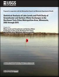
Water-Level Changes in Northeast Twin Cities Lakes Vary with Landscape Setting
The first chapter of a two-chapter report on lake-level fluctuation in the northeast Twin Cities Metropolitan area presents results from statistical analyses of lake-level fluctuations, and also presents interpretations of new field data on surface water-groundwater interactions in the study area. A summary of this report is in our news release. The full chapter is available online.
Contact: Perry Jones, [email protected].
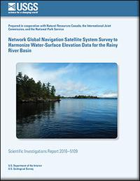
Harmonizing Water-Surface Elevation Data for the Rainy River Basin
Rainy Lake and Namakan Reservoir water elevations and streamgages were referenced to several different vertical datums, confounding efforts to model the flow of water through the system. Therefore, reference marks at 16 streamgages were surveyed using global navigation satellite system receivers, and offsets were developed to correct collected streamgage data to a common vertical datum. The results of this study are available here.
Contact: Jeff Ziegeweid, [email protected].
Dimensionless Sediment Rating Curves for Rivers in Minnesota
Sucker River near Palmers, Minnesota, during spring
runoff just prior to collection of a sediment sample.  |
A recent study evaluated Dimensionless Sediment Rating Curves to predict measured suspended-sediment concentrations, bedload, and annual sediment loads for selected rivers in Minnesota. Models developed using data from Minnesota were effective at compensating for differences in individual stream characteristics across a variety of watershed sizes and flow regimes. Model estimates of suspended sediment concentration (SSC) and bedload can be used for stream restoration activities and for estimating annual sediment loads for streams where few or no sediment data are available. Full report.
Contact: Joel Groten, [email protected].
3-D Maps of Suspended-Sediment Concentrations in Duluth-Superior Harbor
Sampling during placement of dredge material in the
21st Avenue West Channel Embayment of the
Duluth-Superior Harbor.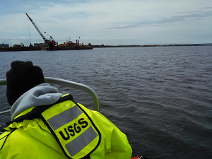 |
The U.S. Geological Survey, in cooperation with the U.S. Army Corps of Engineers, collected turbidity and SSCs in 2014-15 to measure the horizontal and vertical distribution of SSCs during placement of dredged materials. Using a simple statistical model relating SSC and turbidity, a series of 12 three-dimensional visualization maps were developed as a tool to assess the spatial distribution of model-predicted SSCs. See the full report for more information.
Contact: Joel Groten, [email protected]
Geomorphic Responses of Duluth-Area Streams to the June 2012 Flood, Minnesota
Molly McCool (left) and Jerry Storey (right) perform
a geomorphic assessment of a Duluth area stream.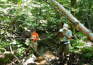 |
In 2013, the U.S. Geological Survey, in cooperation with the Minnesota Pollution Control Agency, completed a geomorphic assessment of Duluth-area streams to describe and document the geomorphic changes associated with the June 2012 flood. The comparative analyses of field data collected in 2003–04 and again in 2013 indicated notable changes, some expected and others not. Whether or not the geomorphic conditions will return to their preflood condition depends on the location along the longitudinal continuum. Results from this study can be used by local managers in postflood reconstruction efforts and provide baseline information for continued monitoring of geomorphic responses after the June 2012 flood.
Contact: Joel Groten, [email protected].
New paper provides approach to understand CEC effects on aquatic organisms
In recent years, researchers have gathered data on the occurrence of complex mixtures of unregulated organic contaminants—chemicals with a wide variety of uses and chemical properties that are often lumped under the term Contaminants of Emerging Concern (CECs). Relating occurrence of complex mixtures of CECs to potential adverse effects in aquatic organisms remains a daunting challenge. A new paper by researchers from seven federal and university institutions addresses this challenge by integrating CEC occurrence data, known chemical-gene interactions, and genetic data from field-exposed fathead minnows to assess possible biological effects associated with chemicals detected in water samples. This integrated approach allowed for evaluation of the likelihood of specific chemicals contributing to observed biological responses, and may inform future monitoring and assessment efforts. The full paper is available for download.
Contact: Kathy Lee ([email protected]) or Dan Villeneuve ([email protected]).
|
Significant national reports
New NAWQA paper on decadal stream loads
The National Water-Quality Assessment (NAWQA) Project recently published a paper that evaluates methods for computing decadal water-quality loads. This article represents the culmination of a multi-year effort by an internal U.S. Geological Survey (USGS) workgroup to respond to concerns about USGS load computation techniques (i.e. Stenback and others; Richards and others). The article provides a detailed evaluation of the accuracy of load estimation methods across constituents, sampling strategies, sampling frequencies, and the effects of multi-year gaps in sampling at locations across the U.S. This evaluation is being used to improve the accuracy of load estimates in future USGS SPARROW modeling efforts. A similar study is underway to evaluate methods for computing loads for shorter time periods.
Contacts: Casey Lee ([email protected]), or Steve Preston ([email protected]).
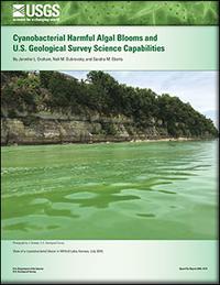
USGS releases new report on the state of harmful algal bloom science
Recent harmful cyanobacterial algal blooms (cyanoHABs) in Ohio, Florida, Oregon, and numerous other states have posed human and ecosystem health concerns and caused economic damages. A recent USGS Open-File Report describes cyanoHABs, the state of the science, and recent USGS cyanoHABs science and monitoring. The Science of Harmful Algae Blooms highlights the information presented in the USGS report.
This information was developed in cooperation with the USGS National Water Quality Program and the Toxic Substances Hydrology Program.
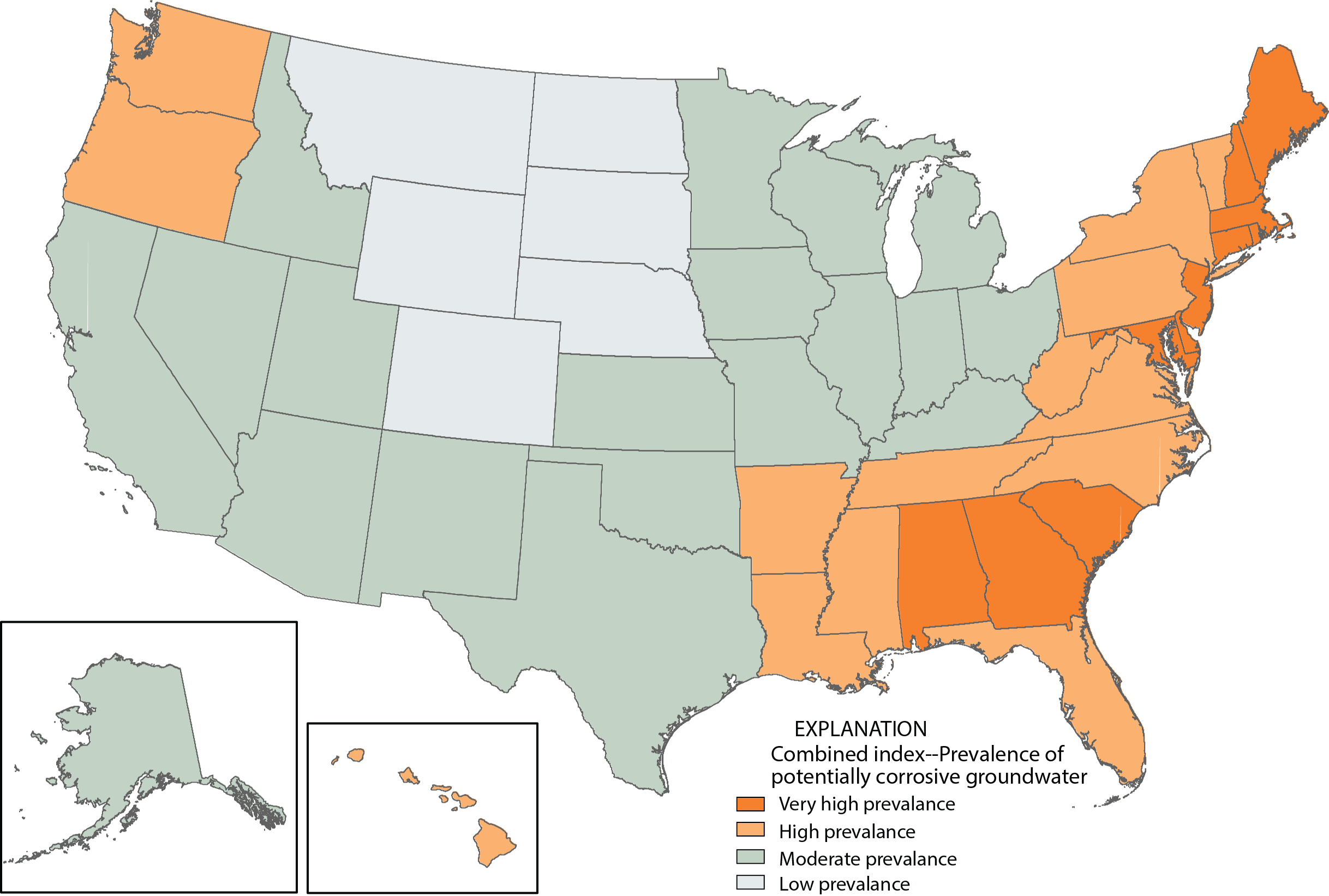
New Study Shows High Potential for Groundwater to be Corrosive in Half of U.S. States
Click for full size image |
A recent USGS assessment of more than 20,000 wells nationwide indicates that groundwater found in 25 states and the District of Columbia has a high potential for being naturally corrosive.
The findings have the greatest implications for homeowners with private drinking water systems. Naturally corrosive water is not dangerous to consume by itself. Nevertheless, it can cause health-related problems by reacting with pipes and plumbing fixtures in homes. Signs of corrosive water causing leaching of metals may include bluish-green stains in sinks, metallic taste to water, and small leaks in plumbing fixtures.
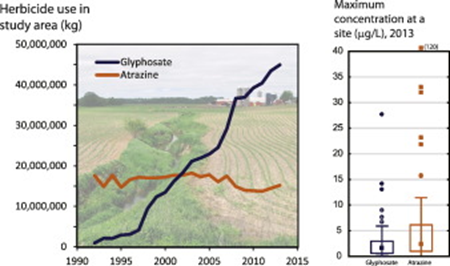
Three papers from the USGS 2013 Midwest Stream Quality Assessment (MSQA)
The first paper reports on temporal patterns in glyphosate and atrazine concentrations measured in 100 small streams in the Midwest during the 2013 growing season. Glyphosate and atrazine are the most intensively used herbicides in the United States. Although there is abundant data on atrazine, there are far fewer data for glyphosate. Studies that compare the two herbicides are rare. Glyphosate was detected more frequently in urban streams than in agricultural streams. In contrast, atrazine was detected more frequently in agricultural streams than in urban streams.
Contact: Barbara Mahler, [email protected].
A second MSQA paper examines complex mixtures of pesticides in the Midwest using polar organic chemical integrative samplers (POCIS). The authors deployed these time-integrated samplers in 100 small streams across the Midwest for about 5 weeks during summer 2013 and analyzed the extracts for 227 pesticide compounds. One hundred forty-one compounds were detected at least once, indicating a high level of pesticide contamination of streams in the region. Summed herbicide concentrations were greater at agricultural sites than at urban sites but summed concentrations of insecticides and fungicides were greater at urban sites.
Contact: Pete Van Metre, [email protected].
A third paper describes high nitrate concentrations in Midwest streams in 2013 following the severe drought of 2012. The authors determined that fertilizer and manure used in crop production, principally corn, were the dominant sources of nitrate. The high nitrate levels in parts of the Midwest in 2013 coincide with reported higher-than-normal nitrate loads in the Mississippi River.
Contact: Pete Van Metre, [email protected].
Farewells
Hydrologic technicians Lindsay Hastings (left)
and Katie Allenson. 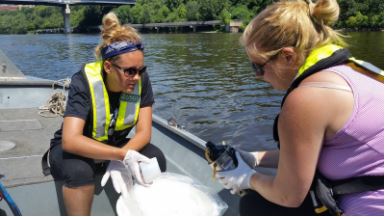 |
We bid farewell to Lindsay Hastings. Since joining the USGS in 2014, Lindsay has been an integral part of our sediment team and has supported numerous other field-intensive studies. Lindsay will continue her career as a hydrologic technician in the USGS New Mexico Water Science Center in Albuquerque. We are sad to see her go, but wish her all the best in the Land of Enchantment!
Visiting Scientist Samuel Costa making a
streamflow measurement in the
Vermillion River.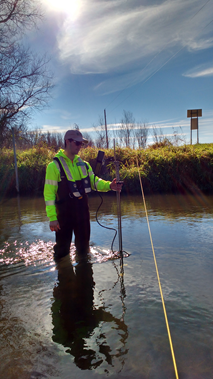 |
We also say good-bye to visiting scientist Samuel Costa from the Institute for Technological Research in São Paulo, Brazil. Last year, with the help of Gustavo Merten, a Professor at University of Minnesota Duluth and USGS collaborator, and Dr. Chris Ellison, a USGS Hydrologist now working for the Montana Water Science Center, we planned an eight-month volunteer program for Samuel so he could explore new surrogate technologies applied to sediment studies in Minnesota. He was able to work alongside sediment specialists and travel across the State sampling sediments throughout diverse conditions, from wadeable low flows to 100-year floods (annual exceedance probability of 1 percent). Samuel will take plenty of information back to Brazil, including hydroacoustic protocols, which will be pivotal for his future work.
|