 Minnesota Water Science Center Newsletter Winter 2015 |
U.S. Department of Interior U.S. Geological Survey Minnesota Water Science Center 2280 Woodale Drive Mounds View, MN 55112 http://mn.water.usgs.gov |
||||||||||
Employee Highlight
| |||||||||||
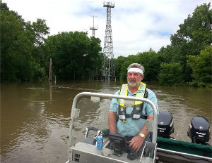 |
Greg started with the USGS in 1976 as a hydrologic field assistant in St. Paul, Minnesota. He soon converted to a hydrologic technician, operating field trips for streamflow, water quality, sediment, and low flow, and computing streamflow records. In 1981, Greg converted to a hydrologist. He was noted as an "exceptional employee who pays strict attention to properly carrying out details of operation... and can be relied upon to meet or exceed the requirement of duties." These qualities were a good match to evolving computer usage in the USGS, so in 1984 he trained for database management and soon became the surface-water database manager for Minnesota. Greg’s work as surface-water database manager grew to include overseeing production of Annual Water Data Reports in 1993, which he has continued to this day. In addition to leading production of Annual Water Data Reports for Minnesota, he found time to coauthor more than five reports and be the lead author on others, including a report documenting a 1996 study on the quantity and quality of runoff from roadways in the Twin Cities that is cited frequently today. Outside of the USGS, Greg spends time with his golden retriever, Maggie, in search of the next pheasant or grouse.
USGS Role in Water Management Near White Bear Lake
 |
Water Quality Studies of the Nation’s Glacial Aquifers
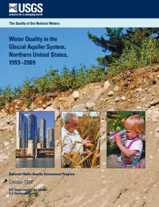 |
This report is one of nine USGS Circulars on regional groundwater quality and one Circular summarizing the national perspective. All 10, listed below, are available electronically at the USGS Publications Warehouse.
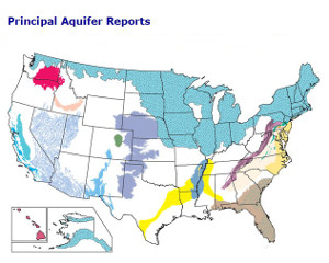 |
Circular 1352 Glacial Aquifer System
Circular 1353 Northern Atlantic Coastal Plain Surficial Aquifer System
Circular 1354 Principal Aquifers of the Piedmont, Blue Ridge, and Valley and Ridge Regions
Circular 1355 Upper Floridan Aquifer and Overlying Surficial Aquifers
Circular 1356 Mississippi Embayment-Texas Coastal Uplands Aquifer System and Mississippi River Valley Alluvial Aquifer
Circular 1357 Denver Basin Aquifer System
Circular 1358 Basin-Fill Aquifers of the Southwestern U.S.
Circular 1359 Columbia Plateau and Snake River Plain Basin-Fill and Basaltic-Rock Aquifers, and the Hawaiian Volcanic-Rock Aquifers
Circular 1337 High Plains Aquifer (*this Circular was released in 2009)
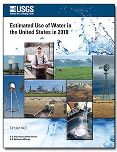
Report Released on the Use of Water in the Nation
 |
USGS Strengthens Minnesota Streamgage Network with New Investment of Federal Funding during 2014
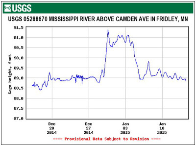 |
With NSIP funding, the USGS can relieve our partners’ strained budgets and provide permanent stability to a vital resource. Currently, most USGS streamgages in Minnesota are jointly funded by the USGS and by Federal, State, tribal, and local partners. NSIP currently fully funds 18 streamgages and partially funds 16 others, which comprises about 23 percent of the streamgage support in Minnesota. One of the goals of the NSIP program is to be the nationwide backbone of Federally-funded streamgages (http://water.usgs.gov/nsip/). In Minnesota, this would consist of an ultimate goal of fully funding 71 existing and 35 new streamgages. As the NSIP program moves towards reaching this goal, the ability of Federal, State, tribal, and local officials to forecast floods, allocate water, and help the public plan for outdoor recreation will improve. Although the streamgages can be used for a variety of purposes by millions of users, one of the most important uses has the potential to save lives and provide financial savings by reducing potential economic loss, especially those streamgages used as flood-forecast points by the National Weather Service (NWS).
Minnesota’s share of the new NSIP funding was used to install two new streamgages and begin installation of a third, reactivate three discontinued streamgages, assume full funding of an existing streamgage, and upgrade or flood harden three streamgages. The two new streamgages were installed on the Mississippi River in Fridley and near Aitkin at flood-forecast points of the NWS to improve forecasting capabilities. A third new streamgage for flood forecasting is underway for the Mississippi River at Red Wing. Reactivated streamgages include the Rapid River near Baudette, the Prairie River near Taconite, and the Root River near Pilot Mound. These streamgages are used for determining response to changes in climate, land use, and water use; for flood forecasting; and by local campgrounds, river rafters, and outdoor recreationists. The NSIP funding was applied to completely cover operational costs of the existing streamgage at Roseau River below State Ditch 51 near Caribou. Lastly, instrumentation at Bois de Sioux River near White Rock, South Branch Buffalo River at Sabin, and Snake River above Warren were upgraded or flood-hardened to operate more efficiently and resiliently, especially during snowmelt floods.
Additional information
What is a streamgage?
Uses of streamflow information
NSIP Federal goal streamgage network
Project Chief: James Fallon (jfallon@usgs.gov)
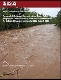
Sediment in Minnesota Streams
 |
Arsenic Cycling in Hydrocarbon Plumes
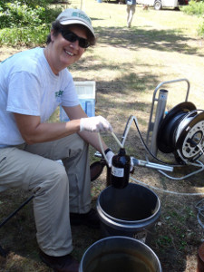 |
Monitored natural attenuation is widely applied as a remediation strategy at hydrocarbon spill sites. Natural attenuation relies on biodegradation of hydrocarbons coupled with reduction of electron acceptors, including solid phase ferric iron. Because arsenic adsorbs to iron-hydroxides, a potential secondary effect of natural attenuation of hydrocarbons coupled with ferric iron (Fe[III]) reduction is a release of naturally occurring arsenic to groundwater. At a crude-oil contaminated aquifer near Bemidji, Minnesota, anaerobic biodegradation of hydrocarbons coupled to ferric iron reduction has been well documented. USGS staff have collected groundwater samples at the site annually from 2009 to 2013 to examine if arsenic is released to groundwater and, if so, to document relationships between arsenic and iron inside and outside of the dissolved hydrocarbon plume. Arsenic concentrations in groundwater in the plume reached 230 micrograms per liter (μg/L), whereas groundwater outside the plume contained arsenic concentrations that were less than 5 μg/L. Combined with previous data from the Bemidji site, study results indicate that naturally occurring arsenic is associated with iron-hydroxides present in the glacially derived aquifer sediments; introduction of hydrocarbons results in reduction of iron-hydroxides, releasing arsenic and iron to groundwater; at the leading edge of the plume, arsenic and iron are removed from groundwater and retained on sediments; and downgradient from the plume, concentrations of arsenic and iron in groundwater are similar to background concentrations. USGS staff have developed a conceptual model of secondary arsenic release due to natural attenuation of hydrocarbons that can be applied to other sites where an influx of biodegradable organic carbon promotes ferric iron reduction. For more information contact co-author Melinda L. Erickson (merickso@usgs.gov).
Reference: Cozzarelli, IM; Schreiber, ME; Erickson, ML; and Ziegler, BA. "Arsenic cycling in hydrocarbon plumes: Secondary effects of natural attenuation," Groundwater, 21 Jan 2015
Water Quality Declines in the Mississippi River Basin (USGS in the news at National Geographic)
Scientists with the USGS have sampled the main stem and four tributaries of the Mississippi River and found that concentrations of nitrate increased at more than one-half the sites from 1980 to 2010. The USGS reported in a congressional briefing on Capitol Hill that overall, nitrate levels increased by 14 percent during that period. The new findings provide a warning about water-quality health nationwide, and raise a troubling issue: even when policymakers and environmental advocates try to clean up the waterways, their efforts are not always successful. USGS scientists have focused on of nitrate because it plays an important role in the environment. The nitrogen in nitrate is an essential nutrient for plants. However, too much nitrate leads to overgrowths of algae, called blooms, which can use up too much oxygen in the water, choke out fish and seagrasses, and in some cases release toxic chemicals. The Mississippi River Basin is a good representative of the rest of the country because it has mixed urban and agricultural areas, and because "many lessons learned there can be applied throughout the U.S.," said Lori Sprague, a hydrologist with USGS's National Water-Quality Assessment Program, at the congressional briefing.
Changes in Trophic State at Voyageurs National Park
The USGS is pleased to announce a new publication on trophic state in Voyageurs National Park lakes. A large data set was compiled to determine trophic state before and after the implementation of the revised water-level management plan (rule curves) established by the International Joint Commission in 2000.
Secchi depth, total phosphorus, and chlorophyll a data were compiled from Rainy, Kabetogama, Namakan, Sand Point, Crane, and Little Vermilion Lakes and Black Bay in Rainy Lake. Average Secchi depth transparency improved (from 1.9 to 2.1 m, p = 0.020) between 1977-1999 and 2000-2011 in Kabetogama Lake for August samples only and remained unchanged in Rainy, Namakan, and Sand Point Lakes, and Black Bay (not enough data were available from Crane and Little Vermilion Lakes). Average open-water season chlorophyll a concentration decreased in Black Bay (from an average of 13 to 6.0 μg/l, p = 0.001) and Kabetogama Lake (from 9.9 to 6.2 μg/l, p = 0.006) between 1977-1999 and 2000-2011. Trophic state index decreased significantly in Black Bay from 59 to 51 (p = 0.006) and in Kabetogama Lake from 57 to 50 (p = 0.006) between 1977-1999 and 2000-2011. Trophic state indices indicated that after 2000, Sand Point, Namakan, and Rainy Lakes remained oligotrophic, whereas eutrophication has decreased in Kabetogama Lake and Black Bay. Although nutrient inputs from inflows and internal sources are still sufficient to produce annual cyanobacterial blooms and may inhibit designated water uses, trophic state has decreased for Kabetogama Lake and Black Bay and there has been no decline in lake ecosystem health since the implementation of the revised water-level management plan. The report is available at: http://onlinelibrary.wiley.com/doi/10.1111/jawr.12234/abstract
Contact: Victoria Christensen, vglenn@usgs.gov
Large Rivers Conference
The International Society for River Science conference will be held in La Crosse, Wisconsin during August 23-28, 2015. The conference theme is connectivity. Abstracts are due March 8. More information is available at the conference website: http://www.uwlax.edu/conted/isrs2015/
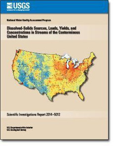
Dissolved-Solids Sources, Loads, Yields, and Concentrations in Streams of the Nation
 |
Continuous Monitoring for Nitrate
USGS scientists are implementing innovative real-time monitoring approaches for continuous nitrate information. Currently, USGS and partners monitor nitrate continuously at nearly 80 locations nationally. Historically, scientists have relied on discrete samples collected weekly or monthly, and laboratory analyses that can take weeks to complete. Such low-frequency data can hamper a timely response and decisions relative to rapid changes in nitrate concentrations and loads that can affect human and ecosystem health. Recent advancements in commercially available in situ sensors, data platforms, and new techniques for data analysis now provide an opportunity to monitor in real time, capturing variability, such as in seasonal runoff, changes in precipitation intensity, and natural disturbances that can affect the storage, production, and transport of nitrogen in watersheds. Transmitting these data in real time can help in many ways, including in the management of water supplies and wastewater; regulation and permitting; recreation; and in the tracking of variability of nitrate transport and contributions to key receiving waters. In addition, sensor information allows for dense datasets that are useful to better understand or model hydrologic systems. Overall, the sensor information improves the understanding of how hydrology and water quality vary over short periods and can lead to more effective water management and conservation practices that improve the quality of the environment and human life. (Pellerin and Bergamaschi, Lakeline, Spring 2014). Reliable and readily available continuous monitoring for nitrate concentrations allows for observations at a high temporal frequency. The observations are transmitted via satellite telemetry, stored in the USGS National Water Information System database, and available on the WaterQualityWatch website: http://waterwatch.usgs.gov/wqwatch/?pcode=00630. Data can be displayed in tables, graphs, and maps and are retrievable in common spreadsheet formats.
New paper on mercury bioaccumulation factors
The USGS is pleased to announce a new paper on mercury bioaccumulation factors, Optimizing fish sampling for fish–mercury bioaccumulation factors by Scudder Eikenberry and others. This new paper is a companion to the previously published, Optimizing stream water mercury sampling for calculation of fish bioaccumulation factors. The information in these two papers will be of interest to natural resource professionals who use bioaccumulation factors to relate fish-mercury concentrations to water-column mercury concentrations in modeling or management contexts, such as for mercury TMDL (total maximum daily load) calculations. The papers use data from 11 Mercury in Stream Ecosystems study rivers, located across the U.S. in Oregon, Wisconsin, New York, South Carolina, and Florida. The Mercury in Stream Ecosystems study was led by Mark Brigham of the Minnesota Water Science Center, as part of the National Water-Quality Assessment Program.
Contact: Mark Brigham, mbrigham@usgs.gov.
Study of Pesticides in the Nation's Streams
Concentrations of pesticides continue to be a concern for aquatic life in many of the Nation’s rivers and streams in agricultural and urban areas, according to a new USGS study spanning two decades (1992-2011). Pesticide concentrations seldom exceeded human-health benchmarks.
More than one-half a billion pounds of pesticides are used annually in the United States to increase crop production and reduce insect-borne disease; however, some of these pesticides are occurring in streams at concentrations that pose a concern for aquatic life. The proportion of streams with one or more pesticides that exceeded an aquatic-life benchmark was similar between the two decades for streams and rivers draining agricultural and mixed land-use areas, but was much greater during 2002-11 for streams draining urban areas. Fipronil, an insecticide that disrupts the central nervous system of insects, was the pesticide most frequently found at concentrations of potential concern for aquatic organisms in urban streams during 2002-11." The information gained through this important research is critical to the evaluation of the risks associated with existing levels of pesticides," said William Werkheiser, USGS Associate Director for Water.
The USGS National Water-Quality Assessment Program is continually working to fill data gaps by analyzing for concentrations of new pesticides that come into use, such as the neonicotinoid and pyrethroid insecticides, improving characterization of short-term acute exposures, and enhancing evaluations of sediment and other environmental media. The study "Pesticides in U.S. Streams and Rivers: Occurrence and trends during 1992-2011" is a feature article in the Environmental Science and Technology journal. The article and additional information including data, reports, and maps on pesticide status, trends, and use are available online. This news release is available at http://usgs.gov/newsroom/article.asp?ID=3997.
Metal Mining in Northeastern Minnesota--Cooperative Studies by the USGS and Partners
How Do Natural Copper-Nickel Bedrocks Influence Water Quality?
Perry Jones, Project Chief
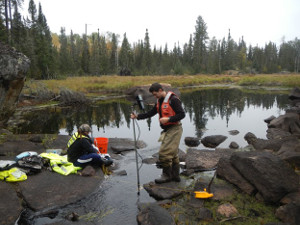 |
Water-quality, streambed sediment, soil, and rock samples were collected and analyzed in three watersheds with differing mineral potential: (1) Filson and South Filson Creeks, (2) St. Louis River, and (3) Keeley Creek. In each of these watersheds, water samples were collected and streamflows were measured at a total of 20 sites four times (April, June, August, and late September/early October) during 2014. Water samples were analyzed for 18 metals, 12 major ions, and dissolved organic carbon. Stream-bed sediment samples were collected at 10 sites on Filson Creek, 4 sites on Keeley Creek, and 8 sites on the headwaters of the St. Louis River in September 2014. Fifteen soil samples were collected in each of the three watersheds from the O and A horizons at each of the sampling sites, and 10 bedrock samples were collected in each of the three watersheds. Streambed sediment and soil samples will be analyzed for 46 major and trace elements and 10 metals. Water-quality samples will be collected four more times in 2015 under different flow settings.
Continuous streamflow data collected at three streamgages will be combined with existing and new water-quality data to develop conceptual hydrologic models for each watershed. Water-quality and modeling results will be compared to data available in the 1979 Minnesota Regional Copper-Nickel Study (Thingvold and others, 1979) to assess long-term trends in water quality.
Cited reference: Thingvold, D., Eger, P., Hewett, M., Honetschlager, B., Lapakko, K., and Mustalish, R., 1979, Water Resources, in Minnesota regional copper-nickel study, 1976-1979, Minnesota Environmental Quality Board, v. 3, no. 4, 217 p.
Upper St. Louis River Watershed Groundwater Model
Tim Cowdery, Project Chief
The Upper St. Louis River groundwater modeling study is a 2-phase, collaborative effort between the USGS and the Fond du Lac Band of Chippewa Indians. The study area includes portions of the large deposits of copper, nickel, cobalt, and platinum-group-elements, and titanium oxide minerals occurring in the Duluth Complex of northeast Minnesota. During phase I of the study, which is the current phase, USGS staff will assemble available hydrologic, geologic, and geochemical information to prepare a preliminary conceptual groundwater model. The conceptual model will be used to explore: (1) groundwater flow, (2) interactions between groundwater in bedrock and unconsolidated deposits and interactions between groundwater and surface water, (3) data insufficiencies and data gaps needed to calibrate and evaluate a complete model; and (4) preliminary and conceptual drawdown maps showing the system responses to proposed dewatering activities. The product of the phase I preliminary conceptual modeling effort will be a proposal that outlines scope of work, budget, and schedule for phase 2: developing a calibrated and tested numerical groundwater-flow model. The proposal also will identify data needs for a fully calibrated model. The proposed study area, the upper portion of the St. Louis River Basin, includes the drainage basin of the Embarrass River, a tributary of the St. Louis River, as well as other tributary streams.

*Any use of trade, firm or product names does not imply endorsement by the U.S. Government.