Employee Spotlight - Don Hansen
Don Hansen |
Don Hansen has announced his retirement in order to devote more time to his family and to his many interest and volunteer activities. For the last 22 years, Don has managed the U.S. Geological Survey (USGS) Minnesota Water Science Center's Investigations Program. One of the highlights of Don's career has been a 10-year leadership role with the interagency St Croix River Basin Team, a part of the state near to Don's heart. The Basin Team's partnership has included collaboration with staff from state environmental agencies in Minnesota and Wisconsin, the Metropolitan Council of the Twin Cities, the Science Museum of Minnesota, the University of Minnesota, county land and water organizations, the St. Croix River Association, and the National Park Service. Don's familiarity with the hydrology of the St. Croix River Basin in Minnesota and Wisconsin, and his ability to communicate that knowledge, have been instrumental to the effectiveness of the Basin Team. His ability to integrate his expertise with the expertise of others has enhanced the understanding of ecological functioning throughout the entire Basin and especially in Lake St. Croix. Don has been instrumental in establishing long-term monitoring sites on the St. Croix River needed to provide water-quality and streamflow data. Don has been instrumental in establishing flow gages on the St. Croix River at Prescott and at the head of Lake St. Croix, in Stillwater through critical partnership with the Twin Cities Metropolitan Council and the Science Museum of Minnesota. These gages are essential in understanding the inputs to, and outputs from Lake St. Croix. His expertise was integral in establishing the St. Croix Monitoring Plan and associated network by sorting monitoring needs into top priorities. Don has helped bring the latest technology to the St. Croix River and greatly improved understanding of Lake St. Croix's hydrology. Because of Don's involvement, the USGS has been an active partner in activities in the Basin Team. Don has provided leadership in several other projects in the St. Croix River Basin including the emerging-contaminant study, the Lake St. Croix trophic assessment, and the Willow River nutrient-loading study. In conjunction with the National Park Service, Don has been successful in securing funding for several grants from the USGS/NPS Water Quality Partnership Program. Don has sought ways to further the science of water resources for the St. Croix National Scenic Riverway, a unit of the National Park Service. During all of these activities Don has worked in a professional manner and has responded to the needs of partners by providing sound advice. His opinions are valued because of his friendly demeanor, professional can-do attitude, and abundant helpfulness. Don has announced his retirement date for November 1. His expertise, as the Center's Investigation Chief, will be missed by all in the Center.
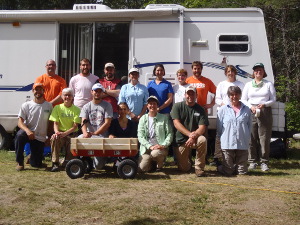
The Silverjackets Say Good-bye to Diane Cooper
Minnesota Center staff want to thank Diane Cooper for her contributions to the hydrologic and flood-risk community, as she moves to new endeavors. Diane, a Service Hydrologist with the National Weather Service has decided to pursue graduate school at Oklahoma State University. Diane's stint in Minnesota was brief but was well timed; arriving in time for consecutive years of frequent and severe flooding in Minnesota. Diane has been a valuable contributor to the hydrologic community and the public through her informative and frequent communications, and her organization of interagency meetings that brought together Federal, State, local, and otherwise separate stake-holders Diane asked the relevant hydrologic and science questions and was willing to see through agency boundaries to seek the greatest benefit to all.
Another Successful Field Session at the National Crude Oil Spill Fate and Natural Attenuation Research Site
In July, a few acres of Beltrami County forest land about 20 miles northwest of Bemidji, Minnesota, were once again the scene of intense scientific activity. The blueberries weren't the main attraction at this site. Rather, the crowd of scientists was drawn to the well-documented spilled crude oil that persists below ground and is still observable through an extensive underground observatory of wells, sensors, and other devices. Every summer since 1983, a team of scientists, supported in large part by the USGS' Toxic Substances Hydrology program, has gathered at this site to better understand the processes and controls of natural attenuation of crude oil. Since 2009, a collaborative agreement between the USGS, Minnesota Pollution Control Agency, Beltrami County, and Enbridge Energy, LLC, has provided additional support for research at the site. This year, research teams from the University of British Columbia, the Swiss Federal Institute of Aquatic Science and Technology (EAWAG), the University of St. Thomas, Rutger's University, Virginia Tech, Western Michigan University, the USGS Branch of Geophysics, and the USGS National Research Program (NRP) along with several staff from the USGS Minnesota Water Science Center and the Minnesota Pollution Control Agency gathered for two weeks in Bemidji. Samples were collected this year to examine a range of topics such as the distribution of arsenic (a secondary contaminant) across the site, the composition of dissolved organic carbon in groundwater affected by the oil, gas compositions in soil and dissolved in groundwater, controls of hydrocarbon degradation, explanations for increased bulk electrical conductivity in the oil smear zone, and temperature variations in the subsurface caused by oil degradation. Additionally, new techniques were tested at the site including the use of nuclear magnetic resonance (NMR) to estimate aquifer hydraulic properties, the use of soil gas sensors to continuously observe soil gas composition above the oil, and the use of a Geoprobe* freezing drive shoe to collect sediment and pore-water samples below the water table. The underground observatory, historical data, and collaborative spirit at this spill site provide researchers unique opportunities to test ideas related to the natural attenuation of hydrocarbons in the subsurface. More details and a list of publications are available at the project's web page: http://mn.water.usgs.gov/projects/bemidji/index.html.
Contacts: Jared Trost and Mindy Erickson
Report Published: Flood Frequency in Minnesota
A report presenting results for peak-flow frequency analyses of streamgages in Minnesota through 2011 has been published in cooperation with the Minnesota Department of Transportation. Peak-flow frequency analyses were completed for 409 streamgages in and bordering Minnesota having at least 10 systematic peak flows through water year 2011. Selected annual exceedance probabilities were determined by fitting a log-Pearson type III probability distribution to the recorded annual peak flows. A detailed explanation of the methods that were used to determine the annual exceedance probabilities, the historical period, acceptable low outliers, and analysis method for each streamgage are presented. The final results of the analyses are presented.
Full Report
Report Published: Mercury in Wetlands at the Glacial Ridge National Wildlife Refuge, Northwestern Minnesota
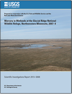 |
A new report on mercury in wetlands at the Glacial Ridge National Wildlife Refuge (NWR) was published in June. The largest wetland and prairie restoration in United States history recently was completed at the Refuge. More than 3000 acres of wetlands were restored, more than 100 miles of ditches were filled, and nearly 18,000 acres of land was reseeded with native prairie plants. Microbial conversion of inorganic mercury to the bioaccumulative methylmercury form is a particularly active process in wetlands, making wetlands important methylmercury "hotspots" on the landscape. Concentrations of methylmercury in the Glacial Ridge NWR wetlands are among some of the highest in the published literature, indicating that seasonal wetlands of northwestern Minnesota are "hotspots" for mercury methylation, and may be a potential concern for wildlife.
Full Report available at: http://pubs.er.usgs.gov/publication/sir20135068
Report Published: Ecological Health in the Nation's Streams, 1993-2005
This report summarizes a national assessment of the ecological health of streams done by the USGS National Water-Quality Assessment Program (NAWQA). Healthy functioning stream ecosystems provide society with many benefits, including water purification, flood control, nutrient recycling, waste decomposition, fisheries, and aesthetics. The value to society of many of these benefits is substantial; for example, sportfishing in the United States generates an estimated annual economic output of $125 billion, including more than 1 million jobs (National Research Council, 2005; American Sportfishing Association, 2008). Continued monitoring and assessment of the Nation's streams is needed to support informed decisions that will safeguard this important natural and economic resource. The quality of streams and rivers is often assessed with measures of the chemical or physical properties of water. However, a more comprehensive perspective is obtained if resident biological communities are also assessed. Guidelines to protect human health and aquatic life have been established for specific physical and chemical properties of water and have become useful yardsticks with which to assess water quality. Biological communities provide additional crucial information because they live within streams for weeks to years and therefore integrate through time the effects of changes to their chemical or physical environment. In addition, biological communities are a direct measure of stream health—an indicator of the ability of a stream to support aquatic life. Thus, the condition of biological communities, integrated with key physical and chemical properties, provides a comprehensive assessment of stream health.
Links to the reports, press release, FAQs, and other information are posted on the project website.
Links to other NAWQA ecological reports are also available online.
Contact: Daren Carlisle
Prioritization of Constituents for National- and Regional-Scale Ambient Monitoring of Water and Sediment in the United States
A total of 2,541 constituents were evaluated and prioritized for national- and regional-scale ambient monitoring of water and sediment in the United States. This prioritization was done by the USGS in preparation for the third decade (Cycle 3; 2013–23) of the National Water-Quality Assessment (NAWQA) Program. This report provides the methods used to prioritize the constituents and the results of that prioritization.
Constituents were prioritized by the NAWQA National Target Analyte Strategy (NTAS) work group on the basis of available information on physical and chemical properties, observed or predicted environmental occurrence and fate, and observed or anticipated adverse effects on human health or aquatic life. Constituents were evaluated within constituent groups that were determined on the basis of physical or chemical properties or on uses or sources. Some constituents were evaluated within more than one constituent group. Although comparable objectives were used in the prioritization of constituents within the different constituent groups, differences in the availability of information accessed for each constituent group led to the development of separate prioritization approaches adapted to each constituent group to make best use of available resources. Constituents were assigned to one of three prioritization tiers: Tier 1, those having the highest priority for inclusion in ambient monitoring of water or sediment on a national or regional scale (including NAWQA Cycle 3 monitoring) on the basis of their likelihood of environmental occurrence in ambient water or sediment, or likelihood of effects on human health or aquatic life; Tier 2, those having intermediate priority for monitoring on the basis of their lower likelihood of environmental occurrence or lower likelihood of effects on human health or aquatic life; and Tier 3, those having low or no priority for monitoring on the basis of evidence of nonoccurrence or lack of effects on human health or aquatic life, or of having insufficient evidence of potential occurrence or effects to justify placement into Tier 2.
Of the 1,081 constituents determined to be of highest priority for ambient monitoring (Tier 1), 602 were identified for water and 686 were identified for sediment (note that some constituents were evaluated for both water and sediment). These constituents included various types of organic compounds, trace elements and other inorganic constituents, and radionuclides. Some of these constituents are difficult to analyze, whereas others are mixtures, isomers, congeners, salts, and acids of other constituents; therefore, modifications to the list of high-priority constituents for ambient monitoring could be made on the basis of the availability of suitable methods for preparation, extraction, or analysis. An additional 1,460 constituents were placed into Tiers 2 or 3 for water or sediment, including some constituents that had been placed into Tier 1 for a different matrix; 436 constituents were placed into Tier 2 for water and 246 constituents into Tier 2 for sediment; 979 constituents were placed into Tier 3 for water and 779 constituents into Tier 3 for sediment.
Full Report
|
Current Water Quality Studies in the St. Croix River Watershed Lake St. Croix Water Quality Mitigation Monitoring
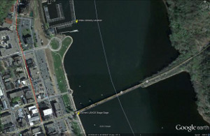
Stillwater, MN, streamgage
An index-velocity streamgage (see picture) was installed at Stillwater in September 2011 to provide direct estimates of discharge and nutrient loading to Lake St. Croix. Federal Highway Administration mitigation funds from the Wisconsin Department of Natural Resources are planned to continue index-velocity gaging at Stillwater for three additional years (2014-2016). Continuation of the index-velocity streamgage will provide discharge data for calculating phosphorus loads to Lake St. Croix from upstream of Stillwater. Direct estimates of continuous discharge from the index-velocity streamgage are critical to current and future lake water quality modeling and management.
Nutrient Loading Monitoring of Wisconsin Tributaries to Lake St. Croix (USGS Wisconsin Water Science Center)
Water-quality data are currently being collected from several Minnesota tributaries to Lake St. Croix by state and local partners. However, recent nutrient data collections for the three largest Wisconsin tributaries to Lake St. Croix (Apple, Willow, and Kinnickinnic Rivers) have been limited to seasonal sampling by the National Park Service and the USGS. Federal Highway Administration mitigation funds from the Wisconsin Department of Natural Resources are planned to reestablish streamflow and water-quality monitoring at the Willow River and to begin routine nutrient sampling at all three rivers. These data will enhance the computation of nutrient loads to Lake St. Croix, allowing the USGS and St. Croix Basin Team partners to evaluate progress in implementing nutrient management plans in the basin
Lake St. Croix Continuous Water-Quality Monitoring
Previous nutrient-loading models for Lake St Croix assumed that oxygen-rich environments were present throughout the lake. Recent monitoring has revealed periods of no oxygen (anoxia) in deep areas of Bayport, Troy Beach, Black Bass, and Kinnickinnic pools. In 2012, these anoxic conditions produced substantial nutrient releases from sediments in the lower three pools. Federal Highway Administration mitigation funds from the Wisconsin Department of Natural Resources are planned for continuous monitoring of dissolved oxygen, temperature, and algal abundance in surface and deep waters in the two lower pools of the lake. The monitors will track algal bloom formation and provide data necessary for water-quality model validation.
Productivity and Fish Habitat responses to Changes in Nutrient Loading and Climate in Lake St. Croix
The USGS Minnesota Water Science Center is developing a hydrodynamic, biophysical water quality model for Lake St. Croix in cooperation with the National Park Service (NPS) and the Science Museum of Minnesota St. Croix Research Station. The work is funded through the USGS/NPS water quality partnership program.
The CE-QUAL-W2 model will simulate Lake St. Croix responses to current climate and watershed land-use conditions using calculated estimates of nutrient loading and measured inflow and outflow. The model will incorporate internal nutrient loading from the deep, anoxic pools in the lake while simulating algal responses to nutrient availability along the entire length of the lake. In addition to modeling primary production and food web responses to nutrient loading, the model will simulate seasonal changes in temperature and dissolved oxygen habitat for fish and other aquatic organisms. The primary use of the model will be to assess lake ecosystem response to changes in nutrient loading under implementation of phosphorus controls proposed as part of lake management plans. The lake model will be linked with nutrient loading estimates from the SWAT watershed model developed by the Science Museum of Minnesota St. Croix Research Station. The lake model will be used to evaluate the effects of the 20-percent reduction in phosphorus loads on trophic dynamics in the lake.
Contact: Richard Kiesling 763-783-3131
New Report Published on Distribution of the Agricultural Use of 459 pesticides for the entire Conterminous United States
The maps and supporting national database of county-level use estimates for each of 459 pesticides were developed by the U.S. Geological Survey for use in national and regional water-quality assessments.
A method was developed to calculate annual county level pesticide use for selected herbicides, insecticides, and fungicides applied to agricultural crops grown in the conterminous United States from 1992 through 2009. Pesticide-use data compiled by proprietary surveys of farm operations located within Crop Reporting Districts were used in conjunction with annual harvested-crop acreage reported by the U.S. Department of Agriculture National Agricultural Statistics Service (NASS) to calculate use rates per harvested crop acre, or a pesticide use estimate. These values are suitable for making national, regional, and watershed assessments of annual pesticide use from 1992 to 2009.
Related publications: SIR 2013-5009 and Data Series 752
Links to interactive national maps and trend graphs: http://water.usgs.gov/nawqa/pnsp/usage/maps
For more information on pesticides in streams and groundwater, please visit the Pesticide National Synthesis Project website.
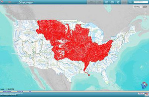
Navigate America's Rivers without Getting Wet — A Nice Tool for Teachers, Students, Demographers, and the Curious
"Streamer" is a new feature of the National Atlas that help's to visualize and understand water flow across America. You can explore our Nation's major streams with a few quick clicks on the map to produce traces upstream to their source or downstream to where they empty. In addition to making maps, Streamer creates reports about your stream traces and the places they pass through simply by picking a point on a stream. The reports include hydrographic and political features encountered along each trace, as well as USGS streamflow gaging stations. Try Streamer at http://go.usa.gov/jjc6. If you like Streamer, but are looking for more technical information about a basin, such as drainage area or basin characteristics, try StreamStats.
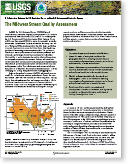
Joint USGS/USEPA Midwest Stream Quality Assessment
In 2013, the USGS National Water-Quality Assessment Program (NAWQA) and USGS Columbia Environmental Research Center (CERC) are collaborating with the U.S. Environmental Protection Agency (USEPA) National Rivers and Streams Assessment (NRSA) to assess stream quality across the Midwestern United States . The sites selected for this study are a sub-set of the larger NRSA, implemented by the USEPA, States and Tribes to sample flowing waters across the United States. The goals are to characterize water-quality stressors-contaminants, nutrients, and sediment and ecological conditions in streams throughout the Midwest and to determine the relative effects of these stressors on aquatic organisms in the streams. Findings will contribute useful information for communities and policymakers by identifying which human and environmental factors are the most critical in controlling stream quality. This collaborative study enhances information provided to the public and policymakers and minimizes costs by leveraging and sharing data gathered under existing programs. Currently, NAWQA is sampling streams weekly for contaminants, nutrients, and sediment. During the same time period, CERC will test sediment and water samples for toxicity, deploy time-integrating samplers, and measure reproductive effects and biomarkers of contaminant exposure in fish or amphibians. NRSA will sample sites once during the summer to assess ecological and habitat conditions in the streams by collecting data on algal, macroinvertebrate, and fish communities and collecting detailed physical-habitat measurements. Study-team members from all three programs will work in collaboration with USGS Water Science Centers and State agencies on study design, execution of sampling and analysis, and reporting.
Full Publication
Publication of Paper on Mercury Modeling
We are pleased to announce the release of a new paper on modeling mercury dynamics under future climate scenarios. This paper, which resulted from a collaboration between the USEPA's National Exposure Research Laboratory and the USGS Mercury in Stream Ecosystems study, focuses on
the McTier Creek Basin in South Carolina.
Contact: Heather Golden
Full Publication
Other NAWQA Mercury Publications
USGS The National Map Topographic Data are Now Available on Mobile Devices that are Using the Android or iOS Operating Systems
USGS National Map data as
viewed in Alpine Quest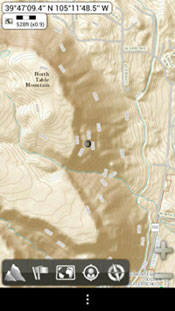 |
Android and iPhone users can now use their mobile devices as digital topographic maps, leveraging USGS maps together with the power of global positioning system (GPS) to zoom in on their precise location while hiking, biking, running, or any other activity that benefits from precision navigation.
The type of data that are available includes USGS imagery and topographic maps from The National Map, as well as road and contour layers. Currently, two Android applications are using USGS data: OruxMaps and AlpineQuest. These apps include USGS services in the list of available online maps.
For users that may be navigating in an area that is outside of cell phone coverage, Mobile Atlas Creator allows users of this desktop application to build small "mobile atlases" with USGS data. These "mobile atlases" can be built over any area of interest at multiple scales, and when completed, the small file is moved to the phone. The "mobile atlases" enable GPS applications on both iPhone (using Galileo) and Android mobile devices. By storing this small amount of data on the phone, these "mobile atlases" ensure the topographic data are available even when cell coverage is not.
Users of mobile devices can use USGS data on their GPS-enabled phones to track their adventure or workout. This capability is new, and promises to increase awareness and use of USGS data and services, as well as increase demand for USGS Topographic Maps.
The USGS National Geospatial Technical Operations Center (NGTOC) is continuing to work with mobile developers, to ensure our data are available to the public.
Disclaimer: Any use of trade, firm or product names does not imply endorsement by the U.S. Government. No warranty, expressed or implied, is made by the USGS or the U.S. Government as to the accuracy and functioning of the commercial software programs cited in this newsletter, and the U.S. Government shall not be held liable for improper or incorrect use of the USGS National Map Topographic Data employing these software programs.
Guest Lecture Given by Hydrologist Don Rosenberry at the University of Minnesota
Don Rosenberry |
On June 6, about 170 people listened to a lecture on the relationship between groundwater and surface water. The lecture described the declines that lakes sometimes experience when groundwater and surface water interact and the rises in lake levels that can occur when groundwater flows into lakes with no outlets. Don Rosenberry, a USGS Hydrologist who assisted in research on White Bear Lake's decade-long decline, spoke about White Bear Lake and lakes and wetlands across the country. Rosenberry's lecture, titled "Not Just for Scientists Anymore: Why the Public Should Care About the Connection Between Groundwater and Lake, Streams and Wetlands" was sponsored by the Freshwater Society and the University of Minnesota College of Biological Sciences. Three Minnesota groundwater experts joined Don Rosenberry in taking questions from the audience.
Full Lecture
|

 with selected members of the Minnesota Silver Jackets Hazard Mitigation Team
(others from left to right: James Fallon, USGS; Jennifer Nelson, Minnesota Homeland Security-Emergency Management; Christiana Czuba, USGS; and Terry Zien, U.S. Army Corps of Engineers.")