Minnesota Water Science Center Newsletter Winter 2014 |
U.S. Department of Interior U.S. Geological Survey Minnesota Water Science Center 2280 Woodale Drive Mounds View, MN 55112 http://mn.water.usgs.gov |
|||
New Project to Assess the Potential Effects of Natural Copper-Nickel Bedrock on Water Quality
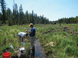
U.S. Geological Survey (USGS) partnerships in northeast Minnesota-Potential copper-nickel mining in northeastern Minnesota seems to be in the news on a daily basis. The world’s demand for copper, nickel, and platinum-group-metals (PGM) are increasing (Doebrich, 2009; Boland, 2012; Yager and others, 2012; Wilburn and Bleiwas, 2004) and will likely continue to rise with increases in population and high-technology applications. The United States is heavily dependent on foreign imports for both nickel and PGM (U.S. Geological Survey, 2010). Currently, there are no active nickel mines in the United States. PGM are extracted from two mines in Montana (U.S. Geological Survey, 2013). Mineral exploration is occurring and mines are being proposed for northeastern Minnesota to extract copper, nickel, cobalt, titanium, and PGM from bedrock of the basal part of the Duluth Complex (Minnesota Department of Natural Resources, 2013; Minnesota Minerals Coordinating Committee, 2013). Minnesota faces a unique opportunity to determine if and how to balance economic development from proposed copper-nickel-PGM mining with the protection of water quality and ecosystems. The USGS Minnesota Water Science Center (Center) is involved in cooperative studies that focus on a better understanding of possible environmental effects of mining. This work is in partnership with the Natural Resources Research Institute (NRRI) at the University of Minnesota-Duluth, the Minnesota Department of Natural Resources (MnDNR), the U.S. Forest Service, and the USGS Eastern Mineral and Environmental Resources Science Center. The work is being funded by the Legislative and Citizens Committee on Minnesota Resources (LCCMR) and by the USGS. The studies will assess copper, nickel, and other metal concentrations in surface water, rocks, streambed sediments, and soils in watersheds where the basal part of the Duluth Complex is present, and determine if these concentrations are currently affecting regional water quality in areas of potential base-metal mining.
Water-quality, streambed-sediment, soil, and bedrock samples will be collected and analyzed in three watersheds with different mineral-deposit settings: (1) copper-nickel-cobalt-PGM mineralization, (2) titanium-oxide mineralization, and (3) no identified mineralized deposits. In each of these three watersheds, rock, soil and water samples will be collected. Results will be compared among the watersheds to assess water-quality difference in the three mineral-deposit settings. The water-quality data will also be compared to data available from the 1979 Regional Copper-Nickel Study (Minnesota Environmental Quality Board, 1979) to assess long-term trends in water quality. Streamflow data, existing and new water-quality data, and existing USGS biotic ligand models will be used to develop new models and assess the nature and extent of possible effects of mine development on regional water quality. New Report: Suspended-Sediment Concentrations, Loads, Total Suspended Solids, Turbidity, and Particle-Size Fractions for Selected Rivers in Minnesota, 2007 through 2011, by Ellison, C.A., Savage, B.E., and Johnson, G.D., 2014This report is released as: U.S. Geological Survey Scientific Investigations Report 2013–5205 and is available online at http://dx.doi.org/10.3133/sir20135205. Report summary: Sediment-laden rivers and streams pose substantial environmental and economic challenges. Excessive sediment transport in rivers causes problems for flood control, soil conservation, irrigation, aquatic health, and navigation, and transports harmful contaminants like organic chemicals and eutrophication-causing nutrients. The Minnesota Pollution Control Agency (MPCA) has identified more than 5,800 miles of streams in Minnesota as impaired due to elevated levels of suspended sediment. The U.S. Geological Survey, in cooperation with the MPCA, operated a 14-site sediment monitoring network from 2007-11 for the systematic sampling of suspended-sediment concentrations (SSC), total suspended solids (TSS), and turbidity in rivers across Minnesota to improve the understanding of fluvial sediment transport relations. The Zumbro River at Kellogg in the driftless region of southeast Minnesota had the highest mean SSC of 226 milligrams per liter (mg/L) followed by the Minnesota River at Mankato with a mean SSC of 193 mg/L. During the 2011 spring runoff, the single highest SSC of 1,250 mg/L was measured at the Zumbro River. The lowest mean SSC of 21 mg/L was measured at Rice Creek in the northern Minneapolis-St. Paul metropolitan area. Total suspended solids (TSS) have been used as a measure of fluvial sediment by the MPCA since the early 1970s; however, TSS concentrations under-represent the amount of suspended sediment. For that reason, MPCA was interested in quantifying the differences between SSC and TSS in different parts of the State. Comparisons between concurrently sampled SSC and TSS indicated significant differences at every site, with SSC on average 50 percent larger than TSS concentrations. Regression analysis indicated that 7 out of 14 sites had poor or no relation between SSC and streamflow. Only two sites, the Knife River [coefficient of determination R2=0.82] and the Wild Rice River at Twin Valley (R2=0.80), had strong correlations between SSC and streamflow. In contrast, turbidity had moderate to strong relations with SSC at 10 of 14 sites and was superior to streamflow for estimating SSC at all sites. These results indicate that turbidity may be beneficial as a surrogate for SSC in many of Minnesota’s rivers. This study provides data to characterize suspended sediment across Minnesota’s diverse geographical settings. The data analysis improves understanding of sediment transport relations, provides information for improving sediment budgets, and documents baseline data to aid in understanding the effects of future land use/land cover on water quality. Project Update: Characterizing Groundwater and Surface-Water Interactions in Northeastern Twin Cities Lakes, Minnesota
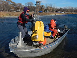
The geophysical surveys consisted of continuous-seismic-reflection (CSP) profiling surveys conducted across the lake surface. During these CSP surveys, an acoustic pulse emitter and a series of hydrophones were installed in a single unit called a towfish (see above photo). The towfish was towed in the water on the side of a boat while the acoustic pulse emitter sent a range of frequencies into the lake and the hydrophones recorded pulses reflected from the lake bottom. The acoustic source used a swept frequency, or chirp, system that produces a range of frequencies that are sent into the lake. The acoustic pulses were converted to electrical signals that are compared to one another to produce an acoustic image of the bottom and sub-bottom structure of the lake. In each lake, a series of 20-40 survey lines were run across the lake to assess the lake bottom. Results from the continuous-seismic-reflection profiling surveys will be used to (1) interpret the subsurface geologic structure and geology under different lake depths and sediment settings, and (2) determine potential locations where seepage to lower aquifers may be more prevalent and further characterization work needs to be done. New paper from the Mercury in Stream Ecosystems study
Mark Brigham of the Minnesota Water Science Center is a co-author on a new paper from the Mercury in Stream Ecosystems. The multidisciplinary study examined mercury cycling in stream ecosystems across the United States. The latest paper from this study was led by modeling experts from the U.S. Environmental Protection Agency who, in collaboration with USGS, applied the relatively new VELMA to the McTier Creek, South Carolina study basin. The VELMA modeling framework simulated flow and total mercury concentrations reasonably well, but poorly represented the seasonal dynamics of methylmercury concentrations. Although mercury methylation is thought to be a temperature dependant process, methylmercury dynamics were out of phase with seasonal temperature fluctuations. Report Released: Assessment of Conservation Easements, Total Phosphorus, and Total Suspended Solids in West Fork Beaver Creek, Minnesota, 1999–2012 by Victoria G. Christensen and Kristen A. KietaThe U.S. Geological Survey cooperated with the Minnesota Board of Water and Soil Resources and worked collaboratively with the Hawk Creek Watershed Project to examine the West Fork Beaver Creek Basin in Renville County, which has the largest number of Reinvest In Minnesota (RIM) land retirement contracts in the State. Among all conservation easement programs, a total of 24,218 acres of agricultural land were retired throughout Renville County, and 2,718 acres were retired in the West Fork Beaver Creek Basin from 1987 through 2012. In 2000, land retirement increased sharply because of the Minnesota River Conservation Reserve Enhancement Program (CREP). The CREP ended in 2002.
Annual flow-weighted mean total-phosphorus concentrations ranged from 0.140 to 0.759 milligrams per liter, and annual flow-weighted mean total suspended solids concentrations ranged from 21.3 to 217 milligrams per liter. A downward trend in flow-weighted mean total-phosphorus concentrations was significant from 1999 through 2008. The downward trend in total-phosphorus concentrations was related significantly to annual land retirement for 1999–2008. However, flow-weighted total-phosphorus concentrations increased substantially in 2009, and the trend was no longer significant. High annual flow-weighted mean concentrations for total phosphorus and total suspended solids in 2009 were affected by outlier concentrations documented in March 2009. An increase in annual flow-weighted mean total-phosphorus concentrations during 2009–11 may be due to a number of factors, including industrial discharges, increases in drain tile installation, changes in land use including decreases in agricultural land retirement after 2008, increases in erosion, or increases in phosphorus applications to fields. Inclusion of land-retirement effects in agency planning along with other factors adds perspective to the broader picture of interdependent systems and allows agencies to make informed decisions on the benefits of perpetual easements compared to limited duration easements. |
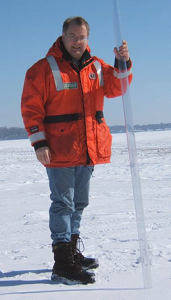
Employee Spotlight - Perry Jones
Perry continues to be involved in mining-related research. He is a member of the USGS Midwest Mining Initiative research team, which conducts studies in existing or potential mining areas in the Midwest, and he currently leads an assessment of background surface-water quality in northeastern Minnesota watersheds where base-metal mining has been proposed. Perry also is an expert on groundwater/surface-water interactions near wetlands and lakes, and currently leads a study that addresses declining water levels in White Bear Lake and other northeast Twin Cities lakes. Perry has been an effective spokesperson for science-based understanding of lake levels, and has applied multiple approaches to assess the complex interactions of climate, water use, and connectivity of lakes with the underlying aquifer. Center Employee Receives Bureau AwardKatie Barnella, Minnesota (MN WSC) has received a 2104 Bureau Safety and Occupational Health Award of Excellence for her contributions to our safety program during 2013. Part of the justification for this award is based on her coordination of ice-safety training for staff in the Center. Report Released: Land-Cover Effects on the Fate and Transport of Surface-Applied Antibiotics and 17-beta-Estradiol through Sandy Soils
Results on the fate and transport of three compounds applied at land surface in a plot-scale field experiment were described in a new report published by the USGS in cooperation with the College of Biological Sciences of the University of Minnesota and the Legislative-Citizen Commission on Minnesota Resources. The compounds sulfamethazine (SMZ), sulfamethoxazole (SMX), and 17-beta-estradiol (17BE) were applied to the surface of bare soil, corn, hay, and prairie plots at Cedar Creek Ecosystem Science Reserve in Anoka County, Minnesota. Concentrations of each chemical in plant-tissue, soil, soil-water, and groundwater samples were determined by using enzyme-linked immunosorbent assay (ELISA) kits. Little to no SMZ or SMX was observed in perennial (prairie, hay) or annual (corn) above-ground plant tissues even though the antibiotics persisted in the soil for at least 8 weeks after application. These observations indicate that only small amounts (less than 1 percent of the applied mass) of these chemicals might be removed from soil through biomass harvesting, regardless of perennial or annual land cover. Detections of SMZ in soil water and groundwater beneath perennial and annual land-cover types on sandy soils highlight the mobility and persistence of this chemical in the environment. Update from Center Director Jim Stark: Center Projects that Involve Climate ChangeIn November I attended a meeting on climate-change at the Science Museum of Minnesota. This was a great conference intended for local officials, planners, engineers, and natural resource practitioners. The focus of the meeting was on sharing successes in developing adaptation strategies in areas such as transportation infrastructure, natural resources, human health, and agriculture. Featured speakers included Mark Seeley and Peter Snyder from the University of Minnesota and Bob Johnson from the Insurance Federation of Minnesota. The afternoon sessions focused on preparing for extreme events, public health preparedness, managing risk for agriculture and highway flood mitigation, adapting urban ecosystems, community stormwater response to change, and strategies for addressing change to water quality and aquatic life. The meeting made me think about projects in the Center that are related to climate change. Some of those projects and programs are highlighted below. Long Term Monitoring Programs
Project Name: Surface Water and Ground-Water Monitoring This program assesses trends in streamflow, peak streamflow, groundwater levels, and temperature. These trends are important for climate change and climate change adaptation. This program provides long-term data for research on climate change by the USGS and other research entities. For the groundwater component of the program, the objectives are to continuously monitor groundwater levels, groundwater temperature, and precipitation. Continuous water levels, water temperature, and precipitation are recorded at wells for the Collection-of-Basic-Records (CBR) program of the USGS Office of Ground Water, at wells for the Upper Sioux Community, and at wells for the Lower Sioux Community and Prairie Island Dakota Community, the Bemidji research site, the Glacial Ridge project, and for the I-94 Corridor project. Assessment of Extreme Events
Project Name:St. Paul Flood Inundation Mapping The Minnesota Silver Jackets team is developing a flood-inundation warning system for the Mississippi River at St Paul. This system will include a digital library of flood-inundation maps for the Mississippi River at St. Paul related to the USGS streamgage (05331000) and National Weather Service river forecast site (STPM5). The primary project objectives include construction and calibration of an updated one-dimensional hydraulic model, computation of water-surface profiles, and development of estimated flood-inundation maps for 1-ft stage increments from approximately bankfull streamflow to greater than the flood of record. Once finished, the interactive flood-inundation maps for the Mississippi River at Saint Paul (USGS streamgage 05331000; NWS station STPM5) will be available through the USGS Flood Inundation Mapping Science Web site and the NWS Advanced Hydrologic Prediction Service (AHPS) Inundation Mapping site where viewers can select estimated inundation maps that correspond to the current stage at the USGS streamgage or the NWS forecasted stages.
Project Name:Post-2012-Flood Revisit of Duluth-Area Streams with Geomorphic Characterization Climate and Water Quality Interactions in Minnesota Lakes
Project Name: Sentinel Lakes Phase I and II Other Climate Related Research
Project Name: I-94 Growth Corridor
Project Name: Statewide Recharge, 2000-10
Project Name: Glacial Aquifer System Groundwater Availability Study
Project Name: Synthetic Hydrographs | |||
| ||||
|
*Any use of trade, firm or product names does not imply endorsement by the U.S. Government. Unsubscribe | ||||