Minnesota Water Science Center Newsletter
Winter 2012/2013
U.S. Geological Survey
Minnesota Water Science Center
2280 Woodale Drive
Mounds View, MN 55112
http://mn.water.usgs.gov
Message from the MNWSC Director - Ensuring Sustainable Water
In November, I attended the Environmental Initiative Policy Forum on groundwater supply, policy, and sustainability. It was a great meeting and I took two messages home. One, from Dr. Swackhamer, was that we need to keep recommendations in the University of Minnesota's "Sustainability Framework" on the forefront as we move forward in addressing water sustainability in our State. The second point, from Steve Hirsch, Director of the Minnesota Department of Natural Resources' (DNR) Division of Ecological and Water Resources, was that the DNR is moving forward with implementing changes in the water appropriations process to ensure sustainable supplies of good quality water for our future. The DNR is taking this step forward by placing emphasis on critical areas (Water Management Areas) through a collaborative stakeholder process. The following four USGS Minnesota Water Science Center projects fit with this vision. They are described below:
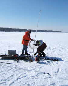
Characterizing Groundwater and Surface-Water Interactions in White Bear Lake
 |
Hydrographs for Ungaged Streams
Minnesota has thousands of miles of streams about which we know very little and it is not practical or feasible to measure streamflow at any given point and time for these streams. However, it is essential to have estimates of flow for permitting effluent discharge limits, allocating limited water resources, and evaluating the effects of appropriations on fish communities, endangered species, and other high priority uses. This project adapts proven methodologies for estimating flows in un-gaged watersheds using regionally similar watershed characteristics associated with long-term streamgages. The effort will provide streamflow estimates at un-gaged areas that will compliment streamgaging information and will improve low-flow information for groundwater modeling and needed information about watershed conditions. Our partner in this effort is the Minnesota Pollution Control Agency.
Estimating Statewide Groundwater Recharge
This effort builds on previous work by the USGS Minnesota Water Science Center and the Minnesota Department of Natural Resources. The project will result in a refined statewide groundwater recharge map that will include a parameter sensitivity analysis. Our project partner is the Minnesota Pollution Control Agency
Water Sustainability Assessment in the I94 Growth Corridor
The USGS Minnesota Water Center is partnering with the Minnesota Department of Natural Resources to refine estimates of groundwater discharge and aquifer recharge to the surficial aquifer that discharges to the Mississippi River along the I94 growth corridor between the west Metro and St. Cloud leading to a groundwater mass-balance for the surficial aquifer. These estimates, combined with an analysis of water use, consideration for water-quality degradation, and local planning efforts are critical for providing local entities with information for making sustainable water management decisions for the growth corridor.
Minnesota Mining in the News
 |
USGS Mining Initiative
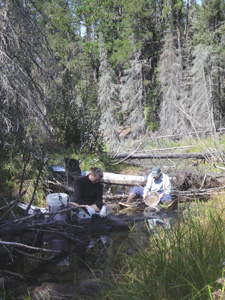
This study characterizes pre-mining conditions along the basal portion of the Duluth Complex of rocks in northeastern Minnesota. The work is funded by the USGS--Midwest Region and the Eastern Minerals Science Center. During last fiscal year, Minnesota Water Science Center staff compiled existing water-quality data for streams and lakes in northeastern Minnesota along the subcrop of the Duluth Complex. These data were sent to USGS Eastern Minerals Science Center for inclusion into environmental models. This year, water-quality and soil samples will be collected in the Filson Creek, Keeley Creek, and St. Louis River. USGS staff also is working with researchers from the University of Minnesota – Duluth/National Resources Research Institute and Minnesota Department of Natural Resources to plan and begin more detailed water-quality, geochemistry, and hydrology sampling in the watersheds of those streams.
New report on Lake Superior
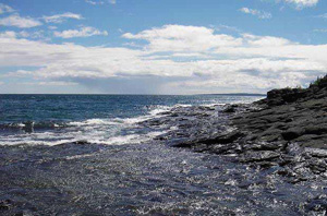 |
Contact: Carri Lohse-Hanson, Minnesota Pollution Control Agency
Webcam for the Mississippi at St. Paul
We have added a link to the City of St. Paul's river webcam on our streamgage home page for Mississippi River at St. Paul.
We are pleased to announce four new reports from the U.S. Geological Survey's Mercury in Stream Ecosystems study
The first report details fluvial loads and basin yields of mercury and related constituents from study basins, as well as estimates of atmospheric mercury inputs. Datasets are available as Microsoft Excel spreadsheets that can be downloaded from the USGS publications warehouse.
Contact: Celeste Journey
The second report examines methylmercury bioaccumulation in the lower food webs in streams of two study areas.
Available via Open Access (subscription to Ecotoxicology is not required to access this paper).
Contact: Karen Riva-Murray
The third report describes a data viewer and mass-balance modeling tool that was developed to graphically examine geochemical and hydrologic time-series data for our McTier Creek, South Carolina study site.
Contact: Stephen Benedict
The fourth report details a comparison of streamflow simulations using NEXRAD-based and measured rainfall data at one of our study sites. This was a spin-off report that arose out of a desire to see if our streamflow simulations could be improved using a spatially explicit precipitation input (NEXRAD).
Contact: Toby Feaster
USGS Publishes Environmental Health Science Strategy
 |
Contact: Patricia R. Bright or Herbert T. Buxton
Full Report
Chemical Mixtures Common in Public Water Supply
USGS scientists found that contaminants detected in water samples from public-supply wells usually occurred with other contaminants as mixtures. However, little is known about the potential health effects of chemical mixtures. The study included more chemical contaminants than in previous studies of public-supply wells. The scientists assessed the occurrence of chemical mixtures in untreated source-water samples from public-supply wells, determined the composition of the most frequently occurring mixtures, and characterized the potential toxicity of mixtures. About 4 percent of source-water samples contained mixtures of two or more contaminants with concentrations greater than individual human-health benchmarks. Health-based benchmarks have not been established for most chemical mixtures, but concentrations of contaminants in mixtures were compared to individual benchmarks. The human-health benchmarks used in the study were U.S. Environmental Protection Agency Maximum Contaminant Levels or USGS Health-Based Screening Levels. The chemical mixtures that most frequently occurred and had the greatest potential toxicity primarily were composed of trace elements (including arsenic, strontium, or uranium), radon, or nitrate. Herbicides, disinfection by-products, and solvents were the most common organic contaminants in mixtures. The findings can be used to help set priorities for groundwater monitoring and suggest future directions for drinking-water treatment studies, and for toxicity assessments of chemical mixtures in water resources. This work was funded by the USGS National Water-Quality Assessment (NAWQA) Program.
Contact: Patty Toccalino
Full Report
New Report Describes Processes and Misconceptions Concerning the Effects of Groundwater Pumping on Streamflow
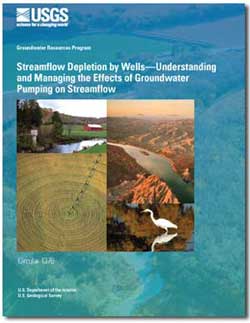 |
Full Report
New report released: Chemicals of Emerging Concern in Water and Bottom Sediment in Great Lakes Areas of Concern, 2010 to 2011—Collection Methods, Analyses Methods, Quality Assurance, and Data
The U.S. Geological Survey (USGS) cooperated with the U.S. Environmental Protection Agency and the U.S. Fish and Wildlife Service on a study to identify the occurrence of chemicals of emerging concern (CECs) in water and bottom-sediment samples collected during 2010–11 at sites in seven areas of concern throughout the Great Lakes. Study sites include tributaries to the Great Lakes in areas of concern (AOCs) located near Duluth, Minn.; Green Bay, Wis.; Rochester, N.Y.; Detroit, Mich.; Toledo, Ohio; Milwaukee, Wis.; and Ashtabula, Ohio. This report documents the collection methods, analyses methods, quality-assurance data, and provides the data for this study. Water and bottom-sediment samples were analyzed at the USGS National Water Quality Laboratory in Denver, Colo., for a broad suite of CECs. Sixty-one of the 69 wastewater indicator chemicals, 28 of the 48 pharmaceuticals, and 10 of the 20 steroid hormones and sterols analyzed in water were detected. For bottom-sediment samples, 47 of the 57 wastewater indicator chemicals, 17 of the 20 steroid hormones and sterols, 12 of the 20 pharmaceuticals, and 6 of the 11 antidepressants were detected.
Contact: Kathy Lee
Full Report
Employee Spotlight: Christiana Czuba
 |
Christiana started with the USGS as a student in the Illinois Water Science Center and performed hydrologic and hydraulic modeling to map flood hazard areas of streams in developing areas. She then spent a few years in the Washington Water Science Center, where her studies focused on geographic information system (GIS) analyses and one- and two-dimensional hydraulic modeling of rivers to gain insight into flood inundation, changes in channel morphology, scour of salmon redds, and sediment transport. Christiana is excited to be back in the Midwest and is looking forward to working on local water resources issues such as identifying flood risks, assessing geomorphic changes of rivers and streams, and linking hydraulic modeling to aquatic habitat. Christiana quickly got her feet wet in Minnesota. At the time of this newsletter, her first report documents the frequency and magnitude of the Duluth area floods of June 2012. Christiana is also working with the U.S. Army Corps of Engineers and National Weather Service to develop flood inundation maps for the City of St. Paul and on a pilot project to develop methodology to inventory undocumented levee structures from LiDAR topography data. Learn more about Christiana's recent publications and contributions by viewing her USGS profile.
New Report on Urban Streams
The effect of urban development on streams is not a new concern, but its environmental significance is rapidly increasing. The USGS National Water-Quality Assessment (NAWQA) Program recently released the results of a study about urban development on streams and aquatic life in different regions of the country. The study describes differences observed in nine metropolitan areas, the reasons for these differences, and implications for stream protection and restoration. The report also describes a new tool that can assist decision makers at all levels of government to evaluate how improvements to one or more stream conditions can increase the likelihood of reaching stream goals. Results of this nationwide study and details about the effects of urbanization on the nine metropolitan areas can be found in a new USGS publication titled, "Effects of urban development on stream ecosystems in nine metropolitan study areas across the United States. Management strategies used throughout the U.S. to reduce the impacts of urban development on stream ecosystems are described in a new USGS report written in partnership with the Center for Watershed Protection in Maryland titled, "Strategies for Managing the Effects of Urban Development on Streams.
Contact: Kathy Lee
Acid Rain: Precipitation is Getting Less Acidic
The National Acid Precipitation Assessment Program (NAPAP) recently reported measurable improvements in air quality and visibility, human health, and water quality in many acid-sensitive lakes and streams. These improvements were achieved through decreases in acid rain as a result of reduced emissions from electric generating power plants. NAPAP is a cooperative Federal program that includes USGS scientists. The program was authorized in 1980 to coordinate acid rain research and report the findings to Congress. Acid rain occurs when emissions of sulfur dioxide (SO2) and nitrogen oxides (NOx) react in the atmosphere with water, oxygen, and oxidants to form acidic compounds. Emissions may be transported hundreds of miles away from their emitting sources. These acidic compounds can damage human health, degrade air quality and visibility, cause acidification of lakes and streams, harm sensitive forests and coastal ecosystems, and accelerate the decay of building materials.
Contact: Douglas A. Burns
Full Report
Pyrethroid Insecticide Contamination Increases with Urbanization
Contamination and toxicity in streambed sediments caused by pyrethroid insecticides generally increased with the degree of urbanization in seven metropolitan areas across the Nation. Pyrethroids are a group of synthetic insecticides similar to the natural pesticide pyrethrum—produced by chrysanthemum flowers—that are used to control insect pests. USGS scientists tested sediment and water from 98 streams for 14 commonly used pyrethroid insecticides. The streams are in the following metropolitan areas: Atlanta, Boston, Dallas, Denver, Milwaukee-Green Bay, Salt Lake City, and Seattle. The scientists also conducted laboratory toxicity tests on streambed sediments from the streams, which showed that pyrethroid insecticides in these urban streams reached levels that were toxic to aquatic organisms. The U.S. Environmental Protection Agency (USEPA) is working with the California Department of Pesticide Regulation to reevaluate certain pesticide products containing pyrethroids. This study will provide additional information to the USEPA and to water-resource and wildlife managers about the occurrence and environmental effects of pyrethroids in urban streams across the Nation. Funding for this study was provided by the USGS Toxic Substances Hydrology Program, National Water-Quality Assessment (NAWQA) Program.
Contact: Kathryn Kuivila
USGS and USEPA are Collaborating on a New Study
 |
Findings will contribute useful information for communities and policymakers by identifying human and environmental factors that are the most critical in controlling stream quality. This study enhances information provided to the public and policymakers and minimizes costs by leveraging and sharing data gathered under existing programs. In the spring and early summer, USGS staff will sample streams weekly for pesticides, nutrients, and suspended sediment and characterize biological communities. USGS will test bottom sediment and water samples for toxicity, deploy time-integrating samplers, and measure biomarkers of contaminant exposure in fish or amphibians at selected sites. As many as 100 sites will be sampled jointly by study partners across the region and approximately 8 sites will be located in Minnesota. Opportunities are available to gain additional information and to optimize project resources through partnerships with other monitoring or research studies. Possible examples include additional monitoring at some or all sites to evaluate mercury fate and fish contamination, and the analysis of endocrine-disrupting chemicals in stream water.
More information
Contact: Kathy Lee, 763-783-3254
NGWA Press has released a book
 |
New Report on Agricultural Stream Quality
Relations between Retired Agricultural Land, Water Quality, and Aquatic-Community Health, Minnesota River Basin by Victoria G. Christensen, Kathy E. Lee, J. Matthew McLees, and Scott L. Niemela, was published in the September issue of the Journal of Environmental Quality. The study demonstrates the importance of agricultural land retirement on water quality and aquatic-community health in the Minnesota River Basin. Eighty-two sites were examined in cooperation with the Minnesota Pollution Control Agency and the Minnesota Board of Water and Soil Resources. The study examined nutrient concentrations, measures of aquatic-community health, and environmental factors. The importance of the proximity of agricultural land retirement to streams also was determined by examining land retirement in riparian zones. The index of biotic integrity (IBI), a measure of the health of the fish community in a stream, was correlated to retired land percentage in the 50- to 400-meter riparian zones surrounding the streams. Statistical models indicated that other environmental factors (such as drainage area and lake and wetland features) commonly were correlated to aquatic-community health measures, as were in-stream factors (standard deviation of water depth and substrate type). The results indicated that agricultural land retirement is significantly related to fish communities as measured by the IBI scores and that a combination of basin, riparian, and in-stream factors act together to influence IBI scores.
Contact: Victoria Christensen
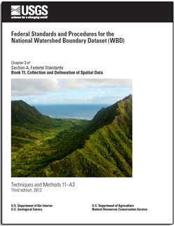
New Federal Standards and Procedures for the National Watershed Boundary Dataset - U.S. Geological Survey and U.S. Department of Agriculture, Natural Resources Conservation Service
 |
New Publications from the Minnesota Geological Survey
- C-20 Geologic Atlas of McLeod County, Minnesota, Part A: Barbara A. Lusardi, project manager
- C-21 Geologic Atlas of Caver County, Minnesota, Part A: E.J. Bauer, project manager
- C-22 Geologic Atlas of Chisago County, Minnesota, Part A: D.R. Setterholm, project manager
- C-23 Geologic Atlas of Benton County, Minnesota, Part A: D. R. Setterholm, project manager
- C-24 Geologic Atlas of Sibley County, Minnesota, Part A: D.R. Setterholm, project manager
- C-25 Geologic Atlas of Nicollett County, Minnesota, Part A: D.R. Setterholm, project manager
- C-26 Geologic Atlas of Blue Earth County, Minnesota, Part A: D.R. Setterholm, project manager
New Report - Floods of June 2012 in Northeastern Minnesota
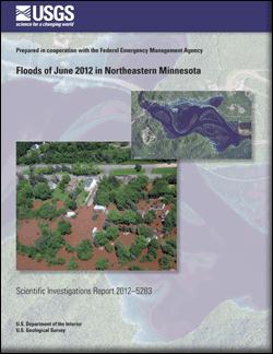 |
The U.S. Geological Survey documented the magnitude and extent of flooding in northeastern Minnesota following heavy rainfall during June 19–20, 2012. Widespread flash and river flooding caused evacuations of residents, and damages to residences, businesses, and infrastructure. Peak-of-record streamflows were recorded at 13 of 35 U.S. Geological Survey streamgages in the nine counties in northeastern Minnesota with disaster declarations due to the flooding. Flood-peak streamflows in June 2012 had annual exceedance probabilities estimated to be less than 0.002 (0.2 percent; recurrence interval greater than 500 years) for five streamgages, and between 0.002 and 0.01 (1 percent; recurrence interval greater than 100 years) for four streamgages. High-water marks were collected to represent the flood-peak water-surface profile within the most severely affected communities of Barnum (Moose Horn River), Carlton (Otter Creek), Duluth Heights neighborhood of Duluth (Miller Creek), Fond du Lac neighborhood of Duluth (St. Louis River), Moose Lake (Moose Horn River and Moosehead Lake), and Thomson (Thomson Reservoir outflow near the St. Louis River). Flood-peak inundation maps were constructed in a geographic information system by combining high-water-mark data with high-resolution digital elevation model data. The flood maps and profiles show the extent and depth of flooding through the communities and can be used for flood response and recovery efforts by local, county, State, and Federal agencies.
Full Report